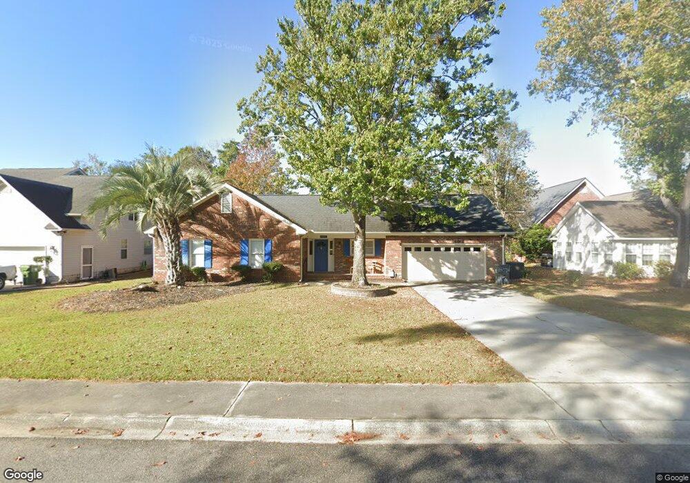
127 Ashton Cir Unit 127 Ashton Circle Myrtle Beach, SC 29588
Estimated Value: $326,000 - $355,717
3
Beds
2
Baths
2,004
Sq Ft
$172/Sq Ft
Est. Value
About This Home
This home is located at 127 Ashton Cir Unit 127 Ashton Circle, Myrtle Beach, SC 29588 and is currently estimated at $343,929, approximately $171 per square foot. 127 Ashton Cir Unit 127 Ashton Circle is a home located in Horry County with nearby schools including Lakewood Elementary, Socastee Middle, and Socastee High School.
Ownership History
Date
Name
Owned For
Owner Type
Purchase Details
Closed on
May 17, 2021
Sold by
Morrow Bailey M
Bought by
Fulmer Robert John
Current Estimated Value
Purchase Details
Closed on
Jan 25, 2006
Sold by
Joyner Melton E and Joyner Mona L
Bought by
Morrow Bailey M and Morrow Ansley S
Home Financials for this Owner
Home Financials are based on the most recent Mortgage that was taken out on this home.
Original Mortgage
$41,000
Interest Rate
6.14%
Mortgage Type
Stand Alone Second
Create a Home Valuation Report for This Property
The Home Valuation Report is an in-depth analysis detailing your home's value as well as a comparison with similar homes in the area
Home Values in the Area
Average Home Value in this Area
Purchase History
| Date | Buyer | Sale Price | Title Company |
|---|---|---|---|
| Fulmer Robert John | $260,000 | -- | |
| Morrow Bailey M | $205,000 | None Available |
Source: Public Records
Mortgage History
| Date | Status | Borrower | Loan Amount |
|---|---|---|---|
| Previous Owner | Morrow Bailey M | $41,000 | |
| Previous Owner | Morrow Bailey M | $164,000 |
Source: Public Records
Tax History Compared to Growth
Tax History
| Year | Tax Paid | Tax Assessment Tax Assessment Total Assessment is a certain percentage of the fair market value that is determined by local assessors to be the total taxable value of land and additions on the property. | Land | Improvement |
|---|---|---|---|---|
| 2024 | $1,291 | $14,357 | $3,910 | $10,447 |
| 2023 | $1,291 | $10,111 | $1,999 | $8,112 |
| 2021 | $1,166 | $6,740 | $1,332 | $5,408 |
| 2020 | $2,118 | $10,111 | $1,999 | $8,112 |
| 2019 | $2,118 | $10,111 | $1,999 | $8,112 |
| 2018 | $1,929 | $8,861 | $1,799 | $7,062 |
| 2017 | $1,914 | $8,861 | $1,799 | $7,062 |
| 2016 | -- | $8,861 | $1,799 | $7,062 |
| 2015 | $1,930 | $8,861 | $1,799 | $7,062 |
| 2014 | $2,616 | $8,861 | $1,799 | $7,062 |
Source: Public Records
Map
Nearby Homes
- 130 Ashton Cir
- 104 Willow Ridge Rd
- 105 Willow Ridge Rd
- 333 Ashwood Ln Unit MB
- 6357 Highway 707
- 280 Hidden Woods Dr
- 279 Leste Rd
- 449 Levanto Rd
- 347 Leste Rd
- 6189 Highway 707 Unit Signalized intersect
- 3910 Stillwood Dr
- 3990 Lochview Dr
- 237 Delano Way
- 201 Delano Way
- 7420 Springside Dr
- 4096 Grousewood Dr
- 411 Moss Pond Rd
- 118 Sly Fox Trail
- 3888 Stillwood Dr
- 357 Cabo Loop
- 127 Ashton Cir
- 201 Willow Ridge Rd
- 203 Willow Ridge Rd
- 123 Ashton Cir
- 123 Ashton Cir Unit Lot 113
- 205 Willow Ridge Rd
- 128 Ashton Cir
- 132 Ashton Cir
- 102 Ashford Ct
- 102 Ashford Ct Unit Lot 112
- 126 Ashton Cir
- 200 Willow Ridge Rd
- 202 Willow Ridge Rd
- 111 Willow Ridge Rd
- 334 Ashwood Ln
- 332 Ashwood Ln
- 124 Ashton Cir
- 104 Ashford Ct
- 104 Ashford Ct
- 106 Willow Ridge Rd