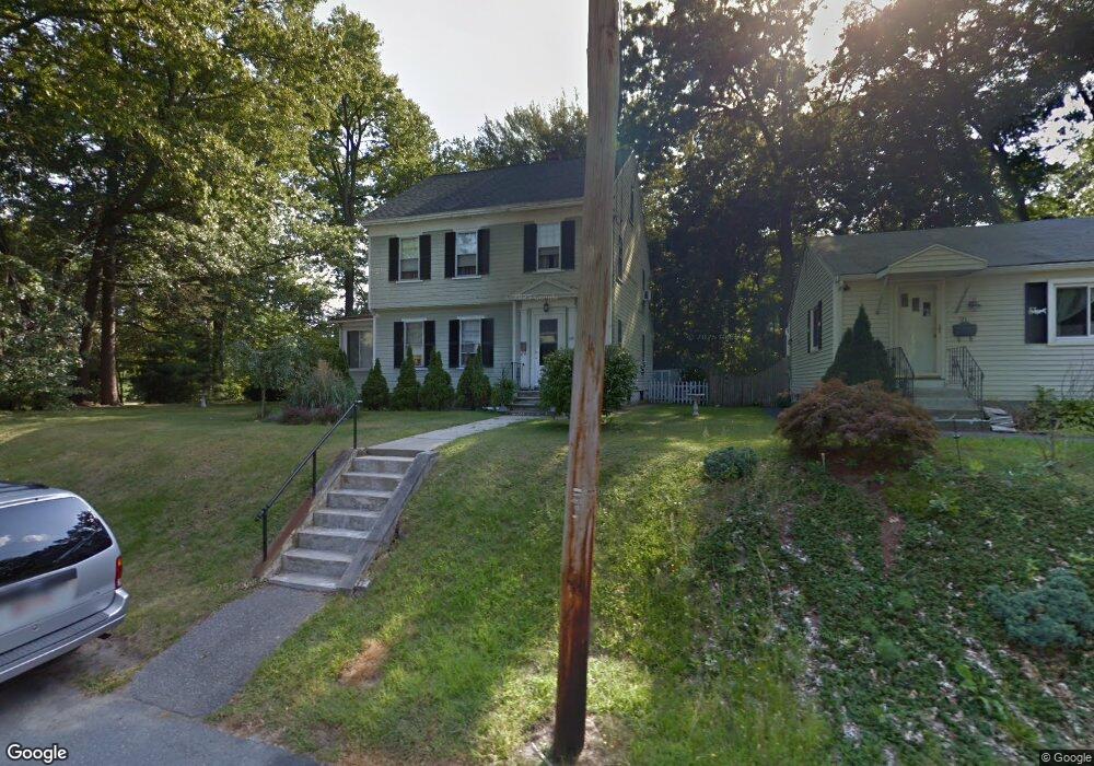
127 Belrose Ave Lowell, MA 01852
Belvidere NeighborhoodEstimated Value: $460,324 - $585,000
3
Beds
2
Baths
1,693
Sq Ft
$316/Sq Ft
Est. Value
About This Home
This home is located at 127 Belrose Ave, Lowell, MA 01852 and is currently estimated at $534,831, approximately $315 per square foot. 127 Belrose Ave is a home located in Middlesex County with nearby schools including Moody Elementary School, Abraham Lincoln Elementary School, and Greenhalge Elementary School.
Ownership History
Date
Name
Owned For
Owner Type
Purchase Details
Closed on
Jun 30, 2000
Sold by
Bazemore Todd M and Bazemore Kelliann
Bought by
Gentile John J and Gentile Patricia A
Current Estimated Value
Home Financials for this Owner
Home Financials are based on the most recent Mortgage that was taken out on this home.
Original Mortgage
$120,000
Interest Rate
8.59%
Mortgage Type
Purchase Money Mortgage
Purchase Details
Closed on
Apr 27, 1995
Sold by
Murphy Sheila and Murphy Mary
Bought by
Bazemore Todd and Bazemore Kelliann
Create a Home Valuation Report for This Property
The Home Valuation Report is an in-depth analysis detailing your home's value as well as a comparison with similar homes in the area
Home Values in the Area
Average Home Value in this Area
Purchase History
| Date | Buyer | Sale Price | Title Company |
|---|---|---|---|
| Gentile John J | $215,000 | -- | |
| Gentile John J | $215,000 | -- | |
| Bazemore Todd | $123,000 | -- | |
| Bazemore Todd | $123,000 | -- |
Source: Public Records
Mortgage History
| Date | Status | Borrower | Loan Amount |
|---|---|---|---|
| Open | Bazemore Todd | $122,000 | |
| Closed | Bazemore Todd | $120,000 |
Source: Public Records
Tax History Compared to Growth
Tax History
| Year | Tax Paid | Tax Assessment Tax Assessment Total Assessment is a certain percentage of the fair market value that is determined by local assessors to be the total taxable value of land and additions on the property. | Land | Improvement |
|---|---|---|---|---|
| 2025 | $4,220 | $367,600 | $154,100 | $213,500 |
| 2024 | $4,416 | $370,800 | $157,200 | $213,600 |
| 2023 | $4,081 | $328,600 | $131,600 | $197,000 |
| 2022 | $3,726 | $293,600 | $119,700 | $173,900 |
| 2021 | $3,473 | $258,000 | $104,100 | $153,900 |
| 2020 | $3,357 | $251,300 | $104,100 | $147,200 |
| 2019 | $3,580 | $255,000 | $90,800 | $164,200 |
| 2018 | $3,550 | $246,700 | $86,500 | $160,200 |
| 2017 | $3,448 | $231,100 | $82,700 | $148,400 |
| 2016 | $3,323 | $219,200 | $71,000 | $148,200 |
| 2015 | $3,149 | $203,400 | $71,000 | $132,400 |
| 2013 | $3,122 | $208,000 | $85,800 | $122,200 |
Source: Public Records
Map
Nearby Homes
- 97 Hoyt Ave
- 338 Fairmount St
- 44 Hanks St
- 53 Fairmount St
- 216 Nesmith St Unit 2
- 18 Whitehead Ave
- 112 Fort Hill Ave
- 5 Lenox St Unit 2
- 80 Rogers St Unit 204
- 80 Rogers St Unit 304
- 90 Roper St Unit G
- 197 Moore St
- 31 Merrill St
- 14 Watson St Unit 4
- 9 Watson St
- 1199 Lawrence St
- 158 Concord St
- 8 Clarks Ct
- 24 Richmond Ave
- 318 Andover St
- 121 Belrose Ave
- 140 Park Ave E
- 109 Belrose Ave
- 132 Belrose Ave
- 124 Belrose Ave
- 130 Park Ave E
- 116 Belrose Ave
- 114 Belrose Ave
- 124 Park Ave E
- 123 Confidential Ave
- 999 Confidential
- 99 Belrose Ave
- 141 Hoyt Ave
- 110 Belrose Ave
- 64 Wellington Ave
- 125 Hoyt Ave
- 104 Belrose Ave
- 121 Hoyt Ave
- 117 Hoyt Ave
- 95 Belrose Ave