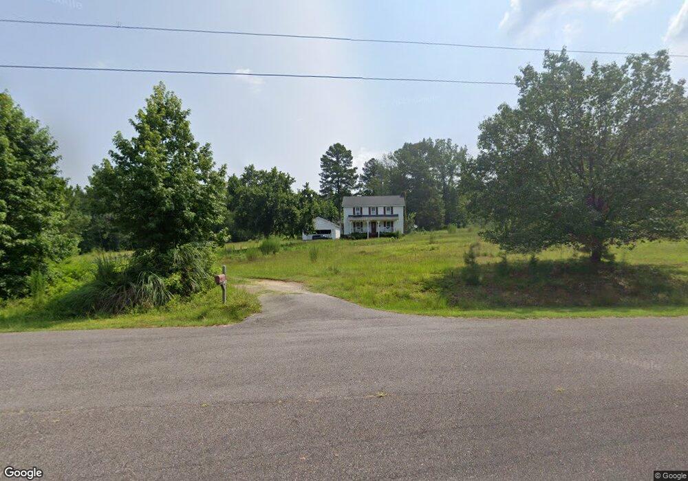
127 Big Branch Ct North Augusta, SC 29860
Southeast Edgefield NeighborhoodEstimated Value: $248,000 - $321,047
1
Bed
2
Baths
1,911
Sq Ft
$149/Sq Ft
Est. Value
About This Home
This home is located at 127 Big Branch Ct, North Augusta, SC 29860 and is currently estimated at $284,524, approximately $148 per square foot. 127 Big Branch Ct is a home located in Edgefield County with nearby schools including Merriwether Elementary School, Merriwether Middle School, and Strom Thurmond High School.
Ownership History
Date
Name
Owned For
Owner Type
Purchase Details
Closed on
Aug 6, 2018
Sold by
Gore Joshuva Scott and Gore Madison
Bought by
Nice Robert and Nice Cory
Current Estimated Value
Purchase Details
Closed on
Jul 23, 2015
Sold by
Benson Kelly C and Benson Kelly
Bought by
Gore Joshua Scott and Gore Madison
Home Financials for this Owner
Home Financials are based on the most recent Mortgage that was taken out on this home.
Original Mortgage
$196,500
Interest Rate
4.09%
Mortgage Type
VA
Purchase Details
Closed on
Jul 22, 2015
Sold by
Taylor Keith A
Bought by
Benson Kelly C and Taylor Kelly Benson
Home Financials for this Owner
Home Financials are based on the most recent Mortgage that was taken out on this home.
Original Mortgage
$196,500
Interest Rate
4.09%
Mortgage Type
VA
Purchase Details
Closed on
Sep 16, 2013
Sold by
Key Sylvester and Key Ruby Ann
Bought by
Veihman Jan and Veihman Laurie
Create a Home Valuation Report for This Property
The Home Valuation Report is an in-depth analysis detailing your home's value as well as a comparison with similar homes in the area
Home Values in the Area
Average Home Value in this Area
Purchase History
| Date | Buyer | Sale Price | Title Company |
|---|---|---|---|
| Nice Robert | $189,750 | None Available | |
| Gore Joshua Scott | $196,500 | -- | |
| Benson Kelly C | -- | -- | |
| Veihman Jan | $68,900 | -- |
Source: Public Records
Mortgage History
| Date | Status | Borrower | Loan Amount |
|---|---|---|---|
| Previous Owner | Gore Joshua Scott | $196,500 |
Source: Public Records
Tax History Compared to Growth
Tax History
| Year | Tax Paid | Tax Assessment Tax Assessment Total Assessment is a certain percentage of the fair market value that is determined by local assessors to be the total taxable value of land and additions on the property. | Land | Improvement |
|---|---|---|---|---|
| 2024 | -- | $11,070 | $1,660 | $9,410 |
| 2023 | $3,969 | $11,070 | $1,660 | $9,410 |
| 2022 | $3,969 | $11,070 | $1,660 | $9,410 |
| 2021 | $4,141 | $11,070 | $1,660 | $9,410 |
| 2020 | $4,311 | $11,560 | $1,660 | $9,900 |
| 2019 | $4,306 | $11,560 | $1,660 | $9,900 |
| 2018 | $977 | $7,730 | $1,130 | $6,600 |
| 2017 | $934 | $7,730 | $1,130 | $6,600 |
| 2016 | $904 | $7,886 | $1,130 | $6,756 |
| 2013 | -- | $5,060 | $1,030 | $4,030 |
Source: Public Records
Map
Nearby Homes
- 0 Moore Rd
- 179 Moore Rd
- 184 Deer Springs Rd
- 98 Cheves Creek Rd
- 60 Kesiah Ct
- 454 Wilderness Trail
- 938 Currytowne Blvd
- 0 Rebecca's Ct
- TRACT F Martintown Rd
- 40 Roper Ct
- 39 Ballentine Ct
- 2160 Martintown Rd
- 102 Indian Ridge Dr
- 1821 Silver Maple Dr
- V-19 Fitzsimmons Rd
- G-3 St John's Dr
- Wd261 Helen Dr Unit Wd261
- O-36 Post Office Ct
- 489 Revolutionary Way
- 272 Homeward Bound Dr
- 126 Big Branch Ct
- 122 Big Branch Ct
- 118 Big Branch Ct
- 131 Big Branch Ct
- 117 Big Branch Ct
- 130 Big Branch Ct
- 114 Big Branch Ct
- 111 Big Branch Ct
- 555 Big Branch Ln
- 1022 Cooper Loop
- 1023 Cooper Loop
- 561 Big Branch Ln
- 106 Big Branch Ct
- 121 Briggs Ln
- 591 Big Branch Ln
- 550 Big Branch Ln
- 572 Big Branch Ln
- 302 Moore Rd
- 187 Deer Trail Point
- 538 Big Branch Ln