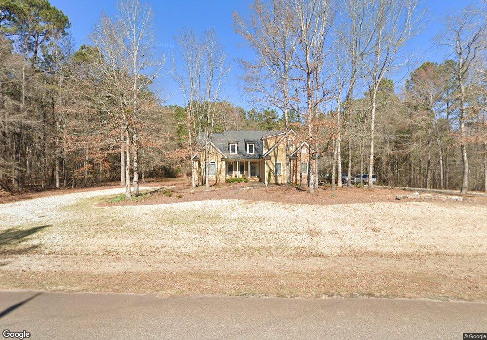
127 Blackthorn Rd Colbert, GA 30628
Estimated Value: $413,430 - $492,000
4
Beds
4
Baths
2,484
Sq Ft
$181/Sq Ft
Est. Value
About This Home
This home is located at 127 Blackthorn Rd, Colbert, GA 30628 and is currently estimated at $450,108, approximately $181 per square foot. 127 Blackthorn Rd is a home located in Oglethorpe County with nearby schools including Oglethorpe County Primary School, Oglethorpe County Elementary School, and Oglethorpe County Middle School.
Ownership History
Date
Name
Owned For
Owner Type
Purchase Details
Closed on
Jun 2, 2008
Sold by
Hawks Landing Phase Ii Llc
Bought by
Daniel Dennis
Current Estimated Value
Purchase Details
Closed on
Jul 18, 2003
Sold by
Dykes Paving & Construction Inc
Bought by
Hawk'S Landing Phase Ii Llc
Purchase Details
Closed on
Mar 29, 2000
Sold by
Dykes Paving & Construction Inc
Bought by
Hawk'S Landing Phase Ii Llc
Create a Home Valuation Report for This Property
The Home Valuation Report is an in-depth analysis detailing your home's value as well as a comparison with similar homes in the area
Purchase History
| Date | Buyer | Sale Price | Title Company |
|---|---|---|---|
| Daniel Dennis | $230,000 | -- | |
| Hawk'S Landing Phase Ii Llc | -- | -- | |
| Hawk'S Landing Phase Ii Llc | -- | -- |
Source: Public Records
Tax History
| Year | Tax Paid | Tax Assessment Tax Assessment Total Assessment is a certain percentage of the fair market value that is determined by local assessors to be the total taxable value of land and additions on the property. | Land | Improvement |
|---|---|---|---|---|
| 2025 | $3,679 | $156,680 | $13,000 | $143,680 |
| 2023 | $3,159 | $150,480 | $10,400 | $140,080 |
| 2022 | $2,975 | $117,920 | $10,400 | $107,520 |
| 2021 | $2,534 | $90,440 | $8,680 | $81,760 |
| 2020 | $1,935 | $90,440 | $8,680 | $81,760 |
| 2019 | $2,556 | $90,440 | $8,680 | $81,760 |
| 2018 | $2,730 | $90,420 | $15,546 | $74,874 |
| 2017 | $2,676 | $90,420 | $15,546 | $74,874 |
| 2016 | $2,617 | $90,420 | $15,546 | $74,874 |
| 2015 | -- | $90,420 | $15,546 | $74,874 |
| 2014 | -- | $90,420 | $15,546 | $74,874 |
| 2013 | -- | $90,420 | $15,546 | $74,874 |
Source: Public Records
Map
Nearby Homes
- 36 Blackthorn Ln
- 3807 Smithonia Rd
- 59 Cotton Cir
- 78 Shadow Lake Dr Unit 28B
- 350 Mitchell Farm Rd
- 152 Sarah's Way
- 203 Pinewood Cir
- 239 Jeremy Dr
- 54 Dove Power Rd
- 134 Mitchell Farm Rd
- 2012 Comer Rd
- 546 Hargrove Lake Rd Unit 2B
- 530 Hargrove Lake Rd Unit 1B
- 20 Water Oak Ln
- 15 Shady Oaks Ln
- 54 Red Oak Run
- 147 Conifer Ct
- 120 Ashton Ct
- 2477 Shoal Creek Rd
- 46 Creek Ridge
- 139 Blackthorn Rd
- 130 Black Thorn Rd
- 130 Blackthorn Rd Unit 29
- 116 River Estate Dr
- 39 Deanna Dr
- 15 Deanna Dr
- 0 River Estates Dr Unit 28 7583450
- 0 River Estates Dr Unit 7574972
- 124 River Estate Dr
- 46 Deanna Dr
- 136 River Estate Dr Unit Lot 26
- 136 River Estate Dr
- 15 Black Thorn Rd
- 105 River Estate Dr
- 22 Deanna Dr
- 0 River Estate Dr Unit 947903
- 115 River Estate Dr
- 226 Gwens Crossing
- 226 Gwens Crossing Unit 18
- 121 River Estate Dr
Your Personal Tour Guide
Ask me questions while you tour the home.