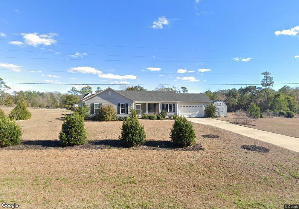
127 Broad Creek Loop Rd Newport, NC 28570
Estimated Value: $401,000 - $442,000
4
Beds
2
Baths
1,712
Sq Ft
$243/Sq Ft
Est. Value
About This Home
This home is located at 127 Broad Creek Loop Rd, Newport, NC 28570 and is currently estimated at $416,739, approximately $243 per square foot. 127 Broad Creek Loop Rd is a home with nearby schools including Bogue Sound Elementary School, Broad Creek Middle School, and Croatan High School.
Ownership History
Date
Name
Owned For
Owner Type
Purchase Details
Closed on
Jun 29, 2018
Sold by
Brb Builders Inc
Bought by
Gilmartin Kevin G
Current Estimated Value
Purchase Details
Closed on
Feb 23, 2018
Sold by
Griffith Scott M and Griffith Erin
Bought by
Brb Builders Inc
Home Financials for this Owner
Home Financials are based on the most recent Mortgage that was taken out on this home.
Original Mortgage
$161,500
Interest Rate
3.99%
Mortgage Type
Construction
Create a Home Valuation Report for This Property
The Home Valuation Report is an in-depth analysis detailing your home's value as well as a comparison with similar homes in the area
Home Values in the Area
Average Home Value in this Area
Purchase History
| Date | Buyer | Sale Price | Title Company |
|---|---|---|---|
| Gilmartin Kevin G | $275,000 | None Available | |
| Brb Builders Inc | $40,000 | None Available |
Source: Public Records
Mortgage History
| Date | Status | Borrower | Loan Amount |
|---|---|---|---|
| Previous Owner | Brb Builders Inc | $161,500 |
Source: Public Records
Tax History Compared to Growth
Tax History
| Year | Tax Paid | Tax Assessment Tax Assessment Total Assessment is a certain percentage of the fair market value that is determined by local assessors to be the total taxable value of land and additions on the property. | Land | Improvement |
|---|---|---|---|---|
| 2025 | $1,354 | $411,921 | $97,468 | $314,453 |
| 2024 | $935 | $190,281 | $41,573 | $148,708 |
| 2023 | $1,009 | $190,281 | $41,573 | $148,708 |
| 2022 | $990 | $190,281 | $41,573 | $148,708 |
| 2021 | $0 | $190,281 | $41,573 | $148,708 |
| 2020 | $960 | $190,281 | $41,573 | $148,708 |
| 2019 | $851 | $172,025 | $24,490 | $147,535 |
| 2017 | $96 | $24,490 | $24,490 | $0 |
| 2016 | $96 | $24,490 | $24,490 | $0 |
| 2015 | $88 | $24,490 | $24,490 | $0 |
| 2014 | -- | $50,262 | $50,262 | $0 |
Source: Public Records
Map
Nearby Homes
- 111 Hampton Place
- 121 Guthrie Dr
- 110 Soundview Dr
- 265 Bay Run
- 318 Norfolk Dr Unit 333
- 220 Sequoia Dr Unit 263
- 421 Old Swansboro Rd
- 118 Turtle Ct
- 680 Broad Creek Loop Rd
- 312 Rollingwood Dr
- 531 Eagle Rd
- 264 Pearson Cir
- 124 Creek Bluff Rd
- 114 Creek Bluff Rd
- 106 Key West Ln
- 111 Key West Ln
- 444 Pearson Cir
- 401 Scot Dr
- 118 Buena Vista Dr
- 240 Salt Meadow Ln
- 421 George Taylor Rd
- 419 George Taylor Rd
- 415 George Taylor Rd
- 109 Eudora Dr
- 107 Eudora Dr
- 105 Eudora Dr
- 113 Eudora Dr
- 103 Eudora Dr
- 121 Eudora Dr
- 181 Broad Creek Loop Rd
- 117 Eudora Dr
- 110 Eudora Dr
- 108 Eudora Dr
- 112 Eudora Dr
- 191 Sir Christopher Dr
- 106 Eudora Dr
- 127 Nicks Ave
- 159 Sir Christopher Dr
- 104 Eudora Dr
- 116 Eudora Dr