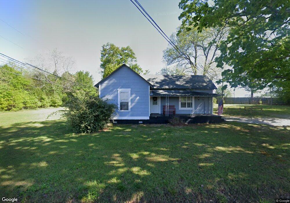
127 Burnette Rd Barnesville, GA 30204
Estimated Value: $91,000 - $215,000
2
Beds
1
Bath
1,389
Sq Ft
$109/Sq Ft
Est. Value
About This Home
This home is located at 127 Burnette Rd, Barnesville, GA 30204 and is currently estimated at $151,681, approximately $109 per square foot. 127 Burnette Rd is a home located in Lamar County with nearby schools including Lamar County Primary School, Lamar County Elementary School, and Lamar County Middle School.
Ownership History
Date
Name
Owned For
Owner Type
Purchase Details
Closed on
Jan 17, 2018
Sold by
Coffey Patsy
Bought by
Bryan Brad
Current Estimated Value
Purchase Details
Closed on
Mar 30, 2016
Sold by
Woodall Betty
Bought by
Coffey Patsy
Purchase Details
Closed on
Jul 26, 2007
Sold by
Woodall Betty S
Bought by
Hatley William K
Purchase Details
Closed on
Aug 29, 2005
Sold by
Woodall Betty
Bought by
Rooks R Neil and Rooks Denise
Purchase Details
Closed on
Feb 18, 1954
Bought by
Woodall Betty Simmons
Create a Home Valuation Report for This Property
The Home Valuation Report is an in-depth analysis detailing your home's value as well as a comparison with similar homes in the area
Home Values in the Area
Average Home Value in this Area
Purchase History
| Date | Buyer | Sale Price | Title Company |
|---|---|---|---|
| Bryan Brad | $43,000 | -- | |
| Coffey Patsy | $10,000 | -- | |
| Hatley William K | $2,364 | -- | |
| Rooks R Neil | $30,000 | -- | |
| Woodall Betty Simmons | -- | -- |
Source: Public Records
Tax History Compared to Growth
Tax History
| Year | Tax Paid | Tax Assessment Tax Assessment Total Assessment is a certain percentage of the fair market value that is determined by local assessors to be the total taxable value of land and additions on the property. | Land | Improvement |
|---|---|---|---|---|
| 2025 | $783 | $32,297 | $6,000 | $26,297 |
| 2024 | $783 | $27,313 | $6,000 | $21,313 |
| 2023 | $829 | $26,850 | $6,000 | $20,850 |
| 2022 | $725 | $26,266 | $6,000 | $20,266 |
| 2021 | $660 | $21,957 | $6,000 | $15,957 |
| 2020 | $681 | $21,498 | $6,000 | $15,498 |
| 2019 | $682 | $21,498 | $6,000 | $15,498 |
| 2018 | $204 | $6,680 | $2,680 | $4,000 |
| 2017 | $0 | $6,680 | $2,680 | $4,000 |
| 2016 | -- | $6,680 | $2,680 | $4,000 |
| 2015 | $79 | $14,200 | $2,680 | $11,520 |
| 2014 | $79 | $14,200 | $2,680 | $11,520 |
| 2013 | -- | $14,200 | $2,680 | $11,520 |
Source: Public Records
Map
Nearby Homes
- 0 Washington Cir
- 500 Rose Ave
- 13 Brown St
- 746 Highway 18 W
- 0 Old Milner Rd Unit 10630085
- 254 Needleleaf Dr
- 125 Byrd St
- 420 Zebulon St
- 0 Veterns Pkwy Unit 10515268
- 531 Thomaston St
- 150 Georgia Ave
- 295 Grove St
- 205 Georgia Ave
- 0 Highway 341 S Unit 181569
- 0 Highway 341 S Unit 10610486
- 339 Atlanta St
- 306 Spencer St
- 245 Atlanta St
- 00 Yatesville Rd Unit 1
- 818 Cannafax Rd
- 508 Highway 18 W
- 514 Highway 18 W
- 518 Georgia 18
- 528 Highway 18 W
- 532 Georgia 18
- 155 Burnette Rd
- 96 Ashley Oaks Dr
- 101 Ashley Oaks Dr
- 100 Ashley Oaks Dr
- 98 Ashley Oaks Dr
- 103 Ashley Oaks Dr
- 536 Highway 18 W
- 102 Ashley Oaks Dr
- 105 Ashley Oaks Dr
- 539 Highway 18 W
- 165 Burnette Rd
- 0 Ashley Oaks Dr Unit 7566068
- 0 Ashley Oaks Dr
- 540 Highway 18 W
- 104 Ashley Oaks Dr