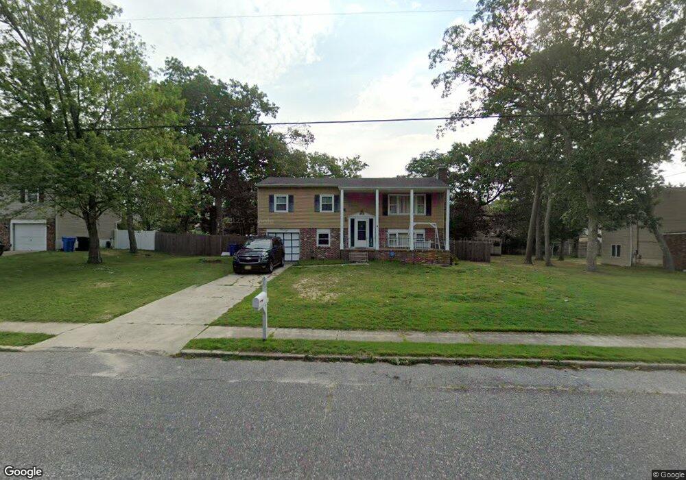
127 Butter Rd Ocean View, NJ 08230
Estimated Value: $319,910 - $477,000
--
Bed
--
Bath
1,080
Sq Ft
$362/Sq Ft
Est. Value
About This Home
This home is located at 127 Butter Rd, Ocean View, NJ 08230 and is currently estimated at $390,978, approximately $362 per square foot. 127 Butter Rd is a home located in Cape May County with nearby schools including Upper Township Primary School, Upper Township Elementary School, and Upper Township Middle School.
Ownership History
Date
Name
Owned For
Owner Type
Purchase Details
Closed on
Sep 19, 2016
Sold by
The Estate Of Andrea R Dearing and Kenneth Christopher
Bought by
Dearing Christopher K and Dearing Matthew P
Current Estimated Value
Purchase Details
Closed on
Mar 16, 2007
Sold by
Dearing Bernadette M
Bought by
Dearing Andrea R and Dearing Bernadette M
Create a Home Valuation Report for This Property
The Home Valuation Report is an in-depth analysis detailing your home's value as well as a comparison with similar homes in the area
Home Values in the Area
Average Home Value in this Area
Purchase History
| Date | Buyer | Sale Price | Title Company |
|---|---|---|---|
| Dearing Christopher K | -- | None Available | |
| Dearing Andrea R | -- | None Available |
Source: Public Records
Tax History Compared to Growth
Tax History
| Year | Tax Paid | Tax Assessment Tax Assessment Total Assessment is a certain percentage of the fair market value that is determined by local assessors to be the total taxable value of land and additions on the property. | Land | Improvement |
|---|---|---|---|---|
| 2025 | $5,219 | $227,400 | $113,800 | $113,600 |
| 2024 | $5,219 | $227,400 | $113,800 | $113,600 |
| 2023 | $4,962 | $227,400 | $113,800 | $113,600 |
| 2022 | $4,780 | $227,400 | $113,800 | $113,600 |
| 2021 | $3,412 | $227,400 | $113,800 | $113,600 |
| 2020 | $4,432 | $227,400 | $113,800 | $113,600 |
| 2019 | $4,314 | $227,400 | $113,800 | $113,600 |
| 2018 | $4,200 | $227,400 | $113,800 | $113,600 |
| 2017 | $4,148 | $227,400 | $113,800 | $113,600 |
| 2016 | $3,745 | $201,900 | $113,800 | $88,100 |
| 2015 | $3,644 | $201,900 | $113,800 | $88,100 |
| 2014 | $4,460 | $303,000 | $175,800 | $127,200 |
Source: Public Records
Map
Nearby Homes
- 124 Butter Rd
- 11 Red Oak Dr
- 40 Butter Rd
- 46 Victoria Ln
- 1233 Route 9
- 4 Bayview Ave
- 1340 U S 9
- 19 Bayview Ave
- 100 Bayview Ave
- 28 Queen Anne Ct
- 734 Stagecoach Rd
- 11 Evio John Ct
- 24 E Timber Dr
- 731 Oceancrest Ave
- 705 Route Us 9 S
- 4 Sandcastle Dr
- 1729 Shore Rd
- 3 Sandcastle Dr
- 1731 Route 9 Unit 28
- 430 S Shore Rd
- 131 Butter Rd
- 123 Butter Rd
- 30 Red Oak Dr
- 28 Red Oak Dr
- 32 Red Oak Dr
- 135 Butter Rd
- 119 Butter Rd
- 26 Red Oak Dr
- 26 Red Oak Dr Unit Oak Forest
- 117 Butter Rd
- 34 Red Oak Dr
- 24 Red Oak Dr
- 139 Butter Rd
- 138 Butter Rd
- 31 Red Oak Dr
- 29 Red Oak Dr
- 1205 Stagecoach Rd
- 27 Red Oak Dr
- 120 Butter Rd
- 33 Red Oak Dr