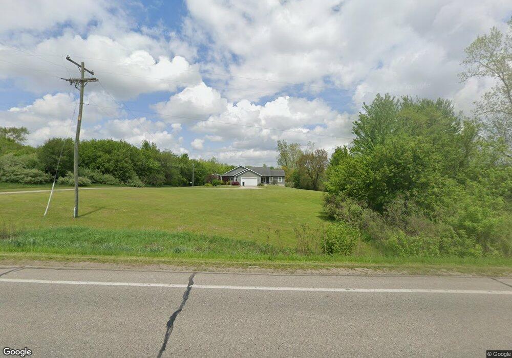
127 Byron Rd SW Byron Center, MI 49315
Estimated Value: $575,772 - $970,000
--
Bed
--
Bath
2,317
Sq Ft
$341/Sq Ft
Est. Value
About This Home
This home is located at 127 Byron Rd SW, Byron Center, MI 49315 and is currently estimated at $790,924, approximately $341 per square foot. 127 Byron Rd SW is a home located in Ottawa County with nearby schools including Jamestown Lower Elementary School, Riley Street Middle School, and Hudsonville Freshman Campus.
Ownership History
Date
Name
Owned For
Owner Type
Purchase Details
Closed on
Mar 15, 2013
Sold by
Smith Leslie G and Hoorn Russell
Bought by
Hoorn Russell and Hoorn Tracy
Current Estimated Value
Purchase Details
Closed on
Sep 12, 2003
Sold by
Smith Leslie G
Bought by
Smith Leslie G and Hoorn Russell
Home Financials for this Owner
Home Financials are based on the most recent Mortgage that was taken out on this home.
Original Mortgage
$63,200
Interest Rate
6.25%
Mortgage Type
Purchase Money Mortgage
Purchase Details
Closed on
Sep 11, 2003
Sold by
Allen Vivian M
Bought by
Carter Shawn L
Home Financials for this Owner
Home Financials are based on the most recent Mortgage that was taken out on this home.
Original Mortgage
$63,200
Interest Rate
6.25%
Mortgage Type
Purchase Money Mortgage
Create a Home Valuation Report for This Property
The Home Valuation Report is an in-depth analysis detailing your home's value as well as a comparison with similar homes in the area
Home Values in the Area
Average Home Value in this Area
Purchase History
| Date | Buyer | Sale Price | Title Company |
|---|---|---|---|
| Hoorn Russell | -- | None Available | |
| Smith Leslie G | -- | -- | |
| Smith Leslie G | $79,000 | -- | |
| Carter Shawn L | -- | -- |
Source: Public Records
Mortgage History
| Date | Status | Borrower | Loan Amount |
|---|---|---|---|
| Closed | Smith Leslie G | $63,200 |
Source: Public Records
Tax History Compared to Growth
Tax History
| Year | Tax Paid | Tax Assessment Tax Assessment Total Assessment is a certain percentage of the fair market value that is determined by local assessors to be the total taxable value of land and additions on the property. | Land | Improvement |
|---|---|---|---|---|
| 2025 | $5,488 | $297,700 | $0 | $0 |
| 2024 | $4,418 | $256,800 | $0 | $0 |
| 2023 | $4,219 | $236,800 | $0 | $0 |
| 2022 | $4,986 | $216,800 | $0 | $0 |
| 2021 | $4,854 | $219,100 | $0 | $0 |
| 2020 | $4,806 | $204,300 | $0 | $0 |
| 2019 | $4,732 | $190,600 | $0 | $0 |
| 2018 | $4,415 | $191,500 | $0 | $0 |
| 2017 | $4,327 | $191,500 | $0 | $0 |
| 2016 | -- | $177,300 | $0 | $0 |
| 2015 | -- | $162,200 | $0 | $0 |
| 2014 | -- | $151,100 | $0 | $0 |
Source: Public Records
Map
Nearby Homes
- 2280 8th Ave SW Unit Parcel 3
- 4483 76th St SW
- 8441 Homerich Ave SW
- 8047 Erie Dr
- Redwood Plan at Railside - Woodland Series
- Sycamore Plan at Railside - Woodland Series
- Bay Harbor Plan at Railside - Landmark Series
- Northport Plan at Railside - Landmark Series
- Pentwater Plan at Railside - Landmark Series
- Oakwood Plan at Railside - Woodland Series
- 1649 Byron Rd
- 8115 Byron Depot Dr SW
- 3563 Conrail Dr
- 7998 Byron Depot Dr SW
- 1615 Round Barn Dr
- 3183 Railway Dr SW
- 1633 Round Barn Dr
- 3410 92nd St SW
- The Preston Plan at Spring Grove Village
- The Rutherford Plan at Spring Grove Village
- 79 Byron Rd SW
- 2415 Kenowa Ave SW
- 170 Byron Rd SW
- 197 Byron Rd
- 231 Byron Rd
- 2479 Kenowa Ave SW
- 24 Byron Rd SW
- 0 Kenowa Ave SW Unit 65015019664
- 0 Kenowa Ave SW Unit 65015019677
- 0 Kenowa Ave SW Unit 65014035324
- 0 Kenowa Ave SW Unit 65014035321
- 0 Kenowa Ave SW Unit 65013032879
- 0 Kenowa Ave SW Unit M13032879
- 0 Kenowa Ave SW Unit M13032870
- 0 Kenowa Ave SW Unit M13032862
- 0 Kenowa Ave SW Unit M14035324
- 0 Kenowa Ave SW Unit M14035321
- 0 Kenowa Ave SW Unit M15019664
- 0 Kenowa Ave SW Unit M15019677
- 0 Kenowa Ave SW Unit M17049660