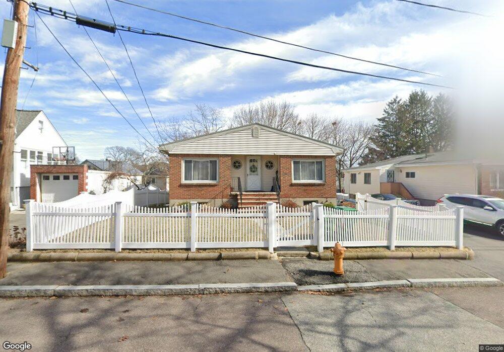
127 Circuit Rd Medford, MA 02155
Lawrence Estates NeighborhoodEstimated Value: $810,000 - $955,000
3
Beds
3
Baths
1,368
Sq Ft
$646/Sq Ft
Est. Value
About This Home
This home is located at 127 Circuit Rd, Medford, MA 02155 and is currently estimated at $883,659, approximately $645 per square foot. 127 Circuit Rd is a home located in Middlesex County with nearby schools including Medford High School, Mystic Valley Regional Charter School, and St. Joseph School.
Ownership History
Date
Name
Owned For
Owner Type
Purchase Details
Closed on
Oct 29, 2008
Sold by
Olson Loretta A
Bought by
Olson Ft
Current Estimated Value
Purchase Details
Closed on
Sep 25, 1990
Sold by
Nandhavan Kamoldhep
Bought by
Olson Thomas J
Home Financials for this Owner
Home Financials are based on the most recent Mortgage that was taken out on this home.
Original Mortgage
$110,000
Interest Rate
9.89%
Mortgage Type
Purchase Money Mortgage
Create a Home Valuation Report for This Property
The Home Valuation Report is an in-depth analysis detailing your home's value as well as a comparison with similar homes in the area
Home Values in the Area
Average Home Value in this Area
Purchase History
| Date | Buyer | Sale Price | Title Company |
|---|---|---|---|
| Olson Ft | -- | -- | |
| Olson Thomas J | $167,000 | -- |
Source: Public Records
Mortgage History
| Date | Status | Borrower | Loan Amount |
|---|---|---|---|
| Previous Owner | Olson Thomas J | $107,500 | |
| Previous Owner | Olson Thomas J | $110,000 | |
| Previous Owner | Olson Thomas J | $125,000 | |
| Previous Owner | Olson Thomas J | $100,000 |
Source: Public Records
Tax History Compared to Growth
Tax History
| Year | Tax Paid | Tax Assessment Tax Assessment Total Assessment is a certain percentage of the fair market value that is determined by local assessors to be the total taxable value of land and additions on the property. | Land | Improvement |
|---|---|---|---|---|
| 2025 | $7,033 | $799,200 | $408,900 | $390,300 |
| 2024 | $6,255 | $734,100 | $389,400 | $344,700 |
| 2023 | $5,527 | $639,000 | $363,900 | $275,100 |
| 2022 | $5,370 | $596,000 | $330,800 | $265,200 |
| 2021 | $5,394 | $573,200 | $315,100 | $258,100 |
| 2020 | $5,218 | $568,400 | $323,100 | $245,300 |
| 2019 | $4,971 | $517,800 | $293,800 | $224,000 |
| 2018 | $4,663 | $455,400 | $267,000 | $188,400 |
| 2017 | $4,727 | $447,600 | $249,600 | $198,000 |
| 2016 | $4,470 | $399,500 | $226,900 | $172,600 |
| 2015 | $3,971 | $339,400 | $216,100 | $123,300 |
Source: Public Records
Map
Nearby Homes
- 203 Ashcroft Rd
- 3 Mary Kenney Way
- 197 Governors Ave
- 30 Westwood Rd
- 59-65 Valley St Unit 4G
- 0 Gordon Rd
- 15 King Ave
- 26 Foss St Unit 1
- 94 Damon Rd
- 5 Ash St Unit 9
- 10 Lewis St Unit PH
- 10 Lewis St Unit 1
- 83 Court St
- 50 Water St Unit 24
- 12 Gaston St
- 38 Tainter St
- 154 High St Unit 204
- 32 Almont St Unit 32-1
- 190 High St Unit 605
- 11 Whitney Rd
- 125 Circuit Rd
- 131 Circuit Rd
- 112 Sherwood Rd
- 112 Sherwood Rd
- 112 Sherwood Rd Unit 1
- 119 Circuit Rd
- 106 Sherwood Rd
- 130 Circuit Rd
- 102 Sherwood Rd
- 19 Circuit Rd
- 126 Circuit Rd
- 115 Circuit Rd
- 74 Massachusetts Ave
- 15 Circuit Rd
- 122 Circuit Rd
- 90 Sherwood Rd
- 61 Massachusetts Ave
- 21 Circuit Rd
- 86 Sherwood Rd
- 111 Circuit Rd