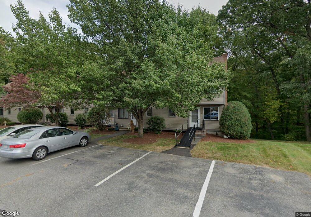
127 Cortland Cir Leominster, MA 01453
Estimated Value: $317,049 - $337,000
2
Beds
2
Baths
1,058
Sq Ft
$311/Sq Ft
Est. Value
About This Home
This home is located at 127 Cortland Cir, Leominster, MA 01453 and is currently estimated at $329,012, approximately $310 per square foot. 127 Cortland Cir is a home located in Worcester County with nearby schools including Leominster High School, St. Anna Catholic School, and St. Leo School.
Ownership History
Date
Name
Owned For
Owner Type
Purchase Details
Closed on
Aug 31, 2000
Sold by
Callahan Sean P and Callahan Paula M
Bought by
Lawrence David S and Lawrence Linda F
Current Estimated Value
Home Financials for this Owner
Home Financials are based on the most recent Mortgage that was taken out on this home.
Original Mortgage
$107,120
Interest Rate
8.16%
Mortgage Type
Purchase Money Mortgage
Create a Home Valuation Report for This Property
The Home Valuation Report is an in-depth analysis detailing your home's value as well as a comparison with similar homes in the area
Home Values in the Area
Average Home Value in this Area
Purchase History
| Date | Buyer | Sale Price | Title Company |
|---|---|---|---|
| Lawrence David S | $104,000 | -- |
Source: Public Records
Mortgage History
| Date | Status | Borrower | Loan Amount |
|---|---|---|---|
| Open | Lawrence David S | $126,250 | |
| Closed | Lawrence David S | $103,150 | |
| Closed | Lawrence David S | $18,000 | |
| Closed | Lawrence David S | $107,120 |
Source: Public Records
Tax History Compared to Growth
Tax History
| Year | Tax Paid | Tax Assessment Tax Assessment Total Assessment is a certain percentage of the fair market value that is determined by local assessors to be the total taxable value of land and additions on the property. | Land | Improvement |
|---|---|---|---|---|
| 2025 | $3,609 | $257,200 | $0 | $257,200 |
| 2024 | $3,561 | $245,400 | $0 | $245,400 |
| 2023 | $3,386 | $217,900 | $0 | $217,900 |
| 2022 | $2,949 | $178,100 | $0 | $178,100 |
| 2021 | $3,156 | $174,100 | $0 | $174,100 |
| 2020 | $2,958 | $164,500 | $0 | $164,500 |
| 2019 | $2,553 | $137,700 | $0 | $137,700 |
| 2018 | $2,617 | $135,400 | $0 | $135,400 |
| 2017 | $2,539 | $128,700 | $0 | $128,700 |
| 2016 | $2,440 | $124,600 | $0 | $124,600 |
| 2015 | $2,422 | $124,600 | $0 | $124,600 |
| 2014 | $2,437 | $129,000 | $0 | $129,000 |
Source: Public Records
Map
Nearby Homes
- 498 Lancaster St
- 17 1st Ave
- 6 Longwood Ave
- 14 Florence St
- 77 Vezina St
- 31 Johnson St
- 851 Lancaster St
- 59 Webber St
- 49 Meadow Pond Dr Unit C
- 49 Meadow Pond Dr Unit I
- 284 Mechanic St
- 36 Meadow Pond Dr Unit I
- 257 Spruce St
- 740 Central St Unit R24
- 740 Central St Unit L22
- 556 Central St Unit 43
- 556 Central St Unit 39
- 30 Abbey Rd Unit 207
- 10 Abbey Rd Unit 108
- 30 Abbey Rd Unit 202
- 137 Cortland Cir Unit 137
- 137 Cortland Cir Unit 47
- 137 Cortland Cir
- 135 Cortland Cir
- 133 Cortland Cir
- 131 Cortland Cir
- 129 Cortland Cir
- 133 Cortland Cir
- 133 Cortland Cir Unit 133
- 133 Cortland Cir
- 137 Cortland Cir Unit 42
- 133 Cortland Cir Unit 40
- 135 Cortland Cir Unit 41
- 145 Cortland Cir
- 143 Cortland Cir
- 141 Cortland Cir
- 139 Cortland Cir
- 141 Cortland Cir Unit 44
- 145 Cortland Cir Unit 145
- 120 Cortland Cir