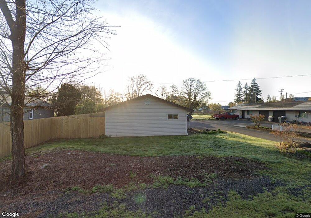
127 Curtis St NE Albany, OR 97322
East Albany NeighborhoodEstimated Value: $371,846 - $397,000
2
Beds
2
Baths
1,392
Sq Ft
$276/Sq Ft
Est. Value
About This Home
This home is located at 127 Curtis St NE, Albany, OR 97322 and is currently estimated at $384,423, approximately $276 per square foot. 127 Curtis St NE is a home located in Linn County with nearby schools including Timber Ridge School, Clover Ridge Elementary School, and South Albany High School.
Ownership History
Date
Name
Owned For
Owner Type
Purchase Details
Closed on
Mar 30, 2022
Sold by
Murray-Mason Rentals Llc
Bought by
Barna Randy
Current Estimated Value
Purchase Details
Closed on
Jun 28, 2013
Sold by
Ybarra Samuel E and Ybarra Emma D
Bought by
Murray Mason Rentals Llc
Home Financials for this Owner
Home Financials are based on the most recent Mortgage that was taken out on this home.
Original Mortgage
$380,000
Interest Rate
3.48%
Mortgage Type
Seller Take Back
Create a Home Valuation Report for This Property
The Home Valuation Report is an in-depth analysis detailing your home's value as well as a comparison with similar homes in the area
Home Values in the Area
Average Home Value in this Area
Purchase History
| Date | Buyer | Sale Price | Title Company |
|---|---|---|---|
| Barna Randy | $400,000 | Ticor Title | |
| Murray Mason Rentals Llc | $480,000 | Amerititle |
Source: Public Records
Mortgage History
| Date | Status | Borrower | Loan Amount |
|---|---|---|---|
| Previous Owner | Murray Mason Rentals Llc | $380,000 |
Source: Public Records
Tax History Compared to Growth
Tax History
| Year | Tax Paid | Tax Assessment Tax Assessment Total Assessment is a certain percentage of the fair market value that is determined by local assessors to be the total taxable value of land and additions on the property. | Land | Improvement |
|---|---|---|---|---|
| 2025 | $3,707 | $183,850 | -- | -- |
| 2024 | $3,594 | $178,500 | -- | -- |
| 2023 | $3,493 | $173,310 | $0 | $0 |
| 2022 | $3,443 | $168,270 | $0 | $0 |
| 2021 | $3,246 | $163,370 | $0 | $0 |
| 2020 | $3,208 | $158,620 | $0 | $0 |
| 2019 | $3,135 | $154,000 | $0 | $0 |
| 2018 | $3,051 | $149,520 | $0 | $0 |
| 2017 | $2,733 | $145,170 | $0 | $0 |
| 2016 | $2,569 | $140,950 | $0 | $0 |
| 2015 | $2,466 | $136,850 | $0 | $0 |
| 2014 | $2,357 | $132,870 | $0 | $0 |
Source: Public Records
Map
Nearby Homes
- 3705 Earl Ave NE
- 3711 Earl Ave NE
- 3886 Linn Ave SE
- 3482 Adah Ave NE
- 3448 Adah Ave NE
- 300 Western St SE
- 505 Montclair Dr NE
- 664 Montclair Dr NE
- Lot 113 Knox Butte Rd E
- 3607 Cameron Ct NE
- 4009 Somerset Dr NE
- 4145 Winners Circle Ave SE
- 391 Churchill Downs St SE
- 538 Churchill Downs St SE
- 4301 Hackamore Ct SE
- 4315 Hackamore SE
- 552 Churchill Downs St SE
- Ashland Plan at Brandis Estates
- Arlington Plan at Brandis Estates
- Jade Plan at Brandis Estates
- 123 Curtis St NE
- 131 Curtis St NE
- 140 Opal St NE
- 117 Curtis St NE
- 139 Curtis St NE
- 120 Opal St NE
- 130 Curtis St NE
- 3605 Knox Butte Rd E
- 3615 Knox Butte Rd E
- 120 Curtis St NE
- 3625 Knox Butte Rd E
- 3635 Knox Butte Rd E
- 3645 Knox Butte Rd E
- 3655 Knox Butte Rd E
- 212 Expo Pkwy NE
- 154 Manor St NE
- 154 Manor St NE
- 3592 Dunlap Ave NE
- 3715 Knox Butte Rd E
- 3725 Knox Butte Rd E