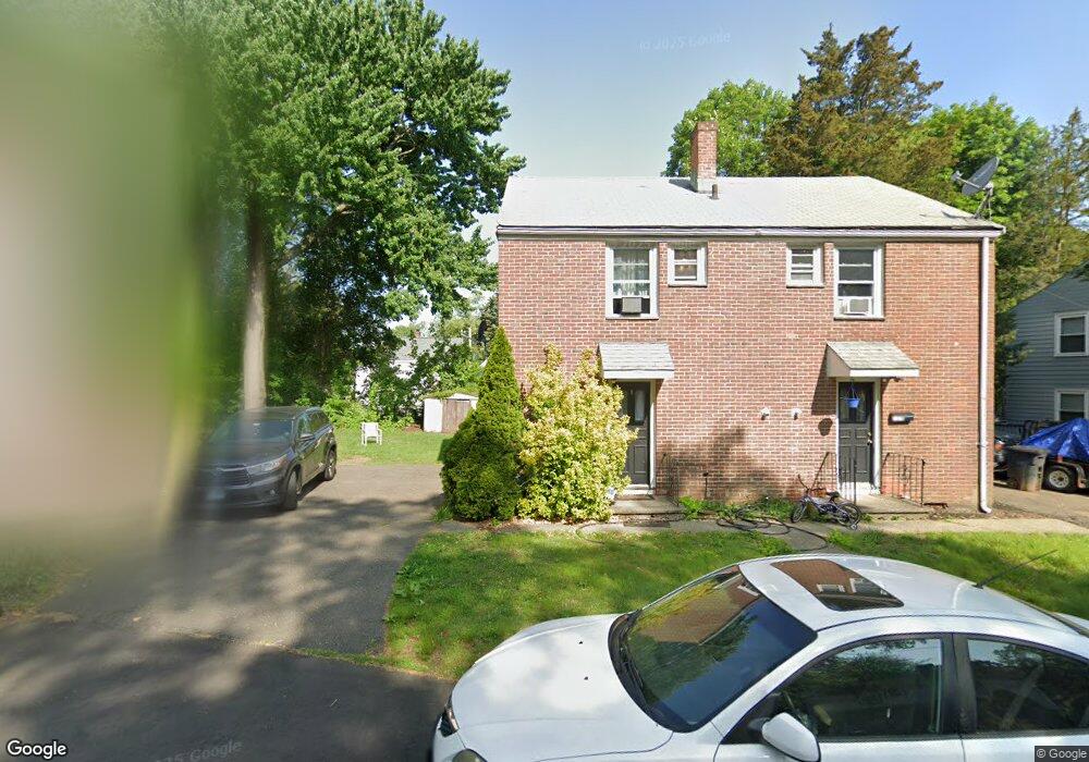
127 Dupont Place Unit 129 Bridgeport, CT 06610
North Bridgeport NeighborhoodEstimated Value: $325,000 - $407,000
4
Beds
2
Baths
1,620
Sq Ft
$228/Sq Ft
Est. Value
About This Home
This home is located at 127 Dupont Place Unit 129, Bridgeport, CT 06610 and is currently estimated at $368,805, approximately $227 per square foot. 127 Dupont Place Unit 129 is a home located in Fairfield County with nearby schools including Hooker School and Harding High School.
Ownership History
Date
Name
Owned For
Owner Type
Purchase Details
Closed on
Apr 5, 2018
Sold by
Edwards Caridad
Bought by
Edwards Nigel and Edards Caridad
Current Estimated Value
Purchase Details
Closed on
Mar 1, 2018
Sold by
Edwards Nigel
Bought by
Edwards Caridad
Purchase Details
Closed on
Apr 28, 2004
Sold by
Lambert Bonnie
Bought by
Edwards Nigel
Home Financials for this Owner
Home Financials are based on the most recent Mortgage that was taken out on this home.
Original Mortgage
$187,400
Interest Rate
5.36%
Purchase Details
Closed on
Jul 10, 1998
Sold by
Anderson Robert B
Bought by
Lambert Bonnie L
Home Financials for this Owner
Home Financials are based on the most recent Mortgage that was taken out on this home.
Original Mortgage
$23,750
Interest Rate
7.02%
Mortgage Type
Unknown
Create a Home Valuation Report for This Property
The Home Valuation Report is an in-depth analysis detailing your home's value as well as a comparison with similar homes in the area
Home Values in the Area
Average Home Value in this Area
Purchase History
| Date | Buyer | Sale Price | Title Company |
|---|---|---|---|
| Edwards Nigel | -- | -- | |
| Edwards Nigel | -- | -- | |
| Edwards Caridad | -- | -- | |
| Edwards Caridad | -- | -- | |
| Edwards Nigel | $189,000 | -- | |
| Edwards Nigel | $189,000 | -- | |
| Lambert Bonnie L | $25,000 | -- | |
| Lambert Bonnie L | $25,000 | -- |
Source: Public Records
Mortgage History
| Date | Status | Borrower | Loan Amount |
|---|---|---|---|
| Previous Owner | Lambert Bonnie L | $187,400 | |
| Previous Owner | Lambert Bonnie L | $23,750 |
Source: Public Records
Tax History Compared to Growth
Tax History
| Year | Tax Paid | Tax Assessment Tax Assessment Total Assessment is a certain percentage of the fair market value that is determined by local assessors to be the total taxable value of land and additions on the property. | Land | Improvement |
|---|---|---|---|---|
| 2025 | $6,045 | $139,120 | $51,580 | $87,540 |
| 2024 | $6,045 | $139,120 | $51,580 | $87,540 |
| 2023 | $6,045 | $139,120 | $51,580 | $87,540 |
| 2022 | $6,045 | $139,120 | $51,580 | $87,540 |
| 2021 | $6,045 | $139,120 | $51,580 | $87,540 |
| 2020 | $6,097 | $112,930 | $39,860 | $73,070 |
| 2019 | $6,097 | $112,930 | $39,860 | $73,070 |
| 2018 | $6,140 | $112,930 | $39,860 | $73,070 |
| 2017 | $6,140 | $112,930 | $39,860 | $73,070 |
| 2016 | $6,140 | $112,930 | $39,860 | $73,070 |
| 2015 | $6,244 | $147,960 | $48,240 | $99,720 |
| 2014 | $6,244 | $147,960 | $48,240 | $99,720 |
Source: Public Records
Map
Nearby Homes
- 197 Dupont Place Unit 199
- 165 Nutmeg Rd
- 50 Pilgrim Rd
- 11 Nob Hill Cir
- 206 Huntington Turnpike
- 132 Virginia Ave Unit 132
- 94 Virginia Ave Unit 94
- 120 Huntington Turnpike Unit 202
- 120 Huntington Turnpike Unit 606
- 120 Huntington Turnpike Unit 801
- 33 Louisiana Ave Unit 35
- 275 Roger Williams Rd
- 53 Beverly Dr
- 374 Mapledale Place
- 2463 E Main St
- 123 Beverly Dr
- 69 Glen Cir
- 3699 Broadbridge Ave Unit 107
- 83 Berkeley Place Unit 85
- 149 Edna Ave Unit 153
- 119 Dupont Place
- 117 Dupont Place Unit 119
- 117 Dupont Place
- 143 Dupont Place Unit 1
- 143-145 Dupont Place
- 128 Dupont Place Unit 130
- 80 Dupont Place
- 82 Dupont Place Unit 88
- 144 Dupont Place Unit 146
- 115 Dupont Place Unit 117
- 78 Dupont Place Unit 80
- 82-88 Dupont Place
- 146 Dupont Place Unit 146
- 118 Dupont Place Unit 120
- 11 Dupont Place
- 144-146 Dupont Place
- 117 East Ave
- 160 Dupont Place Unit 164
- 167 Dupont Place Unit 169