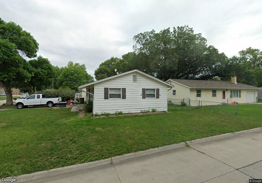
127 E 13th St Hastings, NE 68901
Estimated Value: $106,000 - $146,625
2
Beds
1
Bath
744
Sq Ft
$180/Sq Ft
Est. Value
About This Home
This home is located at 127 E 13th St, Hastings, NE 68901 and is currently estimated at $133,656, approximately $179 per square foot. 127 E 13th St is a home located in Adams County with nearby schools including Hastings Senior High School and St. Cecilia High School.
Ownership History
Date
Name
Owned For
Owner Type
Purchase Details
Closed on
Aug 25, 2011
Sold by
Fried Daniel L
Bought by
Leichleiter Tanner J
Current Estimated Value
Home Financials for this Owner
Home Financials are based on the most recent Mortgage that was taken out on this home.
Original Mortgage
$43,632
Outstanding Balance
$29,865
Interest Rate
4.25%
Mortgage Type
FHA
Estimated Equity
$103,791
Purchase Details
Closed on
Jun 24, 2009
Sold by
King Susan G and King Josh
Bought by
Fried Daniel L
Home Financials for this Owner
Home Financials are based on the most recent Mortgage that was taken out on this home.
Original Mortgage
$31,949
Interest Rate
5.71%
Mortgage Type
FHA
Create a Home Valuation Report for This Property
The Home Valuation Report is an in-depth analysis detailing your home's value as well as a comparison with similar homes in the area
Home Values in the Area
Average Home Value in this Area
Purchase History
| Date | Buyer | Sale Price | Title Company |
|---|---|---|---|
| Leichleiter Tanner J | $45,000 | Adams Land Title | |
| Fried Daniel L | $34,000 | -- |
Source: Public Records
Mortgage History
| Date | Status | Borrower | Loan Amount |
|---|---|---|---|
| Open | Leichleiter Tanner J | $43,632 | |
| Previous Owner | Fried Daniel L | $31,949 |
Source: Public Records
Tax History Compared to Growth
Tax History
| Year | Tax Paid | Tax Assessment Tax Assessment Total Assessment is a certain percentage of the fair market value that is determined by local assessors to be the total taxable value of land and additions on the property. | Land | Improvement |
|---|---|---|---|---|
| 2024 | $1,416 | $88,259 | $12,406 | $75,853 |
| 2023 | $1,681 | $81,487 | $12,406 | $69,081 |
| 2022 | $1,550 | $68,799 | $12,406 | $56,393 |
| 2021 | $1,410 | $64,307 | $7,914 | $56,393 |
| 2020 | $1,329 | $61,622 | $7,914 | $53,708 |
| 2019 | $1,260 | $59,064 | $7,914 | $51,150 |
| 2018 | $1,193 | $55,640 | $4,490 | $51,150 |
| 2017 | $1,192 | $55,640 | $0 | $0 |
| 2016 | $1,042 | $48,585 | $4,490 | $44,095 |
| 2011 | -- | $0 | $0 | $0 |
Source: Public Records
Map
Nearby Homes
- 1142 N Minnesota Ave
- 1233 N Colorado Ave
- 208 Ringland Rd
- 1113 N Colorado Ave
- 1402 N Saint Joseph Ave
- 216 Forest Blvd
- 234 Forest Blvd
- 914 N Colorado Ave
- 514 W 14th St
- 1407 N Denver Ave
- 1131 N Denver Ave
- TBD Kansas Ave
- 831 N Cedar Ave
- 903 N Saint Joseph Ave
- 1101 N Hastings Ave
- 411 University Ave
- 615 W 10th St
- 919 N Hastings Ave
- 1000 N Burlington Ave
- 814 N Lincoln Ave
- 1309 McDonald Ave
- 121 E 13th St
- 1247 McDonald Ave
- 1302 McDonald Ave
- 111 E 13th St
- 1321 McDonald Ave
- 1243 McDonald Ave
- 122 Pacific St
- 1246 McDonald Ave
- 1314 McDonald Ave
- 107 E 13th St
- 1239 McDonald Ave
- 112 Pacific St
- 1238 McDonald Ave
- 1318 McDonald Ave
- 110 Pacific St
- 1303 N Pine Ave
- 1235 McDonald Ave
- 1307 N Pine Ave
- 1322 McDonald Ave