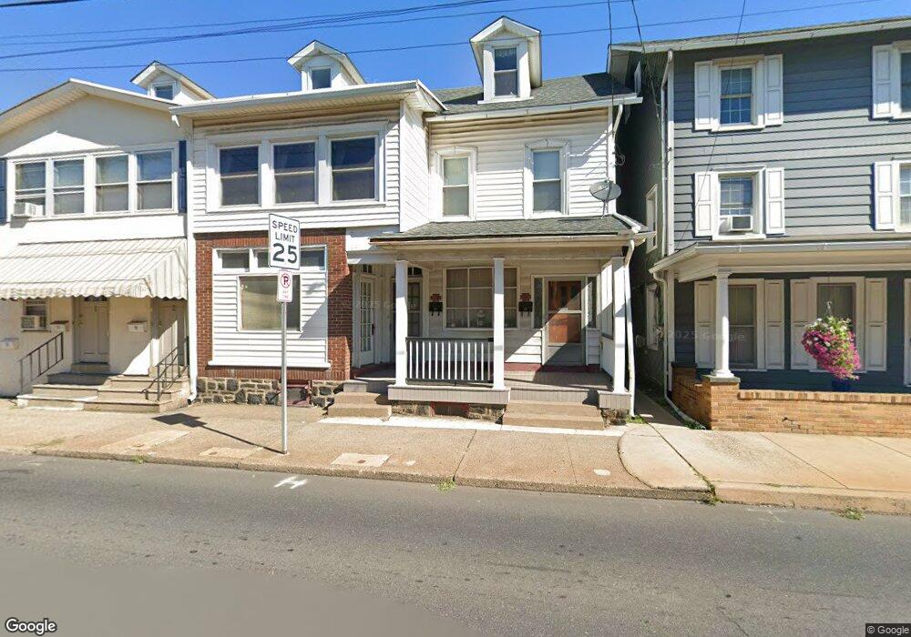
127 E Broad St Unit 129 Quakertown, PA 18951
Milford-Quakertown NeighborhoodEstimated Value: $241,000 - $339,926
5
Beds
2
Baths
2,654
Sq Ft
$112/Sq Ft
Est. Value
About This Home
This home is located at 127 E Broad St Unit 129, Quakertown, PA 18951 and is currently estimated at $297,732, approximately $112 per square foot. 127 E Broad St Unit 129 is a home located in Bucks County with nearby schools including Trumbauersville Elementary School, Quakertown Community Senior High School, and United Friends School.
Ownership History
Date
Name
Owned For
Owner Type
Purchase Details
Closed on
Nov 9, 2023
Sold by
Heukeroth David W
Bought by
Heukeroth Connie
Current Estimated Value
Purchase Details
Closed on
Dec 12, 2005
Sold by
Heuckeroth James L and Estate Of Frances Louise Heuck
Bought by
Heuckeroth David W
Purchase Details
Closed on
Jul 9, 1965
Bought by
Heuckeroth Lester M and Heuckeroth Frances
Create a Home Valuation Report for This Property
The Home Valuation Report is an in-depth analysis detailing your home's value as well as a comparison with similar homes in the area
Home Values in the Area
Average Home Value in this Area
Purchase History
| Date | Buyer | Sale Price | Title Company |
|---|---|---|---|
| Heukeroth Connie | -- | Pride Abstract & Settlement Se | |
| Heuckeroth David W | $140,000 | None Available | |
| Heuckeroth Lester M | -- | -- |
Source: Public Records
Tax History Compared to Growth
Tax History
| Year | Tax Paid | Tax Assessment Tax Assessment Total Assessment is a certain percentage of the fair market value that is determined by local assessors to be the total taxable value of land and additions on the property. | Land | Improvement |
|---|---|---|---|---|
| 2025 | $3,204 | $15,920 | $2,640 | $13,280 |
| 2024 | $3,204 | $15,920 | $2,640 | $13,280 |
| 2023 | $3,173 | $15,920 | $2,640 | $13,280 |
| 2022 | $3,119 | $15,920 | $2,640 | $13,280 |
| 2021 | $3,119 | $15,920 | $2,640 | $13,280 |
| 2020 | $3,119 | $15,920 | $2,640 | $13,280 |
| 2019 | $3,923 | $15,920 | $2,640 | $13,280 |
| 2018 | $2,927 | $15,920 | $2,640 | $13,280 |
| 2017 | $2,836 | $15,920 | $2,640 | $13,280 |
| 2016 | $2,836 | $15,920 | $2,640 | $13,280 |
| 2015 | -- | $15,920 | $2,640 | $13,280 |
| 2014 | -- | $15,920 | $2,640 | $13,280 |
Source: Public Records
Map
Nearby Homes
- 136 Woodview Dr
- 2500 Yankee Rd
- 202 Andover Ct Unit 202
- 2285 Richland Terrace
- 66 Cedar Dr
- 232 Yankee Rd Unit 156
- 344 Apple Dr
- 1844 Enclave Dr
- 1124 Longwood Dr
- Manchester Plan at Fallbrooke Farms - Single Family Homes
- Arcadia Plan at Millstone at Parkside
- Covington Plan at Millstone at Parkside
- Harrison Plan at Millstone at Parkside
- Nottingham Plan at Fallbrooke Farms - Single Family Homes
- Parker Plan at Fallbrooke Farms - Single Family Homes
- Andrews Plan at Millstone at Parkside
- Nottingham Plan at Millstone at Parkside
- Arcadia Plan at Fallbrooke Farms - Single Family Homes
- Hawthorne Plan at Millstone at Parkside
- Augusta Plan at Fallbrooke Farms - Single Family Homes
- 113 E Broad St
- 117 E Broad St
- 121 E Broad St
- 120 E Broad St
- 119 E Broad St
- 116 E Broad St
- 112 E Broad St
- 203 W Broad St
- 111 E Broad St
- 118 E Broad St
- 110 E Broad St
- 107 E Broad St Unit . A
- 107 E Broad St Unit . B
- 107 E Broad St Unit . 2
- 107 E Broad St
- 108 E Broad St
- 200 E Broad St
- 206 E Broad St
- 105 E Broad St
- 202 E Broad St