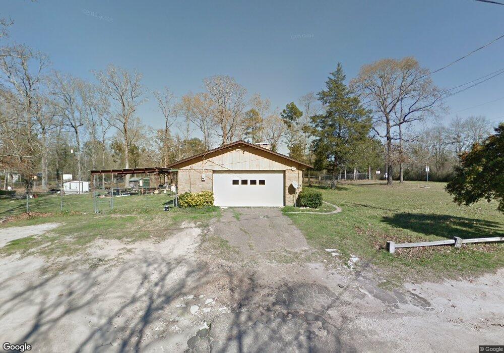
127 Falcon Ave Lufkin, TX 75904
Estimated Value: $198,000 - $228,000
Studio
8
Baths
1,293
Sq Ft
$162/Sq Ft
Est. Value
About This Home
This home is located at 127 Falcon Ave, Lufkin, TX 75904 and is currently estimated at $209,843, approximately $162 per square foot. 127 Falcon Ave is a home located in Angelina County with nearby schools including W.F. Peavy Primary School, W.H. Bonner Elementary School, and Hudson Middle School.
Ownership History
Date
Name
Owned For
Owner Type
Purchase Details
Closed on
May 26, 2006
Sold by
Pharris Charles D and Pharris Selena M
Bought by
Escobedo Hector M
Current Estimated Value
Home Financials for this Owner
Home Financials are based on the most recent Mortgage that was taken out on this home.
Original Mortgage
$97,850
Outstanding Balance
$56,994
Interest Rate
6.5%
Mortgage Type
New Conventional
Estimated Equity
$152,849
Create a Home Valuation Report for This Property
The Home Valuation Report is an in-depth analysis detailing your home's value as well as a comparison with similar homes in the area
Home Values in the Area
Average Home Value in this Area
Purchase History
| Date | Buyer | Sale Price | Title Company |
|---|---|---|---|
| Escobedo Hector M | $97,850 | Community Title |
Source: Public Records
Mortgage History
| Date | Status | Borrower | Loan Amount |
|---|---|---|---|
| Open | Escobedo Hector M | $97,850 |
Source: Public Records
Tax History
| Year | Tax Paid | Tax Assessment Tax Assessment Total Assessment is a certain percentage of the fair market value that is determined by local assessors to be the total taxable value of land and additions on the property. | Land | Improvement |
|---|---|---|---|---|
| 2025 | $2,651 | $179,220 | $55,410 | $123,810 |
| 2024 | $2,410 | $176,760 | $55,410 | $121,350 |
| 2023 | $2,178 | $176,870 | $55,410 | $121,460 |
| 2022 | $2,257 | $164,840 | $39,580 | $125,260 |
| 2021 | $2,237 | $151,920 | $39,580 | $112,340 |
| 2020 | $2,036 | $110,890 | $20,780 | $90,110 |
| 2019 | $2,044 | $107,700 | $20,170 | $87,530 |
| 2018 | $1,572 | $106,350 | $20,170 | $86,180 |
| 2017 | $1,572 | $98,560 | $16,150 | $82,410 |
| 2016 | $1,836 | $95,570 | $16,150 | $79,420 |
| 2015 | $1,522 | $94,630 | $16,150 | $78,480 |
| 2014 | $1,522 | $96,070 | $16,150 | $79,920 |
Source: Public Records
Map
Nearby Homes
- 260 Falcon Ave
- 183 Falcon Ave
- 1568 S Fm 706
- Lot 2 Bethlehem Rd
- 105,115,116,195 Wilcox Dr
- 375 John Lucy Ln
- 2459 Bethlehem Rd
- 3405 Bethlehem Rd
- 1072 Stephenson Brown Rd
- 895 Foster Rd
- 905 Foster Rd
- 885 Foster Rd
- 176 Lancewood Cir
- 151 Lancewood Cir
- PID 25110 James Oates Rd
- 184 Beechnut Cir
- 5740 Hwy 103e
- 270 Long Leaf Cir
- Derek RD None
- 271 Long Leaf Cir
- 176 Falcon Ave
- 1358 S Fm 706
- 128 Bluejay Cir
- 141 Falcon Ave
- 108 Bluejay Cir
- 110 Bluejay Cir
- 175 Falcon Ave
- 1376 S Fm 706
- 1236 S Fm 706
- 109 Bluejay Cir
- 109 Blue Jay Cir
- 216 Canary Cir
- 1264 S Fm 706
- 219 Falcon Ave
- 103 Blue Jay Cir
- 131 Blue Jay Cir
- 107 Bluejay Cir
- 117 Bluejay Cir
- 1402 S Farm To Market 706
- 1402 Farm To Market 706
Your Personal Tour Guide
Ask me questions while you tour the home.