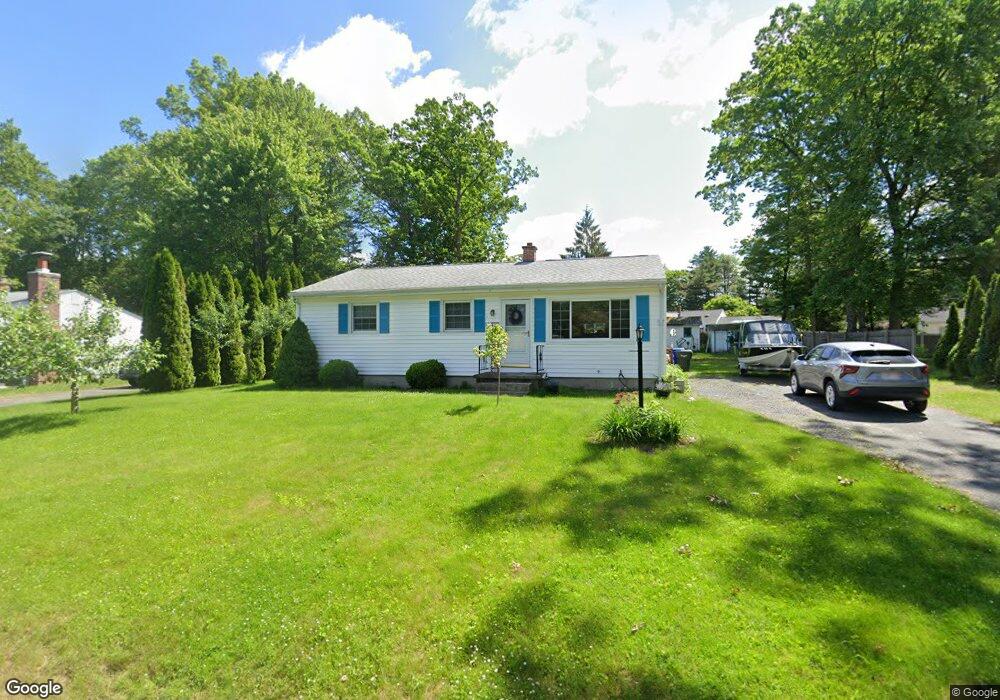
127 Feltham Rd Springfield, MA 01118
Sixteen Acres NeighborhoodEstimated Value: $259,000 - $296,000
3
Beds
1
Bath
999
Sq Ft
$280/Sq Ft
Est. Value
About This Home
This home is located at 127 Feltham Rd, Springfield, MA 01118 and is currently estimated at $280,164, approximately $280 per square foot. 127 Feltham Rd is a home located in Hampden County with nearby schools including Arthur T Talmadge Elementary School, M Marcus Kiley Middle, and Springfield High School of Science and Technology.
Ownership History
Date
Name
Owned For
Owner Type
Purchase Details
Closed on
Mar 22, 1996
Sold by
Cullen Maurice C and Cullen Marion W
Bought by
Ogden Daniel and Ogden Ann
Current Estimated Value
Home Financials for this Owner
Home Financials are based on the most recent Mortgage that was taken out on this home.
Original Mortgage
$60,172
Outstanding Balance
$2,351
Interest Rate
6.99%
Mortgage Type
Purchase Money Mortgage
Estimated Equity
$277,813
Create a Home Valuation Report for This Property
The Home Valuation Report is an in-depth analysis detailing your home's value as well as a comparison with similar homes in the area
Home Values in the Area
Average Home Value in this Area
Purchase History
| Date | Buyer | Sale Price | Title Company |
|---|---|---|---|
| Ogden Daniel | $60,203 | -- |
Source: Public Records
Mortgage History
| Date | Status | Borrower | Loan Amount |
|---|---|---|---|
| Open | Ogden Daniel | $16,100 | |
| Closed | Ogden Daniel | $13,100 | |
| Open | Ogden Daniel | $60,172 |
Source: Public Records
Tax History Compared to Growth
Tax History
| Year | Tax Paid | Tax Assessment Tax Assessment Total Assessment is a certain percentage of the fair market value that is determined by local assessors to be the total taxable value of land and additions on the property. | Land | Improvement |
|---|---|---|---|---|
| 2025 | $3,690 | $235,300 | $59,400 | $175,900 |
| 2024 | $3,527 | $219,600 | $59,400 | $160,200 |
| 2023 | $3,294 | $193,200 | $56,500 | $136,700 |
| 2022 | $3,414 | $181,400 | $56,500 | $124,900 |
| 2021 | $2,843 | $150,400 | $51,300 | $99,100 |
| 2020 | $2,898 | $148,400 | $51,300 | $97,100 |
| 2019 | $2,702 | $137,300 | $51,300 | $86,000 |
| 2018 | $2,623 | $133,300 | $51,300 | $82,000 |
| 2017 | $2,548 | $129,600 | $51,300 | $78,300 |
| 2016 | $2,530 | $128,700 | $51,300 | $77,400 |
| 2015 | $2,435 | $123,800 | $51,300 | $72,500 |
Source: Public Records
Map
Nearby Homes
- 331 Newhouse St
- 41 Hillside Dr
- 41 Kerry Dr
- 82 Louis Rd
- 86 Talmadge Dr
- 399 Elm St
- 15 Lynwood Rd
- 17 Pebble Mill Rd
- 54 Shady Brook Ln
- 206 Treetop Ave
- 19 Westminster St
- 99 W Crystal Brook Dr
- 43 Sunridge Dr
- 55 Allen St
- 125 Manor Ct Unit 125
- 5 Manor Ct Unit 5
- 19 Manor Ct Unit 19
- 157 Canterbury Rd
- 196 Sawmill Rd
- 32 Lindsay Rd