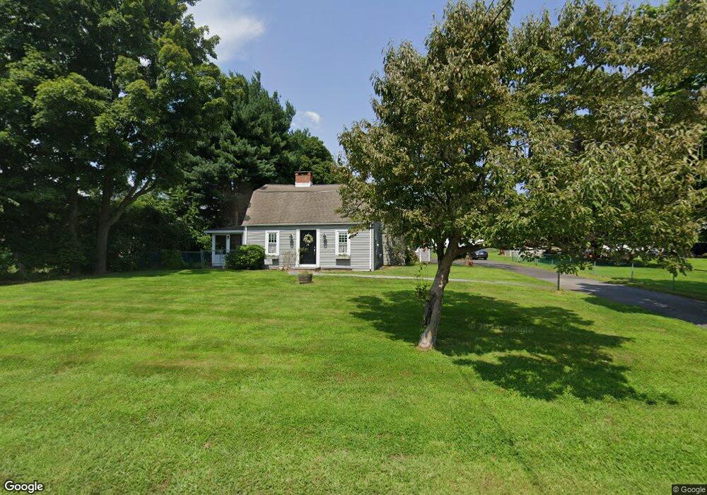
127 France St Rocky Hill, CT 06067
Estimated Value: $421,066 - $485,000
3
Beds
3
Baths
1,666
Sq Ft
$275/Sq Ft
Est. Value
About This Home
This home is located at 127 France St, Rocky Hill, CT 06067 and is currently estimated at $458,767, approximately $275 per square foot. 127 France St is a home located in Hartford County with nearby schools including Albert D. Griswold Middle School and Rocky Hill High School.
Ownership History
Date
Name
Owned For
Owner Type
Purchase Details
Closed on
Mar 16, 1998
Sold by
Bruneau Brian J and Bruneau Mary L
Bought by
Rabbitt Nancy E
Current Estimated Value
Home Financials for this Owner
Home Financials are based on the most recent Mortgage that was taken out on this home.
Original Mortgage
$100,000
Interest Rate
7.03%
Create a Home Valuation Report for This Property
The Home Valuation Report is an in-depth analysis detailing your home's value as well as a comparison with similar homes in the area
Home Values in the Area
Average Home Value in this Area
Purchase History
| Date | Buyer | Sale Price | Title Company |
|---|---|---|---|
| Rabbitt Nancy E | $143,500 | -- | |
| Rabbitt Nancy E | $143,500 | -- |
Source: Public Records
Mortgage History
| Date | Status | Borrower | Loan Amount |
|---|---|---|---|
| Closed | Rabbitt Nancy E | $97,000 | |
| Closed | Rabbitt Nancy E | $100,000 |
Source: Public Records
Tax History Compared to Growth
Tax History
| Year | Tax Paid | Tax Assessment Tax Assessment Total Assessment is a certain percentage of the fair market value that is determined by local assessors to be the total taxable value of land and additions on the property. | Land | Improvement |
|---|---|---|---|---|
| 2025 | $6,778 | $224,140 | $97,440 | $126,700 |
| 2024 | $6,538 | $224,140 | $97,440 | $126,700 |
| 2023 | $5,796 | $161,350 | $65,940 | $95,410 |
| 2022 | $5,570 | $161,350 | $65,940 | $95,410 |
| 2021 | $5,502 | $161,350 | $65,940 | $95,410 |
| 2020 | $5,421 | $161,350 | $65,940 | $95,410 |
| 2019 | $5,244 | $161,350 | $65,940 | $95,410 |
| 2018 | $5,198 | $160,440 | $59,290 | $101,150 |
| 2017 | $5,561 | $175,980 | $59,290 | $116,690 |
| 2016 | $5,455 | $175,980 | $59,290 | $116,690 |
| 2015 | $5,227 | $175,980 | $59,290 | $116,690 |
| 2014 | $5,227 | $175,980 | $59,290 | $116,690 |
Source: Public Records
Map
Nearby Homes
- 15 Murphy Dr
- 326 France St
- 45 Pequot Dr Unit 45
- 12 Clemens Ct Unit 12
- 26 Stevens Place Unit 26
- 370 Hayes Rd
- 221 Westmeadow Rd
- 36 Copper Beech Dr
- 124 Speno Ridge
- 404 The Mews Unit 404
- 306 Gray Fox Ln
- 180 Hayes Rd
- 409 Carlton Ln Unit 409
- 24 Pine Meadow Rd
- 52 Sandy Dr
- 7 Pearl Ln
- 45 Sandy Dr
- 89 Gilbert Ave
- 41 Maxwell Dr
- 18 Stone Hill Dr
- 4 Murphy Dr
- 359 Farmstead Rd
- 345 Farmstead Rd
- 8 Murphy Dr
- 354 Farmstead Rd
- 220 France St
- 348 Farmstead Rd
- 335 Farmstead Rd
- 19 Wynding Brook Dr
- 0 France St
- 214 France St
- 334 Farmstead Rd
- 20 Wynding Brook Dr
- 224 France St
- 200 France St
- 325 Farmstead Rd
- 3 Murphy Dr
- 7 Murphy Dr
- 155 France St
- 324 Farmstead Rd