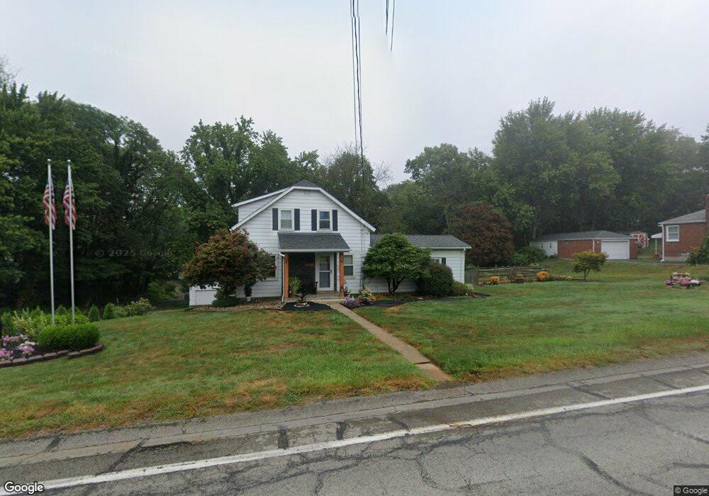
127 Freeport Rd Butler, PA 16002
Butler NeighborhoodEstimated Value: $116,858 - $250,000
2
Beds
1
Bath
1,144
Sq Ft
$165/Sq Ft
Est. Value
About This Home
This home is located at 127 Freeport Rd, Butler, PA 16002 and is currently estimated at $188,465, approximately $164 per square foot. 127 Freeport Rd is a home located in Butler County with nearby schools including Butler Middle School, Butler Intermediate High School, and Butler Catholic School.
Ownership History
Date
Name
Owned For
Owner Type
Purchase Details
Closed on
Jul 19, 2013
Sold by
Wylie Richard L and Wylie Kristina A
Bought by
Wylie Richard L and Wylie Kristina A
Current Estimated Value
Home Financials for this Owner
Home Financials are based on the most recent Mortgage that was taken out on this home.
Original Mortgage
$76,000
Outstanding Balance
$55,380
Interest Rate
3.97%
Mortgage Type
New Conventional
Estimated Equity
$133,085
Create a Home Valuation Report for This Property
The Home Valuation Report is an in-depth analysis detailing your home's value as well as a comparison with similar homes in the area
Home Values in the Area
Average Home Value in this Area
Purchase History
| Date | Buyer | Sale Price | Title Company |
|---|---|---|---|
| Wylie Richard L | -- | -- |
Source: Public Records
Mortgage History
| Date | Status | Borrower | Loan Amount |
|---|---|---|---|
| Open | Wylie Richard L | $76,000 | |
| Closed | Wylie Richard L | $76,000 |
Source: Public Records
Tax History Compared to Growth
Tax History
| Year | Tax Paid | Tax Assessment Tax Assessment Total Assessment is a certain percentage of the fair market value that is determined by local assessors to be the total taxable value of land and additions on the property. | Land | Improvement |
|---|---|---|---|---|
| 2025 | $1,451 | $9,770 | $2,010 | $7,760 |
| 2024 | $1,425 | $9,770 | $2,010 | $7,760 |
| 2023 | $1,396 | $9,770 | $2,010 | $7,760 |
| 2022 | $1,396 | $9,770 | $2,010 | $7,760 |
| 2021 | $1,396 | $9,770 | $0 | $0 |
| 2020 | $1,396 | $9,770 | $2,010 | $7,760 |
| 2019 | $351 | $9,770 | $2,010 | $7,760 |
| 2018 | $1,367 | $9,770 | $2,010 | $7,760 |
| 2017 | $1,335 | $9,770 | $2,010 | $7,760 |
| 2016 | $429 | $9,770 | $2,010 | $7,760 |
| 2015 | -- | $9,770 | $2,010 | $7,760 |
| 2014 | $198 | $9,770 | $2,010 | $7,760 |
Source: Public Records
Map
Nearby Homes
- 133 Freeport Rd
- 121 Crest View Dr
- 124 Morningside Dr
- 125 Dolphin Dr
- Lot #3 Saxonburg Rd
- Lot #1 Saxonburg Rd
- 106 Phil Mar Dr
- 115 Dreher Farm Ln
- 165 Saxonburg Rd
- 129 Slagle Ave
- 126 W Boyd Ave
- 716 Hettie Way
- 424 Zeigler Ave
- 461 Zeigler Ave
- 149 Standard Ave
- 104 Standard Ave
- 201 E Rockenstein Ave
- 221 Brown Ave
- 108 E Christie Ave
- 115 Spring St
- 129 Freeport Rd
- 131 Freeport Rd
- 201 Glendale Ave
- 205 Glendale Ave
- 128 Freeport Rd
- 124 Freeport Rd
- 130 Freeport Rd
- 202 Glendale Ave
- 135 Freeport Rd
- 121 Freeport Rd
- 207 Glendale Ave
- 120 Freeport Rd
- 119 Freeport Rd
- 103 Morningside Dr
- 117 Freeport Rd
- 102 Morningside Dr
- 132 Freeport Rd
- 134 Freeport Rd
- 104 Dolphin Dr
- 130 Crestview Dr