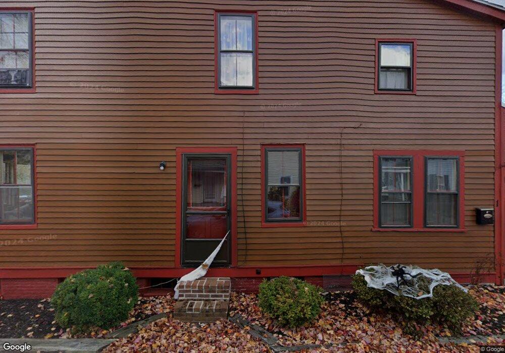
127 Friend St Amesbury, MA 01913
Estimated Value: $535,000 - $629,000
5
Beds
2
Baths
2,437
Sq Ft
$241/Sq Ft
Est. Value
About This Home
This home is located at 127 Friend St, Amesbury, MA 01913 and is currently estimated at $588,526, approximately $241 per square foot. 127 Friend St is a home located in Essex County with nearby schools including Amesbury High School and Amesbury Seventh-Day Adventist School.
Ownership History
Date
Name
Owned For
Owner Type
Purchase Details
Closed on
Apr 12, 2016
Sold by
Batal Cheryl T
Bought by
Batal Ft
Current Estimated Value
Purchase Details
Closed on
Oct 5, 2010
Sold by
Batal William F
Bought by
Batal Cheryl T
Purchase Details
Closed on
Apr 9, 1993
Sold by
Nolan Donald M
Bought by
Wesav Investment Corp
Create a Home Valuation Report for This Property
The Home Valuation Report is an in-depth analysis detailing your home's value as well as a comparison with similar homes in the area
Home Values in the Area
Average Home Value in this Area
Purchase History
| Date | Buyer | Sale Price | Title Company |
|---|---|---|---|
| Batal Ft | -- | -- | |
| Batal Cheryl T | -- | -- | |
| Wesav Investment Corp | $95,712 | -- |
Source: Public Records
Mortgage History
| Date | Status | Borrower | Loan Amount |
|---|---|---|---|
| Previous Owner | Wesav Investment Corp | $100,000 | |
| Previous Owner | Wesav Investment Corp | $75,000 | |
| Previous Owner | Wesav Investment Corp | $50,000 |
Source: Public Records
Tax History Compared to Growth
Tax History
| Year | Tax Paid | Tax Assessment Tax Assessment Total Assessment is a certain percentage of the fair market value that is determined by local assessors to be the total taxable value of land and additions on the property. | Land | Improvement |
|---|---|---|---|---|
| 2025 | $7,456 | $487,300 | $185,200 | $302,100 |
| 2024 | $7,355 | $470,300 | $174,700 | $295,600 |
| 2023 | $7,312 | $447,500 | $151,900 | $295,600 |
| 2022 | $6,464 | $365,400 | $132,100 | $233,300 |
| 2021 | $6,836 | $374,600 | $102,000 | $272,600 |
| 2020 | $6,113 | $355,800 | $98,100 | $257,700 |
| 2019 | $5,201 | $283,100 | $98,100 | $185,000 |
| 2018 | $4,789 | $252,200 | $93,400 | $158,800 |
| 2017 | $4,810 | $241,100 | $93,400 | $147,700 |
| 2016 | $4,699 | $231,700 | $93,400 | $138,300 |
| 2015 | $4,759 | $231,700 | $93,400 | $138,300 |
| 2014 | $4,859 | $231,700 | $93,400 | $138,300 |
Source: Public Records
Map
Nearby Homes
- 129 Friend St
- 19 Perkins St
- 31 Whitter Meadows Dr Unit 31
- 15 Sparhawk St Unit 3
- 17 Lincoln Ct
- 13 Lincoln Ct
- 4 Lincoln Ct
- 81 High St Unit 27
- 179 Lions Mouth Rd
- 37 Millyard Unit 204
- 49 W Greenwood St
- 24 Aubin St Unit 2
- 43 Aubin St Unit 1
- 2 Hitching Post Ln
- 5 Moncrief St Unit 1
- 48 Orchard St
- 188 Lions Mouth Rd
- 4 Greenwood St
- 17 Linwood Place
- 53 Market St
- 127 Friend St
- 1 Cammetts Ct Unit 1
- 3-5 Cammetts Ct
- 5 Cammetts Ct
- 4 Cammett's Ct Unit 4
- 6 Cammett's Ct Unit 6
- 117 Friend St Unit C
- 117 Friend St Unit B
- 117 Friend St Unit A
- 117 Friend St
- 117 Friend St Unit 2
- 117 Friend St Unit 3
- 117 Friend St Unit 1
- 4 Cammetts Ct
- 127 1/2 Friend St
- 6 Cammetts Ct
- 6 Cammetts Ct Unit 6
- 7 Cammetts Ct
- 9 Cammetts Ct Unit 9
- 129 Friend St Unit 2