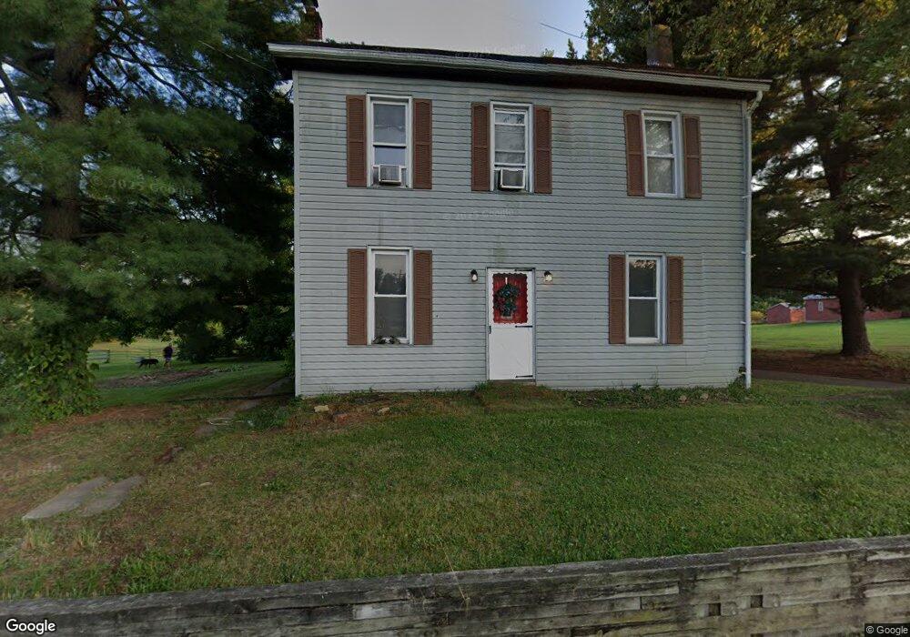
127 Georgetown Rd Littlestown, PA 17340
Estimated Value: $301,000 - $372,271
3
Beds
1
Bath
1,932
Sq Ft
$176/Sq Ft
Est. Value
About This Home
This home is located at 127 Georgetown Rd, Littlestown, PA 17340 and is currently estimated at $340,568, approximately $176 per square foot. 127 Georgetown Rd is a home located in Adams County with nearby schools including Rolling Acres El School, Maple Avenue Middle School, and Littlestown Senior High School.
Ownership History
Date
Name
Owned For
Owner Type
Purchase Details
Closed on
Jun 19, 2007
Sold by
Weller Donald L
Bought by
Philips Diana M
Current Estimated Value
Home Financials for this Owner
Home Financials are based on the most recent Mortgage that was taken out on this home.
Original Mortgage
$208,000
Outstanding Balance
$128,647
Interest Rate
6.39%
Mortgage Type
New Conventional
Estimated Equity
$211,921
Create a Home Valuation Report for This Property
The Home Valuation Report is an in-depth analysis detailing your home's value as well as a comparison with similar homes in the area
Home Values in the Area
Average Home Value in this Area
Purchase History
| Date | Buyer | Sale Price | Title Company |
|---|---|---|---|
| Philips Diana M | $180,000 | -- | |
| Svec Amy L | $260,000 | -- |
Source: Public Records
Mortgage History
| Date | Status | Borrower | Loan Amount |
|---|---|---|---|
| Open | Svec Amy L | $208,000 | |
| Closed | Philips Diana M | $208,000 |
Source: Public Records
Tax History Compared to Growth
Tax History
| Year | Tax Paid | Tax Assessment Tax Assessment Total Assessment is a certain percentage of the fair market value that is determined by local assessors to be the total taxable value of land and additions on the property. | Land | Improvement |
|---|---|---|---|---|
| 2025 | $5,186 | $274,000 | $143,500 | $130,500 |
| 2024 | $4,985 | $274,000 | $143,500 | $130,500 |
| 2023 | $4,859 | $274,000 | $143,500 | $130,500 |
| 2022 | $4,824 | $274,000 | $143,500 | $130,500 |
| 2021 | $4,652 | $274,000 | $143,500 | $130,500 |
| 2020 | $4,585 | $274,000 | $143,500 | $130,500 |
| 2019 | $4,487 | $274,000 | $143,500 | $130,500 |
| 2018 | $4,354 | $274,000 | $143,500 | $130,500 |
| 2017 | $4,217 | $274,000 | $143,500 | $130,500 |
| 2016 | -- | $274,000 | $143,500 | $130,500 |
| 2015 | -- | $274,000 | $143,500 | $130,500 |
| 2014 | -- | $274,000 | $143,500 | $130,500 |
Source: Public Records
Map
Nearby Homes
- 2238 Harney Rd Unit 3
- 2226 Harney Rd Unit 2
- 0 Hershey Rd Unit PALA2058618
- 0 Conestoga Blvd Unit PALA2080682
- 1024 Frederick Pike Unit 6
- 37 Amanda Dr Unit 14
- 15 Yorktowne Ct Unit 97
- 22 Rita Marie Ave
- 620 Saint Johns Rd
- 141 W King St
- 161 Stoners Cir
- 161 Cemetery St
- 117 Charles St
- 115 Charles St
- 22 Cemetery St
- 61 Stoners Cir
- 52 N Gala Unit 394
- 21 Johnamac N Unit 384
- 440 N Queen St
- 6120 Baltimore Pike
- 107 Georgetown Rd
- 147 Georgetown Rd Unit 1
- 102 Georgetown Rd Unit 5
- 146 Georgetown Rd
- 88 Georgetown Rd Unit 4
- 79 Georgetown Rd
- 149 Georgetown Rd
- 158 Georgetown Rd
- 57 Georgetown Rd
- 118 Georgetown Rd Unit 6
- 179 Georgetown Rd
- 85 Georgetown Rd
- 54 Georgetown Rd
- 199 Georgetown Rd
- 0 Georgetown Rd
- 39 Georgetown Rd
- 34 Georgetown Rd
- 2C Georgetown Rd
- 2C Georgetown Rd Unit 2
- 31 Georgetown Rd Unit 52