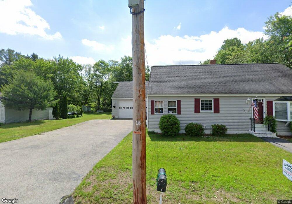
127 Gerrish Ave Dracut, MA 01826
Estimated Value: $495,000 - $549,587
3
Beds
2
Baths
1,324
Sq Ft
$396/Sq Ft
Est. Value
About This Home
This home is located at 127 Gerrish Ave, Dracut, MA 01826 and is currently estimated at $524,147, approximately $395 per square foot. 127 Gerrish Ave is a home located in Middlesex County with nearby schools including George H. Englesby Elementary School, Richardson Middle School, and Dracut Senior High School.
Ownership History
Date
Name
Owned For
Owner Type
Purchase Details
Closed on
Oct 8, 2021
Sold by
Sweeney Sheila E
Bought by
Sweeney Sheila E and Sweeney Robert
Current Estimated Value
Home Financials for this Owner
Home Financials are based on the most recent Mortgage that was taken out on this home.
Original Mortgage
$190,600
Outstanding Balance
$173,809
Interest Rate
2.8%
Mortgage Type
Stand Alone Refi Refinance Of Original Loan
Estimated Equity
$350,338
Create a Home Valuation Report for This Property
The Home Valuation Report is an in-depth analysis detailing your home's value as well as a comparison with similar homes in the area
Home Values in the Area
Average Home Value in this Area
Purchase History
| Date | Buyer | Sale Price | Title Company |
|---|---|---|---|
| Sweeney Sheila E | -- | None Available | |
| Sweeney Sheila E | -- | None Available |
Source: Public Records
Mortgage History
| Date | Status | Borrower | Loan Amount |
|---|---|---|---|
| Open | Sweeney Sheila E | $190,600 |
Source: Public Records
Tax History
| Year | Tax Paid | Tax Assessment Tax Assessment Total Assessment is a certain percentage of the fair market value that is determined by local assessors to be the total taxable value of land and additions on the property. | Land | Improvement |
|---|---|---|---|---|
| 2025 | $4,936 | $487,700 | $198,600 | $289,100 |
| 2024 | $4,662 | $446,100 | $189,200 | $256,900 |
| 2023 | $4,523 | $390,600 | $164,500 | $226,100 |
| 2022 | $4,534 | $368,900 | $149,500 | $219,400 |
| 2021 | $4,430 | $340,500 | $135,900 | $204,600 |
| 2020 | $4,307 | $322,600 | $131,900 | $190,700 |
| 2019 | $4,348 | $316,200 | $125,500 | $190,700 |
| 2018 | $4,016 | $284,000 | $125,500 | $158,500 |
| 2017 | $3,816 | $284,000 | $125,500 | $158,500 |
| 2016 | $3,716 | $250,400 | $120,700 | $129,700 |
| 2015 | $3,652 | $244,600 | $120,700 | $123,900 |
| 2014 | $3,478 | $240,000 | $120,700 | $119,300 |
Source: Public Records
Map
Nearby Homes
- 101 Donohue Rd Unit 19
- 109 Navy Yard Rd
- 67 Glennon Ave
- 94 Hampson St
- 15 Louis Farm Rd Unit 15
- 2300 Skyline Dr Unit 3
- 91 Frederick St Unit 77
- 19 Louis Farm Rd Unit 19
- 13 Louis Farm Rd Unit 13
- 1400 Skyline Dr Unit 6
- 42 Frederick St Unit 9
- 30 4th Ave
- 39 Phoebe Ave
- 9 Arbor Dr
- 105 Columbia Rd
- 28 Sarah Ave
- 49 Sparks St
- 89 Mammoth Rd
- 94 Tennis Plaza Rd Unit 10
- 75 Sladen St
- 137 Gerrish Ave
- 119 Gerrish Ave
- 134 Gerrish Ave
- 141 Gerrish Ave
- 124 Gerrish Ave
- 130 Gerrish Ave
- 140 Gerrish Ave
- 145 Gerrish Ave
- 118 Gerrish Ave
- 105 Gerrish Ave
- 32 Valera St
- 114 Gerrish Ave
- 149 Gerrish Ave
- 148 Gerrish Ave
- 36 Valera St
- 72 Gerrish Ave
- 20 Valera St
- 40 Valera St
- 112 Gerrish Ave
- 152 Gerrish Ave
Your Personal Tour Guide
Ask me questions while you tour the home.