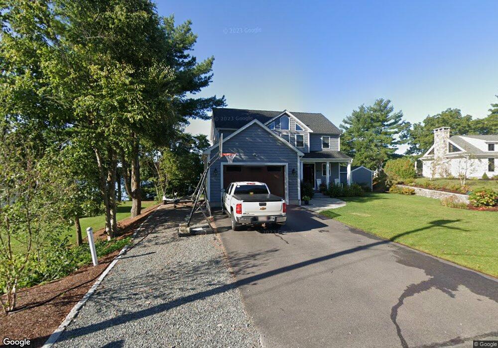
127 Gilmore Rd Wrentham, MA 02093
Estimated Value: $822,000 - $1,245,000
2
Beds
3
Baths
2,240
Sq Ft
$475/Sq Ft
Est. Value
About This Home
This home is located at 127 Gilmore Rd, Wrentham, MA 02093 and is currently estimated at $1,063,384, approximately $474 per square foot. 127 Gilmore Rd is a home with nearby schools including Delaney Elementary School and Charles E Roderick.
Ownership History
Date
Name
Owned For
Owner Type
Purchase Details
Closed on
Jun 12, 2014
Sold by
Constantine Rt
Bought by
Constantine Michael S and Constantine Tricia E
Current Estimated Value
Purchase Details
Closed on
Oct 17, 2003
Sold by
K & A Rt
Bought by
Constantine Rt
Create a Home Valuation Report for This Property
The Home Valuation Report is an in-depth analysis detailing your home's value as well as a comparison with similar homes in the area
Home Values in the Area
Average Home Value in this Area
Purchase History
| Date | Buyer | Sale Price | Title Company |
|---|---|---|---|
| Constantine Michael S | -- | -- | |
| Constantine Rt | $100,000 | -- |
Source: Public Records
Tax History Compared to Growth
Tax History
| Year | Tax Paid | Tax Assessment Tax Assessment Total Assessment is a certain percentage of the fair market value that is determined by local assessors to be the total taxable value of land and additions on the property. | Land | Improvement |
|---|---|---|---|---|
| 2025 | $11,974 | $1,033,100 | $507,700 | $525,400 |
| 2024 | $11,581 | $965,100 | $507,700 | $457,400 |
| 2023 | $11,011 | $872,500 | $455,000 | $417,500 |
| 2022 | $10,038 | $734,300 | $374,200 | $360,100 |
| 2021 | $10,488 | $745,400 | $413,600 | $331,800 |
| 2020 | $11,541 | $809,900 | $420,900 | $389,000 |
| 2019 | $11,400 | $807,400 | $435,900 | $371,500 |
| 2018 | $10,975 | $770,700 | $436,200 | $334,500 |
| 2017 | $10,727 | $752,800 | $427,800 | $325,000 |
| 2016 | $10,530 | $737,400 | $415,400 | $322,000 |
| 2015 | $6,056 | $404,300 | $399,400 | $4,900 |
| 2014 | $35 | $2,300 | $2,300 | $0 |
Source: Public Records
Map
Nearby Homes
- 570 Franklin St
- 500 Franklin St
- 131 Creek St Unit 7
- 11 Earle Stewart Ln
- Lot 1 - Blueberry 2 Car Plan at King Philip Estates
- Lot 8 - Blueberry 2 Car Plan at King Philip Estates
- Lot 5 - Hughes 2 car Plan at King Philip Estates
- Lot 6 - Blueberry 3 Car Plan at King Philip Estates
- Lot 2 - Camden 2 Car Plan at King Philip Estates
- Lot 7 - Cedar Plan at King Philip Estates
- Lot 4 - Hemingway 2 Car Plan at King Philip Estates
- 14 Earle Stewart Ln
- Lot 3 - Blueberry 2 Car Plan at King Philip Estates
- 10 Nature View Dr
- 15 Nature View Dr
- 50 Reed Fulton Ave Unit Lot 61
- 45 Joshua Rd
- 791 South St Unit 5
- 1 Lorraine Metcalf Dr
- 246 Forest Grove Ave
- 131 Gilmore Rd
- 121 Gilmore Rd
- 137 Gilmore Rd
- 130 Gilmore Rd
- 113 Gilmore Rd
- 139 Gilmore Rd
- 139 Gilmore Rd Unit 1
- 110 Gilmore Rd
- 105 Gilmore Rd
- 140 Gilmore Rd
- 103 Gilmore Rd
- 155 Gilmore Rd
- 95 Gilmore Rd
- 95 Metacomet St
- 89 Gilmore Rd
- 100 Gilmore Rd
- 75 Metacomet St
- 85 Metacomet St
- 81 Gilmore Rd
- 80 Gilmore Rd Unit 80