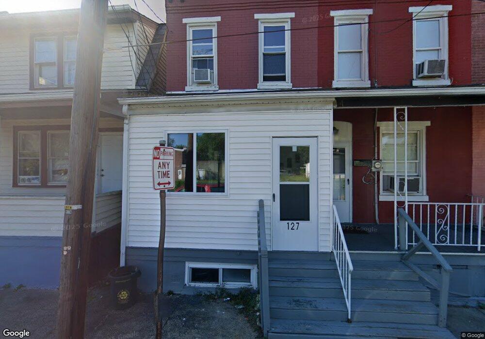
127 Hobart Ave Trenton, NJ 08629
Wilbur NeighborhoodEstimated Value: $146,000 - $195,000
--
Bed
--
Bath
933
Sq Ft
$175/Sq Ft
Est. Value
About This Home
This home is located at 127 Hobart Ave, Trenton, NJ 08629 and is currently estimated at $162,969, approximately $174 per square foot. 127 Hobart Ave is a home located in Mercer County with nearby schools including Hedgepeth-Williams Elementary School, Dr. Martin Luther King Middle School, and Trenton Central High School - Main Campus.
Ownership History
Date
Name
Owned For
Owner Type
Purchase Details
Closed on
Jan 23, 2018
Sold by
Patterson Maria A and M & T Bank
Bought by
Crown Investments One Llc
Current Estimated Value
Purchase Details
Closed on
Feb 18, 2005
Sold by
Resolution Property
Bought by
Patterson Maria
Home Financials for this Owner
Home Financials are based on the most recent Mortgage that was taken out on this home.
Original Mortgage
$68,400
Interest Rate
5.64%
Create a Home Valuation Report for This Property
The Home Valuation Report is an in-depth analysis detailing your home's value as well as a comparison with similar homes in the area
Home Values in the Area
Average Home Value in this Area
Purchase History
| Date | Buyer | Sale Price | Title Company |
|---|---|---|---|
| Crown Investments One Llc | $25,500 | None Available | |
| Patterson Maria | $76,000 | -- |
Source: Public Records
Mortgage History
| Date | Status | Borrower | Loan Amount |
|---|---|---|---|
| Previous Owner | Patterson Maria | $68,400 |
Source: Public Records
Tax History Compared to Growth
Tax History
| Year | Tax Paid | Tax Assessment Tax Assessment Total Assessment is a certain percentage of the fair market value that is determined by local assessors to be the total taxable value of land and additions on the property. | Land | Improvement |
|---|---|---|---|---|
| 2025 | $1,990 | $34,300 | $5,300 | $29,000 |
| 2024 | $1,909 | $34,300 | $5,300 | $29,000 |
| 2023 | $1,909 | $34,300 | $5,300 | $29,000 |
| 2022 | $1,872 | $34,300 | $5,300 | $29,000 |
| 2021 | $1,905 | $34,300 | $5,300 | $29,000 |
| 2020 | $1,899 | $34,300 | $5,300 | $29,000 |
| 2019 | $1,868 | $34,300 | $5,300 | $29,000 |
| 2018 | $1,788 | $34,300 | $5,300 | $29,000 |
| 2017 | $1,700 | $34,300 | $5,300 | $29,000 |
| 2016 | $3,296 | $57,300 | $15,200 | $42,100 |
| 2015 | $3,285 | $57,300 | $15,200 | $42,100 |
| 2014 | $3,270 | $57,300 | $15,200 | $42,100 |
Source: Public Records
Map
Nearby Homes
- 480 S Logan Ave
- 20 Charlotte Ave
- 1427 Hamilton Ave
- 365 Cleveland Ave
- 618 Atlantic Ave
- 631 S Olden Ave
- 51 Charlotte Ave
- 1524 Elizabeth Ave
- 657 S Olden Ave
- 235 Darcy Ave
- 1110 Hamilton Ave
- 42 Bismarck Ave
- 26 Bismarck Ave
- 541 Emmett Ave
- 877 Park Ave
- 822 Fairmount Ave
- 224 Garfield Ave
- 254 S Olden Ave
- 144 Beal St
- 448 Lynwood Ave
- 129 Hobart Ave
- 133 Hobart Ave
- 125 Hobart Ave
- 123 Hobart Ave
- 121 Hobart Ave
- 1292 Hamilton Ave
- 1288 Hamilton Ave
- 1294 Hamilton Ave
- 1286 Hamilton Ave
- 501 S Logan Ave
- 1284 Hamilton Ave
- 1300 Hamilton Ave
- 97 Hobart Ave
- 518 LOGAN S Logan Ave
- 518 S Logan Ave
- 514 S South Logan Ave
- 516 S Logan Ave
- 520 S Logan Ave
- 514 S Logan Ave
- 512 S Logan Ave