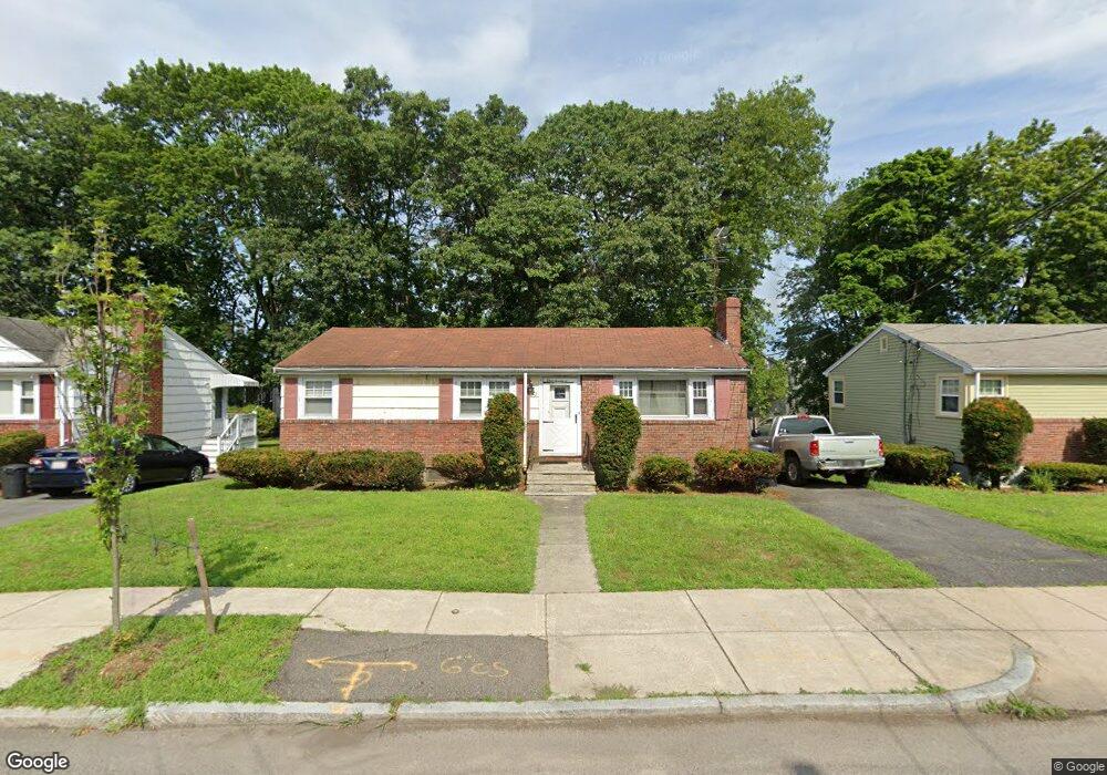
127 Lorna Rd Mattapan, MA 02126
Southern Mattapan NeighborhoodEstimated Value: $529,000 - $597,000
3
Beds
2
Baths
960
Sq Ft
$581/Sq Ft
Est. Value
About This Home
This home is located at 127 Lorna Rd, Mattapan, MA 02126 and is currently estimated at $558,188, approximately $581 per square foot. 127 Lorna Rd is a home located in Suffolk County with nearby schools including KIPP Academy Boston Charter School and Berea Seventh-day Adventist Academy.
Ownership History
Date
Name
Owned For
Owner Type
Purchase Details
Closed on
Dec 26, 2008
Sold by
Drakes Edward E
Bought by
Drakes Nigel H
Current Estimated Value
Home Financials for this Owner
Home Financials are based on the most recent Mortgage that was taken out on this home.
Original Mortgage
$178,825
Outstanding Balance
$118,870
Interest Rate
6.17%
Mortgage Type
Purchase Money Mortgage
Estimated Equity
$439,318
Create a Home Valuation Report for This Property
The Home Valuation Report is an in-depth analysis detailing your home's value as well as a comparison with similar homes in the area
Home Values in the Area
Average Home Value in this Area
Purchase History
| Date | Buyer | Sale Price | Title Company |
|---|---|---|---|
| Drakes Nigel H | $185,000 | -- |
Source: Public Records
Mortgage History
| Date | Status | Borrower | Loan Amount |
|---|---|---|---|
| Open | Drakes Nigel H | $178,825 |
Source: Public Records
Tax History Compared to Growth
Tax History
| Year | Tax Paid | Tax Assessment Tax Assessment Total Assessment is a certain percentage of the fair market value that is determined by local assessors to be the total taxable value of land and additions on the property. | Land | Improvement |
|---|---|---|---|---|
| 2025 | $4,989 | $430,800 | $184,400 | $246,400 |
| 2024 | $4,313 | $395,700 | $169,700 | $226,000 |
| 2023 | $4,049 | $377,000 | $161,700 | $215,300 |
| 2022 | $3,869 | $355,600 | $152,500 | $203,100 |
| 2021 | $3,736 | $350,100 | $152,500 | $197,600 |
| 2020 | $3,038 | $287,700 | $143,100 | $144,600 |
| 2019 | $2,834 | $268,900 | $107,600 | $161,300 |
| 2018 | $2,635 | $251,400 | $107,600 | $143,800 |
| 2017 | $2,635 | $248,800 | $107,600 | $141,200 |
| 2016 | $2,379 | $216,300 | $107,600 | $108,700 |
| 2015 | $2,297 | $189,700 | $108,100 | $81,600 |
| 2014 | $2,229 | $177,200 | $108,100 | $69,100 |
Source: Public Records
Map
Nearby Homes
- 157 Delhi St
- 32 Violet St
- 30 Glenhill Rd
- 11 French St
- 18 Astoria St
- 567B Norfolk St
- 15-17 W Selden St
- 4 Crossman St Unit 4
- 808 Morton St Unit 3
- 25 Fessenden St
- 24 Constitution Rd
- 23 Fessenden St
- 10 Briarcliff Terrace
- 139 Selden St
- 124 Selden St
- 710 Walk Hill St
- 10 Sutton St
- 12 Hiawatha Rd
- 23 Maryknoll St
- 1465 Blue Hill Ave
- 123 Lorna Rd
- 131 Lorna Rd
- 135 Lorna Rd
- 134 W Selden St
- 119 Lorna Rd Unit 121
- 130 W Selden St Unit 132
- 132 W Selden St Unit 1
- 132 W Selden St Unit 2
- 138 W Selden St
- 138 W Selden St Unit 2
- 126 W Selden St Unit 1
- 128 W Selden St Unit 2
- 126 W Selden St Unit 2
- 126 W Selden St Unit 128
- 128 W Selden St
- 140 W Selden St
- 122 W Selden St Unit 124
- 124 Lorna Rd
- 124A Lorna Rd
- 139 Lorna Rd