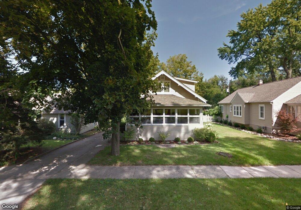
127 Lysander St Rochester, MI 48307
Estimated Value: $346,428 - $404,000
3
Beds
1
Bath
1,234
Sq Ft
$305/Sq Ft
Est. Value
About This Home
This home is located at 127 Lysander St, Rochester, MI 48307 and is currently estimated at $376,357, approximately $304 per square foot. 127 Lysander St is a home located in Oakland County with nearby schools including North Hill Elementary School, Hart Middle School, and Stoney Creek High School.
Ownership History
Date
Name
Owned For
Owner Type
Purchase Details
Closed on
Apr 8, 2005
Sold by
Strickland Debra S
Bought by
Joy Judith Arnold
Current Estimated Value
Home Financials for this Owner
Home Financials are based on the most recent Mortgage that was taken out on this home.
Original Mortgage
$156,000
Outstanding Balance
$133,029
Interest Rate
5.88%
Mortgage Type
Fannie Mae Freddie Mac
Estimated Equity
$243,328
Purchase Details
Closed on
Feb 21, 1997
Sold by
Rooney John
Bought by
Strickland Debra S
Home Financials for this Owner
Home Financials are based on the most recent Mortgage that was taken out on this home.
Original Mortgage
$100,000
Interest Rate
7.93%
Purchase Details
Closed on
Aug 29, 1996
Sold by
C K Management Inc Tr
Bought by
Rooney John
Home Financials for this Owner
Home Financials are based on the most recent Mortgage that was taken out on this home.
Original Mortgage
$102,000
Interest Rate
7.93%
Create a Home Valuation Report for This Property
The Home Valuation Report is an in-depth analysis detailing your home's value as well as a comparison with similar homes in the area
Home Values in the Area
Average Home Value in this Area
Purchase History
| Date | Buyer | Sale Price | Title Company |
|---|---|---|---|
| Joy Judith Arnold | $195,000 | -- | |
| Strickland Debra S | $165,000 | -- | |
| Rooney John | $114,900 | -- |
Source: Public Records
Mortgage History
| Date | Status | Borrower | Loan Amount |
|---|---|---|---|
| Open | Joy Judith Arnold | $156,000 | |
| Previous Owner | Strickland Debra S | $100,000 | |
| Previous Owner | Rooney John | $102,000 |
Source: Public Records
Tax History Compared to Growth
Tax History
| Year | Tax Paid | Tax Assessment Tax Assessment Total Assessment is a certain percentage of the fair market value that is determined by local assessors to be the total taxable value of land and additions on the property. | Land | Improvement |
|---|---|---|---|---|
| 2024 | $2,781 | $132,060 | $0 | $0 |
| 2023 | $2,663 | $131,030 | $0 | $0 |
| 2022 | $2,833 | $130,470 | $0 | $0 |
| 2021 | $2,662 | $129,550 | $0 | $0 |
| 2020 | $2,499 | $124,870 | $0 | $0 |
| 2019 | $2,748 | $119,540 | $0 | $0 |
| 2018 | $2,745 | $102,130 | $0 | $0 |
| 2017 | $2,691 | $101,670 | $0 | $0 |
| 2016 | $2,606 | $97,620 | $0 | $0 |
| 2015 | -- | $94,130 | $0 | $0 |
| 2014 | -- | $86,510 | $0 | $0 |
| 2011 | -- | $70,490 | $0 | $0 |
Source: Public Records
Map
Nearby Homes
- 804 N Main St Unit 2H
- 804 N Main St Unit 2A
- 804 N Main St Unit 2C
- 334 Romeo Rd
- 1219 N Main St
- 1223 N Main St
- 1217 N Main St
- 1228 N Main St
- 714 N Main St
- 164 Albertson St
- 417 Parkdale Ave Unit 13
- 319 Drace St
- 1238 Pine Knoll Ln
- 1220 N Pine St
- 509 E University Dr Unit 508
- 761 Lounsbury Ave
- 500 Romeo Rd Unit 122
- 801 Plate St Unit 201
- 1202 N Pine St
- 428 East St
- 133 Lysander St
- 123 Lysander St
- 137 Lysander St
- 122 Terry Ave
- 128 Terry Ave
- 141 Lysander St
- 136 Terry Ave
- 142 Terry Ave
- 132 Lysander St
- 147 Lysander St
- 136 Lysander St
- 146 Terry Ave
- 118C Terry Ave
- 124 Lysander St
- 149 Lysander St
- 118A Terry Ave
- 1002 N Main St Unit Suite 1
- 1002 N Main St
- 1002 N Main St Unit 24
- 1002 N Main St Unit 77