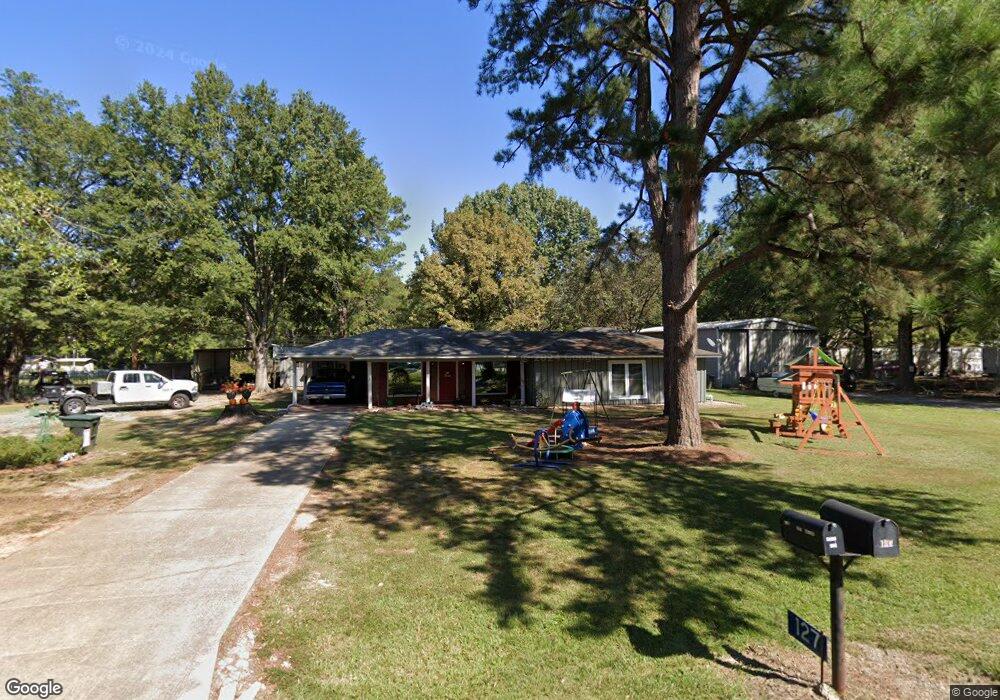
127 Malloy St Crossett, AR 71635
Estimated Value: $137,000 - $296,000
--
Bed
2
Baths
1,880
Sq Ft
$103/Sq Ft
Est. Value
About This Home
This home is located at 127 Malloy St, Crossett, AR 71635 and is currently estimated at $193,427, approximately $102 per square foot. 127 Malloy St is a home located in Ashley County with nearby schools including Crossett Elementary School, Crossett Middle School, and Crossett High School.
Ownership History
Date
Name
Owned For
Owner Type
Purchase Details
Closed on
Aug 27, 2018
Sold by
Le Alyssia J and Wise Brandon
Bought by
Rial Randy K and Rial Renee
Current Estimated Value
Home Financials for this Owner
Home Financials are based on the most recent Mortgage that was taken out on this home.
Original Mortgage
$127,645
Outstanding Balance
$111,455
Interest Rate
4.75%
Mortgage Type
FHA
Estimated Equity
$81,972
Purchase Details
Closed on
Jul 27, 2007
Bought by
Le Alyssia J and Brandon Wise
Purchase Details
Closed on
May 21, 1971
Bought by
Saunders Bobby F and Saunders Sandra R
Purchase Details
Closed on
Apr 7, 1969
Bought by
Saunders Bobby F and Saunders Sandra R
Purchase Details
Closed on
Oct 30, 1968
Bought by
Saunders Bobby F and Saunders Sandra R
Purchase Details
Closed on
May 6, 1968
Bought by
Saunders Bobby F and Saunders Sandra R
Create a Home Valuation Report for This Property
The Home Valuation Report is an in-depth analysis detailing your home's value as well as a comparison with similar homes in the area
Home Values in the Area
Average Home Value in this Area
Purchase History
| Date | Buyer | Sale Price | Title Company |
|---|---|---|---|
| Rial Randy K | $130,000 | None Available | |
| Le Alyssia J | $125,000 | -- | |
| Saunders Bobby F | -- | -- | |
| Saunders Bobby F | -- | -- | |
| Saunders Bobby F | -- | -- | |
| Saunders Bobby F | -- | -- |
Source: Public Records
Mortgage History
| Date | Status | Borrower | Loan Amount |
|---|---|---|---|
| Open | Rial Randy K | $127,645 |
Source: Public Records
Tax History Compared to Growth
Tax History
| Year | Tax Paid | Tax Assessment Tax Assessment Total Assessment is a certain percentage of the fair market value that is determined by local assessors to be the total taxable value of land and additions on the property. | Land | Improvement |
|---|---|---|---|---|
| 2025 | $490 | $27,810 | $1,600 | $26,210 |
| 2024 | $543 | $27,810 | $1,600 | $26,210 |
| 2023 | $570 | $27,810 | $1,600 | $26,210 |
| 2022 | $573 | $20,050 | $1,200 | $18,850 |
| 2021 | $573 | $20,050 | $1,200 | $18,850 |
| 2020 | $573 | $20,050 | $1,200 | $18,850 |
| 2019 | $573 | $20,050 | $1,200 | $18,850 |
| 2018 | $598 | $20,050 | $1,200 | $18,850 |
| 2017 | $578 | $19,630 | $1,000 | $18,630 |
| 2016 | $459 | $18,700 | $1,000 | $17,700 |
| 2015 | $459 | $18,700 | $1,000 | $17,700 |
| 2014 | $459 | $18,700 | $1,000 | $17,700 |
Source: Public Records
Map
Nearby Homes
- 130 Malloy St
- 120 Malloy St
- 126 Yates St
- 136 Malloy St
- 119 Malloy St
- 118 Yates St
- 136 Yates St
- 111 Malloy St
- 140 Malloy St
- 135 Thompson St
- 139 Thompson St
- 148 Yates St
- 124 Thompson St
- 134 Thompson St
- 141 Thompson St
- 1366 Highway 133 N
- 114 Thompson St
- 1390 Highway 133 N
- 112 Thompson St
- 149 Thompson St