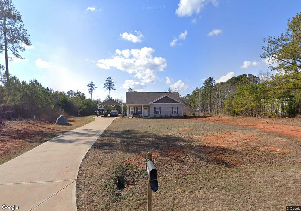
127 Mann Rd Barnesville, GA 30204
Estimated Value: $253,000 - $348,000
3
Beds
2
Baths
1,576
Sq Ft
$188/Sq Ft
Est. Value
About This Home
This home is located at 127 Mann Rd, Barnesville, GA 30204 and is currently estimated at $295,957, approximately $187 per square foot. 127 Mann Rd is a home with nearby schools including Lamar County Primary School, Lamar County Elementary School, and Lamar County Middle School.
Ownership History
Date
Name
Owned For
Owner Type
Purchase Details
Closed on
Apr 15, 2020
Sold by
Hill William Justin
Bought by
Hill William Justin and Hill Jennifer Ann
Current Estimated Value
Home Financials for this Owner
Home Financials are based on the most recent Mortgage that was taken out on this home.
Original Mortgage
$172,812
Outstanding Balance
$153,013
Interest Rate
3.6%
Mortgage Type
FHA
Estimated Equity
$142,944
Purchase Details
Closed on
Aug 9, 2019
Sold by
Dunn Nancy Geraldine
Bought by
Prespro Homes Atlanta Llc
Home Financials for this Owner
Home Financials are based on the most recent Mortgage that was taken out on this home.
Original Mortgage
$21,000
Interest Rate
3.7%
Mortgage Type
Commercial
Purchase Details
Closed on
Apr 9, 2019
Sold by
Mann Charles S
Bought by
Dunn Nancy Geraldine
Purchase Details
Closed on
Nov 23, 2004
Bought by
Mann Charles S
Create a Home Valuation Report for This Property
The Home Valuation Report is an in-depth analysis detailing your home's value as well as a comparison with similar homes in the area
Purchase History
| Date | Buyer | Sale Price | Title Company |
|---|---|---|---|
| Hill William Justin | -- | -- | |
| Hill William Justin | $176,000 | -- | |
| Prespro Homes Atlanta Llc | $28,000 | -- | |
| Dunn Nancy Geraldine | $4,500 | -- | |
| Mann Charles S | $2,500 | -- |
Source: Public Records
Mortgage History
| Date | Status | Borrower | Loan Amount |
|---|---|---|---|
| Open | Hill William Justin | $172,812 | |
| Closed | Hill William Justin | $172,812 | |
| Previous Owner | Prespro Homes Atlanta Llc | $21,000 |
Source: Public Records
Tax History
| Year | Tax Paid | Tax Assessment Tax Assessment Total Assessment is a certain percentage of the fair market value that is determined by local assessors to be the total taxable value of land and additions on the property. | Land | Improvement |
|---|---|---|---|---|
| 2025 | $2,872 | $118,442 | $12,324 | $106,118 |
| 2024 | $2,487 | $97,180 | $12,324 | $84,856 |
| 2023 | $2,683 | $97,180 | $12,324 | $84,856 |
| 2022 | $2,361 | $85,536 | $7,548 | $77,988 |
| 2021 | $2,116 | $70,390 | $5,604 | $64,786 |
| 2020 | $177 | $5,604 | $5,604 | $0 |
| 2019 | $178 | $5,604 | $5,604 | $0 |
| 2018 | $171 | $5,604 | $5,604 | $0 |
| 2017 | $170 | $5,604 | $5,604 | $0 |
| 2016 | $170 | $5,604 | $5,604 | $0 |
| 2015 | $170 | $5,604 | $5,604 | $0 |
| 2014 | $164 | $5,604 | $5,604 | $0 |
| 2013 | -- | $5,885 | $5,885 | $0 |
Source: Public Records
Map
Nearby Homes
- 408 Parker Branch Rd
- 762 Highfalls Park Rd
- 414 Parker Branch Rd
- 0 Possum Trot Rd Unit 7738812
- 0 Possum Trot Rd Unit 183633
- 0 Possum Trot Rd Unit 10687821
- 474 Chappell Mill Rd
- 621 Unionville Rd
- 2093 Highway 36 E
- 342 Norris Rd
- 0 Highway 41 Unit 10655458
- 620 Rocky Creek Rd
- 1845 Georgia 36
- 119 Willow Way
- 138 Charleston Ln
- 122 Lakeside Cir
- 507 N Ridge Rd
- 314 Hickory Rd
- 196 Magnolia Trace
- 196 Horseshoe Bend Rd
Your Personal Tour Guide
Ask me questions while you tour the home.