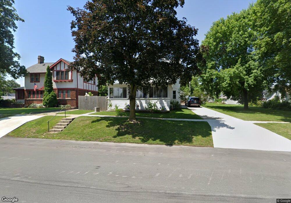
127 N Ridge St Hustisford, WI 53034
Estimated Value: $227,477 - $360,000
--
Bed
2
Baths
--
Sq Ft
7,187
Sq Ft Lot
About This Home
This home is located at 127 N Ridge St, Hustisford, WI 53034 and is currently estimated at $273,869. 127 N Ridge St is a home located in Dodge County with nearby schools including John Hustis Elementary School, Hustisford High School, and Bethany Lutheran School.
Ownership History
Date
Name
Owned For
Owner Type
Purchase Details
Closed on
Oct 31, 2018
Sold by
Wegener Kenneth E and Wegener Ruth Ann
Bought by
Moreno Orlando and Moreno Tamra
Current Estimated Value
Home Financials for this Owner
Home Financials are based on the most recent Mortgage that was taken out on this home.
Original Mortgage
$106,800
Outstanding Balance
$93,523
Interest Rate
4.6%
Mortgage Type
Purchase Money Mortgage
Estimated Equity
$180,346
Create a Home Valuation Report for This Property
The Home Valuation Report is an in-depth analysis detailing your home's value as well as a comparison with similar homes in the area
Home Values in the Area
Average Home Value in this Area
Purchase History
| Date | Buyer | Sale Price | Title Company |
|---|---|---|---|
| Moreno Orlando | $133,500 | None Available |
Source: Public Records
Mortgage History
| Date | Status | Borrower | Loan Amount |
|---|---|---|---|
| Open | Moreno Orlando | $106,800 |
Source: Public Records
Tax History Compared to Growth
Tax History
| Year | Tax Paid | Tax Assessment Tax Assessment Total Assessment is a certain percentage of the fair market value that is determined by local assessors to be the total taxable value of land and additions on the property. | Land | Improvement |
|---|---|---|---|---|
| 2024 | $2,572 | $200,400 | $26,200 | $174,200 |
| 2023 | $2,710 | $115,600 | $19,400 | $96,200 |
| 2022 | $3,243 | $115,600 | $19,400 | $96,200 |
| 2021 | $3,059 | $115,600 | $19,400 | $96,200 |
| 2020 | $3,115 | $115,600 | $19,400 | $96,200 |
| 2019 | $2,985 | $115,600 | $19,400 | $96,200 |
| 2018 | $2,741 | $115,600 | $19,400 | $96,200 |
| 2017 | $2,770 | $115,600 | $19,400 | $96,200 |
| 2016 | $2,896 | $115,600 | $19,400 | $96,200 |
| 2015 | $2,878 | $115,600 | $19,400 | $96,200 |
| 2014 | $2,881 | $115,600 | $19,400 | $96,200 |
Source: Public Records
Map
Nearby Homes
- .68 Acre Parcel Anthony Island
- 244 S Ridge St
- 252 S Hustis St
- 441 Sandy Ln
- 727 E Lakeview Rd Unit 8
- N4510 & N4504 Anthony Island
- N4510 Anthony Island -
- W4436 E Lakeview Rd
- 827 E Lakeview Rd
- N4569 Hazelwood Rd
- N4557 Lakeview Rd
- N4554 Lakeview Rd
- N4973 Lake Dr
- Lt38 Sinissippi Point Rd
- N4550 County Road Dj
- N3220 Hale Rd
- N5413 County Rd S
- W2824 Fox Rd
- 0 Burkwald Ave
- Lot 2 Sleepy Hollow
- 127 N Ridge St
- 121 N Ridge St
- 137 N Ridge St
- 205 W Juneau St
- 143 N Ridge St
- 140 N Ridge St
- 124 N Highland St
- 219 W Juneau St
- 132 Highland St
- 222 W Tweedy St
- 227 W Juneau St
- 121 S Lake St
- 125 N Highland St
- 113 N Lake St
- 207 W Tweedy St
- 121 Tweedy St
- 227 W Tweedy St
- 129 Tweedy St
- 303 W Juneau St
- 126 W Juneau St