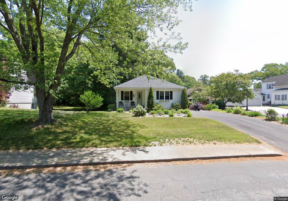
127 Oak St Uxbridge, MA 01569
Estimated Value: $398,000 - $505,000
2
Beds
1
Bath
1,361
Sq Ft
$317/Sq Ft
Est. Value
About This Home
This home is located at 127 Oak St, Uxbridge, MA 01569 and is currently estimated at $431,311, approximately $316 per square foot. 127 Oak St is a home located in Worcester County with nearby schools including Uxbridge High School, Our Lady of the Valley Regional School, and Whitinsville Christian School.
Ownership History
Date
Name
Owned For
Owner Type
Purchase Details
Closed on
Nov 8, 2017
Sold by
Doyle Marie E
Bought by
Frollo Carrie
Current Estimated Value
Home Financials for this Owner
Home Financials are based on the most recent Mortgage that was taken out on this home.
Original Mortgage
$120,000
Outstanding Balance
$100,501
Interest Rate
3.83%
Mortgage Type
New Conventional
Estimated Equity
$330,810
Purchase Details
Closed on
Feb 19, 2010
Sold by
John W Audet Inc
Bought by
Doyle Marie E
Home Financials for this Owner
Home Financials are based on the most recent Mortgage that was taken out on this home.
Original Mortgage
$179,685
Interest Rate
5.37%
Mortgage Type
FHA
Purchase Details
Closed on
Oct 19, 2009
Sold by
Est Novak Edward J and Anderson Helen
Bought by
John W Audet Inc
Create a Home Valuation Report for This Property
The Home Valuation Report is an in-depth analysis detailing your home's value as well as a comparison with similar homes in the area
Home Values in the Area
Average Home Value in this Area
Purchase History
| Date | Buyer | Sale Price | Title Company |
|---|---|---|---|
| Frollo Carrie | $220,000 | -- | |
| Doyle Marie E | $183,000 | -- | |
| John W Audet Inc | $85,000 | -- |
Source: Public Records
Mortgage History
| Date | Status | Borrower | Loan Amount |
|---|---|---|---|
| Open | Frollo Carrie | $120,000 | |
| Previous Owner | Doyle Marie E | $179,685 |
Source: Public Records
Tax History
| Year | Tax Paid | Tax Assessment Tax Assessment Total Assessment is a certain percentage of the fair market value that is determined by local assessors to be the total taxable value of land and additions on the property. | Land | Improvement |
|---|---|---|---|---|
| 2025 | $43 | $328,100 | $132,300 | $195,800 |
| 2024 | $3,867 | $299,300 | $121,300 | $178,000 |
| 2023 | $3,603 | $258,300 | $110,200 | $148,100 |
| 2022 | $3,470 | $228,900 | $99,900 | $129,000 |
| 2021 | $3,552 | $224,500 | $95,500 | $129,000 |
| 2020 | $3,477 | $207,700 | $99,200 | $108,500 |
| 2019 | $3,439 | $198,200 | $91,900 | $106,300 |
| 2018 | $3,170 | $184,600 | $91,900 | $92,700 |
| 2017 | $3,261 | $192,300 | $85,400 | $106,900 |
| 2016 | $3,175 | $180,700 | $83,100 | $97,600 |
| 2015 | $3,111 | $178,800 | $83,100 | $95,700 |
Source: Public Records
Map
Nearby Homes
- 20 Nature View Dr Unit 20
- 24 Olde Canal Way Unit 24
- 35 Pouts Ln
- 76 Pouts Ln
- 3 Strathmore Shire Unit A
- 37 Elizabeth St
- 307 N Main St
- 79 High St
- 36 Elm St
- 71 Rivulet St Unit B
- 0 Louis St
- 288-290 Providence Rd
- 25 Dunny Cove Ln
- 0 Homestead Ave
- 7 Jefferson Ct Unit 7
- 235 Rivulet St
- 251 Union St
- 237 Heritage Dr Unit 237
- 240 Heritage Dr
- 288 High St