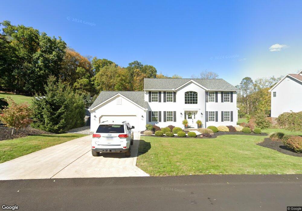
127 Pheasant Run Dr Export, PA 15632
Estimated Value: $418,000 - $476,000
3
Beds
3
Baths
2,664
Sq Ft
$166/Sq Ft
Est. Value
About This Home
This home is located at 127 Pheasant Run Dr, Export, PA 15632 and is currently estimated at $443,073, approximately $166 per square foot. 127 Pheasant Run Dr is a home located in Westmoreland County with nearby schools including Penn Trafford High School.
Ownership History
Date
Name
Owned For
Owner Type
Purchase Details
Closed on
Jan 9, 2012
Sold by
Ott William D
Bought by
Ott William D and Esquino Susan
Current Estimated Value
Purchase Details
Closed on
Oct 31, 2003
Sold by
Van Management Inc
Bought by
Reed Michael J and Reed Susan L
Home Financials for this Owner
Home Financials are based on the most recent Mortgage that was taken out on this home.
Original Mortgage
$210,931
Interest Rate
6.03%
Mortgage Type
Construction
Create a Home Valuation Report for This Property
The Home Valuation Report is an in-depth analysis detailing your home's value as well as a comparison with similar homes in the area
Home Values in the Area
Average Home Value in this Area
Purchase History
| Date | Buyer | Sale Price | Title Company |
|---|---|---|---|
| Ott William D | -- | None Available | |
| Reed Michael J | $39,900 | -- |
Source: Public Records
Mortgage History
| Date | Status | Borrower | Loan Amount |
|---|---|---|---|
| Previous Owner | Reed Michael J | $210,931 |
Source: Public Records
Tax History
| Year | Tax Paid | Tax Assessment Tax Assessment Total Assessment is a certain percentage of the fair market value that is determined by local assessors to be the total taxable value of land and additions on the property. | Land | Improvement |
|---|---|---|---|---|
| 2026 | $6,680 | $47,400 | $11,330 | $36,070 |
| 2025 | $6,490 | $47,400 | $11,330 | $36,070 |
| 2024 | $6,443 | $47,400 | $11,330 | $36,070 |
| 2023 | $6,112 | $47,400 | $11,330 | $36,070 |
| 2022 | $6,041 | $47,400 | $11,330 | $36,070 |
| 2021 | $5,993 | $47,400 | $11,330 | $36,070 |
| 2020 | $5,946 | $47,400 | $11,330 | $36,070 |
| 2019 | $5,804 | $47,400 | $11,330 | $36,070 |
| 2018 | $5,638 | $47,400 | $11,330 | $36,070 |
| 2017 | $5,177 | $44,650 | $11,330 | $33,320 |
| 2016 | $5,025 | $44,650 | $11,330 | $33,320 |
| 2015 | $5,025 | $44,650 | $11,330 | $33,320 |
| 2014 | $4,936 | $44,650 | $11,330 | $33,320 |
Source: Public Records
Map
Nearby Homes
- 5934 Graybrook Dr
- 37 Hones Rd
- 5866 Claridge Rd
- 5812 Torrance Dr
- 1044 Hillstone Village Dr
- 1316 S Valley Dr
- 1213 Harrison Ct
- 2358 Mount Vernon Ave
- 2350 Mount Vernon Ave
- 2667 Puckety Dr
- 5816 Madison Ave
- 5801 Lincoln Ave
- 2003 Trail Side Ct Unit B
- 5816 Tyler Ave
- 4009 Alexander Ct Unit 4009
- 4012 Alexander Ct
- 1001 Black Sands Dr
- 2300 Wheatland Cir Unit A
- 2903 Italy Rd
- 4005 School Rd
- 129 Pheasant Run Dr
- 125 Pheasant Run Dr
- 123 Pheasant Run Dr
- 122 Pheasant Run Dr
- 2 Pheasant Run Dr
- 120 Pheasant Run Dr
- 124 Pheasant Run Dr
- 121 Pheasant Run Dr
- 126 Pheasant Run Dr
- 118 Pheasant Run Dr
- 119 Pheasant Run Dr
- 51 Hones Rd
- 2 Fawn Ln
- 1 Mallard Ct
- 49 Hones Rd
- 3 Mallard Ct
- 6000 Forbes Hollow Rd
- 47 Hones Rd
- 6 Fawn Ln
- 5927 Graybrook Dr
Your Personal Tour Guide
Ask me questions while you tour the home.