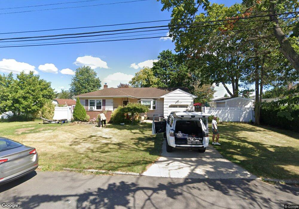
127 Queens Ave West Babylon, NY 11704
Estimated Value: $543,000 - $659,000
--
Bed
--
Bath
1,256
Sq Ft
$486/Sq Ft
Est. Value
About This Home
This home is located at 127 Queens Ave, West Babylon, NY 11704 and is currently estimated at $609,937, approximately $485 per square foot. 127 Queens Ave is a home located in Suffolk County with nearby schools including Robert Moses Middle School and North Babylon High School.
Ownership History
Date
Name
Owned For
Owner Type
Purchase Details
Closed on
May 29, 2025
Sold by
Alito Arlene
Bought by
Arlene Alito Ft and Alito
Current Estimated Value
Purchase Details
Closed on
Jul 19, 2001
Sold by
Cermeli Anthony and Degil Renata
Bought by
Alito David W and Alito Arlene D
Home Financials for this Owner
Home Financials are based on the most recent Mortgage that was taken out on this home.
Original Mortgage
$223,450
Interest Rate
7.14%
Mortgage Type
FHA
Create a Home Valuation Report for This Property
The Home Valuation Report is an in-depth analysis detailing your home's value as well as a comparison with similar homes in the area
Home Values in the Area
Average Home Value in this Area
Purchase History
| Date | Buyer | Sale Price | Title Company |
|---|---|---|---|
| Arlene Alito Ft | -- | None Available | |
| Alito Arlene | -- | None Available | |
| Arlene Alito Ft | -- | None Available | |
| Alito David W | $227,000 | -- | |
| Alito David W | $227,000 | -- |
Source: Public Records
Mortgage History
| Date | Status | Borrower | Loan Amount |
|---|---|---|---|
| Previous Owner | Alito David W | $223,450 |
Source: Public Records
Tax History Compared to Growth
Tax History
| Year | Tax Paid | Tax Assessment Tax Assessment Total Assessment is a certain percentage of the fair market value that is determined by local assessors to be the total taxable value of land and additions on the property. | Land | Improvement |
|---|---|---|---|---|
| 2024 | $9,985 | $3,050 | $350 | $2,700 |
| 2023 | $9,985 | $3,050 | $350 | $2,700 |
| 2022 | $8,751 | $3,050 | $350 | $2,700 |
| 2021 | $8,751 | $3,050 | $350 | $2,700 |
| 2020 | $8,985 | $3,050 | $350 | $2,700 |
| 2019 | $8,985 | $0 | $0 | $0 |
| 2018 | $8,735 | $3,050 | $350 | $2,700 |
| 2017 | $8,735 | $3,050 | $350 | $2,700 |
| 2016 | $8,687 | $3,050 | $350 | $2,700 |
| 2015 | -- | $3,050 | $350 | $2,700 |
| 2014 | -- | $3,050 | $350 | $2,700 |
Source: Public Records
Map
Nearby Homes
- 652 Empire Ave
- 135 Westchester Ave
- 56 Suffolk Ave
- 270 Fulton St
- 155 Throop St
- 37 Seward St
- 21 Silver St
- 170 Van Buren St
- 1569 11th St
- 545 Mount Ave
- 1558 9th St
- 51 Columbia St
- 104 Essex St
- 214 Chelsea Ave
- 340 Westchester Ave
- 17 Wright St
- 82 Schenectady Ave
- 1259 America Ave
- 64 Montgomery Ave
- 57 Rockland Ave
- 128 Monarch Ave
- 119 Queens Ave
- 135 Queens Ave
- 120 Monarch Ave
- 136 Monarch Ave
- 128 Queens Ave
- 120 Queens Ave
- 136 Queens Ave
- 111 Queens Ave
- 143 Queens Ave
- 112 Monarch Ave
- 144 Monarch Ave
- 127 Monarch Ave
- 112 Queens Ave
- 127 Suffolk Ave
- 144 Queens Ave
- 119 Monarch Ave
- 135 Monarch Ave
- 135 Suffolk Ave
- 119 Suffolk Ave