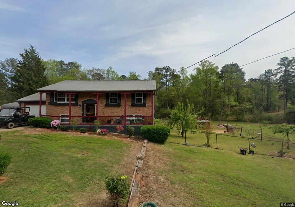
127 Randall Dr SE Milledgeville, GA 31061
Estimated Value: $120,000 - $165,826
--
Bed
--
Bath
2,042
Sq Ft
$67/Sq Ft
Est. Value
About This Home
This home is located at 127 Randall Dr SE, Milledgeville, GA 31061 and is currently estimated at $135,957, approximately $66 per square foot. 127 Randall Dr SE is a home located in Baldwin County with nearby schools including Lakeview Primary, Lakeview Academy, and Oak Hill Middle School.
Ownership History
Date
Name
Owned For
Owner Type
Purchase Details
Closed on
Jan 1, 2001
Bought by
Williams Anthony Troy
Current Estimated Value
Purchase Details
Closed on
Jun 23, 2000
Sold by
Slaton Joann
Bought by
Williams Anthony Tro
Purchase Details
Closed on
Jan 1, 2000
Bought by
French Dennette
Purchase Details
Closed on
Jan 1, 1997
Bought by
Slaton Joann O
Purchase Details
Closed on
Jan 1, 1982
Bought by
Slaton James L and Slaton Joann O
Purchase Details
Closed on
Jan 1, 1966
Bought by
Schubert George A Iii Etal
Create a Home Valuation Report for This Property
The Home Valuation Report is an in-depth analysis detailing your home's value as well as a comparison with similar homes in the area
Home Values in the Area
Average Home Value in this Area
Purchase History
| Date | Buyer | Sale Price | Title Company |
|---|---|---|---|
| Williams Anthony Troy | -- | -- | |
| Williams Anthony Tro | $68,000 | -- | |
| French Dennette | -- | -- | |
| Slaton Joann O | -- | -- | |
| Slaton James L | $38,500 | -- | |
| Schubert George A Iii Etal | -- | -- |
Source: Public Records
Tax History Compared to Growth
Tax History
| Year | Tax Paid | Tax Assessment Tax Assessment Total Assessment is a certain percentage of the fair market value that is determined by local assessors to be the total taxable value of land and additions on the property. | Land | Improvement |
|---|---|---|---|---|
| 2025 | $1,309 | $53,712 | $1,208 | $52,504 |
| 2024 | $1,309 | $53,712 | $1,208 | $52,504 |
| 2023 | $401 | $43,300 | $1,008 | $42,292 |
| 2022 | $858 | $44,164 | $1,008 | $43,156 |
| 2021 | $747 | $29,276 | $1,000 | $28,276 |
| 2020 | $747 | $29,276 | $1,000 | $28,276 |
| 2019 | $516 | $29,276 | $1,000 | $28,276 |
| 2018 | $524 | $29,276 | $1,000 | $28,276 |
| 2017 | $492 | $29,276 | $1,000 | $28,276 |
| 2016 | $351 | $23,040 | $3,880 | $19,160 |
| 2015 | $352 | $23,040 | $3,880 | $19,160 |
| 2014 | $353 | $23,040 | $3,880 | $19,160 |
Source: Public Records
Map
Nearby Homes
- 150 Oak Dr
- 130 Scott Hill St SE
- 190 Youngblood Rd SE
- 123 Lee Dr SE
- 1000 Vinson & 1070 S Jefferson
- 100 Oak Ave
- 394 Broad St
- 179 Park Ave
- 144 Bell Ave SE
- 109 Hollingshed Ave SE
- 120 Caraker Ave
- 107 Little St SE
- 1589 Irwinton Rd
- 1647 Irwinton Rd
- 144 Thomas St SE
- 210 Ato Rd SE
- 111 Lockwood St SW
- 210 C N Main St SW
- 130 N Main St SW
- 106 3rd St
- 0 Randall Dr SE Unit 17 8494200
- 0 Randall Dr SE Unit 7302457
- 0 Randall Dr SE Unit 6 8494357
- 0 Randall Dr SE Unit 2 8494336
- 122 Randall Dr SE
- 131 Randall Dr SE
- 130 Randall Dr SE
- 115 Stuart Cir SE
- 117 Randall Dr SE
- 134 Randall Dr SE
- 116 Randall Dr SE
- 135 Randall Dr SE
- 107 Joy St SE
- 125 Richard Dr SE
- 131 Richard Dr SE Unit 1
- 131 Richard Dr SE
- 114 Randall Dr SE
- 111 Randall Dr SE
- 109 Richard Dr SE Unit 8
- 109 Richard Dr SE