Estimated Value: $150,000 - $205,000
3
Beds
1
Bath
925
Sq Ft
$187/Sq Ft
Est. Value
About This Home
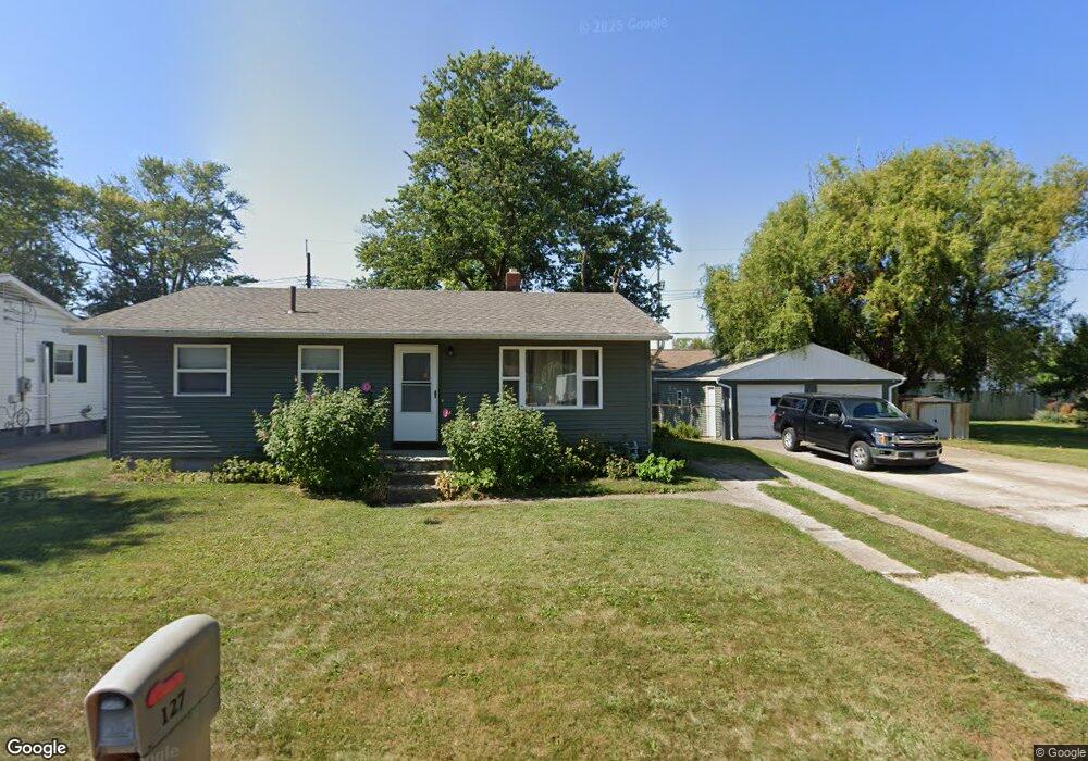
This home is located at 127 Richland Ave, Huron, OH 44839 and is currently estimated at $173,127, approximately $187 per square foot. 127 Richland Ave is a home located in Erie County with nearby schools including Woodlands Intermediate School, Shawnee Elementary School, and McCormick Junior High School.
Ownership History
Date
Name
Owned For
Owner Type
Purchase Details
Closed on
Jan 25, 2020
Sold by
Sheppard Dennis L and Sheppard Michael A
Bought by
Sheppard Stephanie A and Sheppard Dennis L
Current Estimated Value
Purchase Details
Closed on
Mar 15, 2012
Sold by
Sheppard Dennis and Sheppard Drena
Bought by
Sheppard Dennis L and Sheppard Stephanie A
Home Financials for this Owner
Home Financials are based on the most recent Mortgage that was taken out on this home.
Original Mortgage
$40,000
Interest Rate
4%
Mortgage Type
Seller Take Back
Create a Home Valuation Report for This Property
The Home Valuation Report is an in-depth analysis detailing your home's value as well as a comparison with similar homes in the area
Home Values in the Area
Average Home Value in this Area
Purchase History
| Date | Buyer | Sale Price | Title Company |
|---|---|---|---|
| Sheppard Stephanie A | $75,000 | None Available | |
| Sheppard Dennis L | $75,000 | Attorney |
Source: Public Records
Mortgage History
| Date | Status | Borrower | Loan Amount |
|---|---|---|---|
| Previous Owner | Sheppard Dennis L | $40,000 |
Source: Public Records
Tax History Compared to Growth
Tax History
| Year | Tax Paid | Tax Assessment Tax Assessment Total Assessment is a certain percentage of the fair market value that is determined by local assessors to be the total taxable value of land and additions on the property. | Land | Improvement |
|---|---|---|---|---|
| 2024 | $1,376 | $28,910 | $5,775 | $23,135 |
| 2023 | $1,376 | $23,999 | $5,110 | $18,889 |
| 2022 | $995 | $23,996 | $5,110 | $18,886 |
| 2021 | $992 | $24,000 | $5,110 | $18,890 |
| 2020 | $923 | $21,230 | $5,110 | $16,120 |
| 2019 | $963 | $21,230 | $5,110 | $16,120 |
| 2018 | $968 | $21,230 | $5,110 | $16,120 |
| 2017 | $933 | $19,870 | $3,990 | $15,880 |
| 2016 | $925 | $19,870 | $3,990 | $15,880 |
| 2015 | $904 | $19,870 | $3,990 | $15,880 |
| 2014 | $878 | $18,600 | $3,990 | $14,610 |
| 2013 | $779 | $18,600 | $3,990 | $14,610 |
Source: Public Records
Map
Nearby Homes
- 220 Overlook Rd
- 133 Richland Ave
- 224 Atwood Place
- 2016 Cleveland Rd W
- 33 Northview Place
- 2008 Shore Dr
- 41 Poplar St
- 40 Poplar St
- 301 Gumwood Rd
- 0 Bucyrus Ave
- 1361 Cleveland Rd W Unit C
- 711 Elizabeth Dr
- 1208 Cleveland Rd W
- 2109 Bogart Rd
- 11 Turtle Bay
- 919 Glenview Dr
- 932 Glenview Dr
- 514 Wilbor Ave
- 0 W Cleveland Rd
- 28 Turtle Bay
- 127 Richland Ave Unit 44839
- 129 Richland Ave
- 128 Overlook Rd
- 126 Overlook Rd
- 126 Richland Ave
- 128 Richland Ave
- 124 Richland Ave
- 132 Overlook Rd
- 122 Overlook Rd
- 122 Overlook Rd Unit ID1061029P
- 121 Richland Ave
- 122 Richland Ave
- 136 Overlook Rd
- 123 High St
- 135 Richland Ave
- 129 Overlook Rd
- 132 Richland Ave
- 127 Overlook Rd
- 117 Richland Ave
- 129 Ridgewood Ave