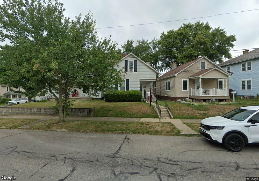
127 S Cherry St Lancaster, OH 43130
Estimated Value: $156,000 - $222,000
3
Beds
2
Baths
1,458
Sq Ft
$130/Sq Ft
Est. Value
About This Home
This home is located at 127 S Cherry St, Lancaster, OH 43130 and is currently estimated at $189,207, approximately $129 per square foot. 127 S Cherry St is a home located in Fairfield County with nearby schools including Thomas Ewing Junior High School, Lancaster High School, and St Mary Elementary School.
Ownership History
Date
Name
Owned For
Owner Type
Purchase Details
Closed on
Mar 26, 2013
Sold by
Fairfield Federal Savings And Loan Assn
Bought by
R & R Real Properties Llc
Current Estimated Value
Home Financials for this Owner
Home Financials are based on the most recent Mortgage that was taken out on this home.
Original Mortgage
$52,000
Outstanding Balance
$38,470
Interest Rate
4.95%
Mortgage Type
Adjustable Rate Mortgage/ARM
Estimated Equity
$150,737
Purchase Details
Closed on
Sep 17, 1996
Sold by
Wilson Kristen N
Bought by
Miller Donald C and Miller Virginia E
Home Financials for this Owner
Home Financials are based on the most recent Mortgage that was taken out on this home.
Original Mortgage
$74,256
Interest Rate
8.29%
Mortgage Type
VA
Purchase Details
Closed on
Sep 22, 1993
Sold by
Strawser Frederick D
Bought by
Strawser Frederick D
Purchase Details
Closed on
Jun 22, 1992
Sold by
Gleason Rita D
Bought by
Strawser Frederick D
Create a Home Valuation Report for This Property
The Home Valuation Report is an in-depth analysis detailing your home's value as well as a comparison with similar homes in the area
Home Values in the Area
Average Home Value in this Area
Purchase History
| Date | Buyer | Sale Price | Title Company |
|---|---|---|---|
| R & R Real Properties Llc | -- | None Available | |
| Miller Donald C | $72,000 | -- | |
| Strawser Frederick D | $50,000 | -- | |
| Strawser Frederick D | $47,500 | -- |
Source: Public Records
Mortgage History
| Date | Status | Borrower | Loan Amount |
|---|---|---|---|
| Open | R & R Real Properties Llc | $52,000 | |
| Previous Owner | Miller Donald C | $74,256 |
Source: Public Records
Tax History
| Year | Tax Paid | Tax Assessment Tax Assessment Total Assessment is a certain percentage of the fair market value that is determined by local assessors to be the total taxable value of land and additions on the property. | Land | Improvement |
|---|---|---|---|---|
| 2025 | $3,037 | $50,110 | $11,610 | $38,500 |
| 2024 | $3,037 | $33,780 | $4,640 | $29,140 |
| 2023 | $1,255 | $33,780 | $4,640 | $29,140 |
| 2022 | $1,263 | $33,780 | $4,640 | $29,140 |
| 2021 | $1,115 | $27,960 | $4,640 | $23,320 |
| 2020 | $1,070 | $27,960 | $4,640 | $23,320 |
| 2019 | $1,018 | $27,960 | $4,640 | $23,320 |
| 2018 | $818 | $21,330 | $4,640 | $16,690 |
| 2017 | $819 | $21,330 | $4,640 | $16,690 |
| 2016 | $798 | $21,330 | $4,640 | $16,690 |
| 2015 | $794 | $20,610 | $4,640 | $15,970 |
| 2014 | $758 | $20,610 | $4,640 | $15,970 |
| 2013 | $758 | $20,610 | $4,640 | $15,970 |
Source: Public Records
Map
Nearby Homes
- 846 E Main St
- 844 E Wheeling St
- 867 E Wheeling St
- 869 E Mulberry St
- 1106 E Walnut St
- 1006 King St
- 621 E Mulberry St
- 641 King St
- 403 S Ewing St
- 545 E Main St
- 534 E Wheeling St
- 736 E Allen St
- 627 Harding Ave
- 1408 E Wheeling St
- 632 N Eastwood Ave
- 627 Sheridan Dr
- 630 Sheridan Dr
- 705 Madison Ave
- 538 E 6th Ave
- 414 E Walnut St
- 125 S Cherry St
- 129 S Cherry St
- 121 S Cherry St
- 831 E Chestnut St
- 819 E Chestnut St
- 848 E Chestnut St
- 846 E Chestnut St
- 124 S Cherry St
- 817 E Chestnut St
- 817 E Chestnut St
- 832 E Chestnut St
- 130 S Cherry St
- 838 E Main St
- 840 E Main St
- 834 E Main St
- 140 S Cherry St
- 815 E Chestnut St
- 832 E Main St
- 826 E Chestnut St
- 201 S Cherry St
Your Personal Tour Guide
Ask me questions while you tour the home.