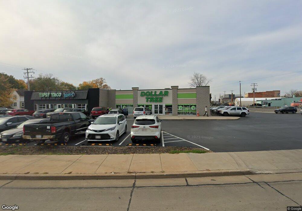
127 S Memorial Dr Appleton, WI 54911
Downtown Appleton NeighborhoodEstimated Value: $1,881,708
Studio
--
Bath
17,670
Sq Ft
$106/Sq Ft
Est. Value
About This Home
This home is located at 127 S Memorial Dr, Appleton, WI 54911 and is currently priced at $1,881,708, approximately $106 per square foot. 127 S Memorial Dr is a home located in Outagamie County with nearby schools including Jefferson Elementary School, Wilson Middle School, and Appleton West High School.
Ownership History
Date
Name
Owned For
Owner Type
Purchase Details
Closed on
Jul 19, 2024
Sold by
Zcf Qozb Llc
Bought by
Westbrook Properties Llc
Current Estimated Value
Home Financials for this Owner
Home Financials are based on the most recent Mortgage that was taken out on this home.
Original Mortgage
$648,999
Outstanding Balance
$641,247
Interest Rate
6.99%
Mortgage Type
New Conventional
Purchase Details
Closed on
Aug 27, 2020
Sold by
Pacifica Appleton Llc A Wisconsin Limite
Bought by
Zcf Qozb Llc A Delaware Limited Liabilit
Purchase Details
Closed on
May 2, 2013
Sold by
Michael S Polsky Esq Receiver Of Hp Hold
Bought by
Anchorbank Fsb
Purchase Details
Closed on
Jul 15, 2005
Sold by
Vanlieshout Thomas J
Bought by
Hp Holdings Llc
Create a Home Valuation Report for This Property
The Home Valuation Report is an in-depth analysis detailing your home's value as well as a comparison with similar homes in the area
Home Values in the Area
Average Home Value in this Area
Purchase History
| Date | Buyer | Sale Price | Title Company |
|---|---|---|---|
| Westbrook Properties Llc | $1,835,700 | First American Title Insurance | |
| Zcf Qozb Llc A Delaware Limited Liabilit | $1,610,000 | -- | |
| Anchorbank Fsb | $770,000 | -- | |
| Hp Holdings Llc | $900,000 | -- |
Source: Public Records
Mortgage History
| Date | Status | Borrower | Loan Amount |
|---|---|---|---|
| Open | Westbrook Properties Llc | $648,999 |
Source: Public Records
Tax History
| Year | Tax Paid | Tax Assessment Tax Assessment Total Assessment is a certain percentage of the fair market value that is determined by local assessors to be the total taxable value of land and additions on the property. | Land | Improvement |
|---|---|---|---|---|
| 2023 | $33,494 | $1,765,900 | $353,900 | $1,412,000 |
| 2022 | $33,674 | $1,370,000 | $269,500 | $1,100,500 |
| 2021 | $28,627 | $1,370,000 | $269,500 | $1,100,500 |
| 2020 | $28,055 | $1,370,000 | $269,500 | $1,100,500 |
| 2019 | $31,389 | $1,370,000 | $269,500 | $1,100,500 |
| 2018 | $10,912 | $479,500 | $269,500 | $210,000 |
| 2017 | $16,006 | $715,000 | $269,500 | $445,500 |
| 2016 | $15,787 | $715,000 | $269,500 | $445,500 |
| 2015 | $17,762 | $715,000 | $269,500 | $445,500 |
| 2014 | $17,645 | $715,000 | $269,500 | $445,500 |
| 2013 | $19,771 | $800,000 | $269,500 | $530,500 |
Source: Public Records
Map
Nearby Homes
- 736 W 8th St
- 739 W 8th St
- 1702 S Perkins St
- 1606 S Carver Ln
- 614 W 6th St
- 400 N Richmond St Unit 328
- 400 N Richmond St Unit 417
- 1003 W Spencer St
- 913 W 5th St
- 731 W Elsie St
- 803 W Prospect Ave
- 821 W Prospect Ave
- 923 W Elsie St
- 823 W Oklahoma St
- 730 W Oklahoma St
- 727 N Bennett St
- 501 W Winnebago St
- 1019 W Oklahoma St
- 400 S Outagamie St
- 1417 W 8th St
- 728 W Lawrence St
- 721 W Lawrence St
- 727 W Lawrence St
- 733 W Lawrence St
- 737 W Lawrence St
- 741 W Lawrence St
- 745 W Lawrence St
- 715 W Lawrence St
- 116 S Block Rd
- W6124 Georgia Ln
- W6124 Fergis Lm
- 0 Forestbrook Ln Unit 50154969
- 0 Forestbrook Ln Unit 50155087
- 0 Forestbrook Ln Unit 50155086
- 0 Forestbrook Ln Unit 50155073
- 0 Forestbrook Ln Unit 50154971
- 0 Forestbrook Ln Unit 50175310
- 0 Forestbrook Ln Unit 50175309
- 0 Forestbrook Ln Unit 50175307
- 0 Forestbrook Ln Unit 50175306
Your Personal Tour Guide
Ask me questions while you tour the home.