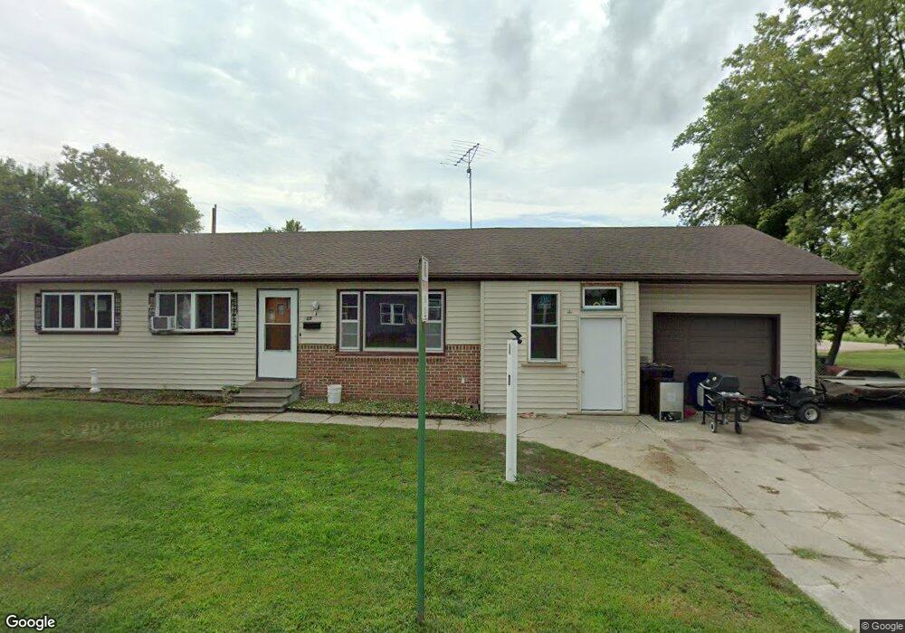
127 W Coburn St West Point, NE 68788
Estimated Value: $103,000 - $180,000
3
Beds
2
Baths
988
Sq Ft
$150/Sq Ft
Est. Value
About This Home
This home is located at 127 W Coburn St, West Point, NE 68788 and is currently estimated at $147,893, approximately $149 per square foot. 127 W Coburn St is a home located in Cuming County with nearby schools including West Point-Beemer Junior/Senior High School, Guardian Angels Elementary School, and St. Paul Lutheran School.
Ownership History
Date
Name
Owned For
Owner Type
Purchase Details
Closed on
Mar 28, 2024
Sold by
Trujillo Filadelfo and Trujillo Cardona Estela
Bought by
Trujillo Filadelfo
Current Estimated Value
Purchase Details
Closed on
Sep 20, 2012
Sold by
Boell Rhonda J
Bought by
Pedroza Filadelfo Trujillo and Cardona Estela
Create a Home Valuation Report for This Property
The Home Valuation Report is an in-depth analysis detailing your home's value as well as a comparison with similar homes in the area
Home Values in the Area
Average Home Value in this Area
Purchase History
| Date | Buyer | Sale Price | Title Company |
|---|---|---|---|
| Trujillo Filadelfo | $5,333 | None Listed On Document | |
| Pedroza Filadelfo Trujillo | $34,000 | None Available |
Source: Public Records
Tax History Compared to Growth
Tax History
| Year | Tax Paid | Tax Assessment Tax Assessment Total Assessment is a certain percentage of the fair market value that is determined by local assessors to be the total taxable value of land and additions on the property. | Land | Improvement |
|---|---|---|---|---|
| 2025 | $907 | $116,125 | $9,225 | $106,900 |
| 2024 | $907 | $107,285 | $9,225 | $98,060 |
| 2023 | $1,198 | $103,840 | $8,150 | $95,690 |
| 2022 | $1,163 | $91,970 | $6,435 | $85,535 |
| 2021 | $1,074 | $80,625 | $5,365 | $75,260 |
| 2020 | $1,018 | $76,205 | $5,365 | $70,840 |
| 2019 | $807 | $59,055 | $5,365 | $53,690 |
| 2018 | $747 | $54,425 | $5,365 | $49,060 |
| 2017 | $763 | $54,425 | $5,365 | $49,060 |
| 2016 | $758 | $52,460 | $5,365 | $47,095 |
| 2015 | $806 | $52,460 | $5,365 | $47,095 |
| 2014 | $1,032 | $46,090 | $5,365 | $40,725 |
| 2013 | $1,032 | $46,090 | $5,365 | $40,725 |
Source: Public Records
Map
Nearby Homes