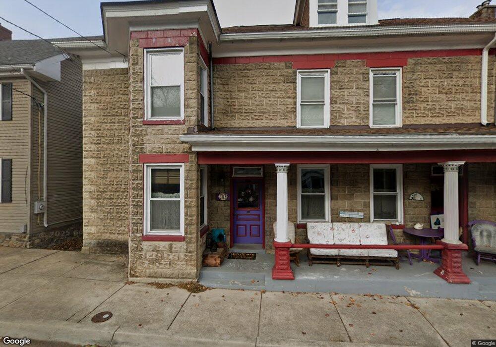
127 W Main St Sharpsburg, MD 21782
Estimated Value: $255,127 - $350,000
--
Bed
--
Bath
3,234
Sq Ft
$90/Sq Ft
Est. Value
About This Home
This home is located at 127 W Main St, Sharpsburg, MD 21782 and is currently estimated at $291,532, approximately $90 per square foot. 127 W Main St is a home located in Washington County with nearby schools including Sharpsburg Elementary School, Boonsboro Middle School, and Boonsboro High School.
Ownership History
Date
Name
Owned For
Owner Type
Purchase Details
Closed on
Dec 12, 2002
Sold by
Marshall Terry E and Marshall Martha R
Bought by
Samuel Chapelle Peter and Samuel Sheila D
Current Estimated Value
Purchase Details
Closed on
May 13, 1997
Sold by
Stotelmyer Richard A and Stotelmyer Tina L
Bought by
Marshall Terry E and Marshall Martha R
Purchase Details
Closed on
Jun 23, 1981
Sold by
Swain H Marcellus
Bought by
Stotelmyer Richard A and Stotelmyer Tina L
Home Financials for this Owner
Home Financials are based on the most recent Mortgage that was taken out on this home.
Original Mortgage
$35,000
Interest Rate
16.71%
Create a Home Valuation Report for This Property
The Home Valuation Report is an in-depth analysis detailing your home's value as well as a comparison with similar homes in the area
Home Values in the Area
Average Home Value in this Area
Purchase History
| Date | Buyer | Sale Price | Title Company |
|---|---|---|---|
| Samuel Chapelle Peter | $97,000 | -- | |
| Marshall Terry E | $42,500 | -- | |
| Stotelmyer Richard A | $32,000 | -- |
Source: Public Records
Mortgage History
| Date | Status | Borrower | Loan Amount |
|---|---|---|---|
| Previous Owner | Stotelmyer Richard A | $35,000 | |
| Closed | Samuel Chapelle Peter | -- |
Source: Public Records
Tax History Compared to Growth
Tax History
| Year | Tax Paid | Tax Assessment Tax Assessment Total Assessment is a certain percentage of the fair market value that is determined by local assessors to be the total taxable value of land and additions on the property. | Land | Improvement |
|---|---|---|---|---|
| 2025 | $1,507 | $186,233 | $0 | $0 |
| 2024 | $1,507 | $168,767 | $0 | $0 |
| 2023 | $1,378 | $151,300 | $47,600 | $103,700 |
| 2022 | $1,372 | $150,600 | $0 | $0 |
| 2021 | $722 | $149,900 | $0 | $0 |
| 2020 | $1,389 | $149,200 | $47,600 | $101,600 |
| 2019 | $1,375 | $147,067 | $0 | $0 |
| 2018 | $1,353 | $144,933 | $0 | $0 |
| 2017 | $1,305 | $142,800 | $0 | $0 |
| 2016 | -- | $142,800 | $0 | $0 |
| 2015 | -- | $142,800 | $0 | $0 |
| 2014 | $1,148 | $142,900 | $0 | $0 |
Source: Public Records
Map
Nearby Homes
- 201 E Main St
- 4723 Harpers Ferry Rd
- 0 Burnside Bridge Rd
- 0 Steamboat Run Rd Unit WVJF2019860
- 16821 Tow Path Ln
- Lot 4A Steamboat Run Rd
- 5103 Red Hill Rd
- 4720 Horizon Ln
- 0 Reachcliff Dr Unit WVJF2019398
- 44 N Tamarac Dr
- 6 Mallard Ln
- 1132 Terrapin Neck Rd
- 79 Chandler Dr
- 200 Meadow Ridge Dr
- 0 Shepherd Grade Rd Unit WVJF2020204
- 6911 Tommytown Rd
- 130 Stonecrest Cir
- 0 Shepherdstown Pike Unit MDWA2018458
- 0 Shepherdstown Pike Unit MDWA2025938
- 6937 Tommytown Rd