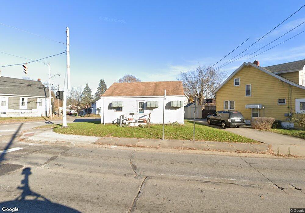
127 W State St Barberton, OH 44203
North Barberton NeighborhoodEstimated Value: $79,000 - $123,000
2
Beds
1
Bath
572
Sq Ft
$173/Sq Ft
Est. Value
About This Home
This home is located at 127 W State St, Barberton, OH 44203 and is currently estimated at $99,080, approximately $173 per square foot. 127 W State St is a home located in Summit County with nearby schools including Barberton Middle School, Barberton Intermediate School 3-5, and Barberton High School.
Ownership History
Date
Name
Owned For
Owner Type
Purchase Details
Closed on
Jul 24, 2006
Sold by
Riggs Jerry L
Bought by
Maag Michael L
Current Estimated Value
Purchase Details
Closed on
Jun 21, 2006
Sold by
Estate Of Donald O Riggs
Bought by
Riggs Jerry L and Riggs Donald O
Purchase Details
Closed on
Nov 3, 2005
Sold by
Riggs Donald O
Bought by
Maag Mick
Create a Home Valuation Report for This Property
The Home Valuation Report is an in-depth analysis detailing your home's value as well as a comparison with similar homes in the area
Home Values in the Area
Average Home Value in this Area
Purchase History
| Date | Buyer | Sale Price | Title Company |
|---|---|---|---|
| Maag Michael L | -- | None Available | |
| Riggs Jerry L | -- | None Available | |
| Maag Mick | -- | None Available |
Source: Public Records
Tax History Compared to Growth
Tax History
| Year | Tax Paid | Tax Assessment Tax Assessment Total Assessment is a certain percentage of the fair market value that is determined by local assessors to be the total taxable value of land and additions on the property. | Land | Improvement |
|---|---|---|---|---|
| 2025 | $38,990 | $24,472 | $6,762 | $17,710 |
| 2024 | $1,685 | $24,472 | $6,762 | $17,710 |
| 2023 | $38,990 | $24,472 | $6,762 | $17,710 |
| 2022 | $1,047 | $15,996 | $4,421 | $11,575 |
| 2021 | $945 | $15,996 | $4,421 | $11,575 |
| 2020 | $1,108 | $16,000 | $4,420 | $11,580 |
| 2019 | $1,421 | $17,010 | $3,890 | $13,120 |
| 2018 | $1,171 | $17,010 | $3,890 | $13,120 |
| 2017 | $1,135 | $17,010 | $3,890 | $13,120 |
| 2016 | $1,137 | $17,010 | $3,890 | $13,120 |
| 2015 | $1,135 | $17,010 | $3,890 | $13,120 |
| 2014 | $1,130 | $17,010 | $3,890 | $13,120 |
| 2013 | $1,138 | $17,780 | $3,890 | $13,890 |
Source: Public Records
Map
Nearby Homes
- 30 W Hiram St
- 197 W State St Unit 182
- 0 Romig Ave
- 714 Orchard Ave
- 76 Hazelwood Ave
- 117 Fernwood Ave
- 1146 Wooster Rd N
- 1150 Wooster Rd N
- 213 Hermann St
- 0 Wooster Rd N
- 217 W Summit St
- 613 Wooster Rd N
- 1515 Grand Blvd
- 485 Lloyd St
- 536 Yale Ave
- 2668 30th St SW
- 1288 Tampa Ave
- 409 Franklin Ave
- 274 E State St
- 526 Wooster Rd N