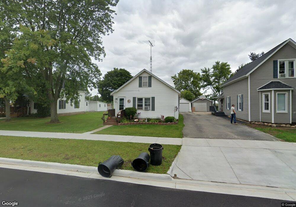
127 Wells St Croswell, MI 48422
Estimated Value: $110,188 - $132,000
--
Bed
--
Bath
--
Sq Ft
5,227
Sq Ft Lot
About This Home
This home is located at 127 Wells St, Croswell, MI 48422 and is currently estimated at $122,297. 127 Wells St is a home.
Ownership History
Date
Name
Owned For
Owner Type
Purchase Details
Closed on
Dec 31, 1994
Sold by
Marsh Melinda
Bought by
Whiting Timothy J and Whiting Diane K
Current Estimated Value
Create a Home Valuation Report for This Property
The Home Valuation Report is an in-depth analysis detailing your home's value as well as a comparison with similar homes in the area
Home Values in the Area
Average Home Value in this Area
Purchase History
| Date | Buyer | Sale Price | Title Company |
|---|---|---|---|
| Whiting Timothy J | $20,000 | -- |
Source: Public Records
Tax History Compared to Growth
Tax History
| Year | Tax Paid | Tax Assessment Tax Assessment Total Assessment is a certain percentage of the fair market value that is determined by local assessors to be the total taxable value of land and additions on the property. | Land | Improvement |
|---|---|---|---|---|
| 2025 | $1,143 | $52,700 | $0 | $0 |
| 2024 | $559 | $47,500 | $0 | $0 |
| 2023 | $541 | $36,300 | $0 | $0 |
| 2022 | $1,045 | $29,800 | $0 | $0 |
| 2021 | $1,013 | $26,400 | $0 | $0 |
| 2020 | $1,000 | $27,500 | $0 | $0 |
| 2019 | $982 | $24,800 | $0 | $0 |
| 2018 | $959 | $25,300 | $0 | $0 |
| 2017 | $939 | $23,200 | $0 | $0 |
| 2016 | $460 | $20,200 | $0 | $0 |
| 2015 | -- | $20,700 | $0 | $0 |
| 2014 | -- | $18,600 | $0 | $0 |
Source: Public Records
Map
Nearby Homes
- 229 Melvin St
- 235 N Howard Ave
- 0 Harrington Rd Dot Street-Parcel B Unit 50032187
- 241 Anderson Ave
- Lot #17 Jay St
- Parcel E Dot St
- Parcel D Dot St
- Parcel C Dot St
- 0 Dot Unit 20251010317
- Lot 4 Red Pine Ln
- 42 S Flower St
- Lot 18 White Pine Ln
- Lot 16 White Pine Ln
- vac Peck Rd
- 0000 Peck Wildcat Rd
- 4405 Black River Rd
- 5393 Cedar St
- 4204 Peck Rd
- 4941 Wixson Rd
- 5447 Willow Dr