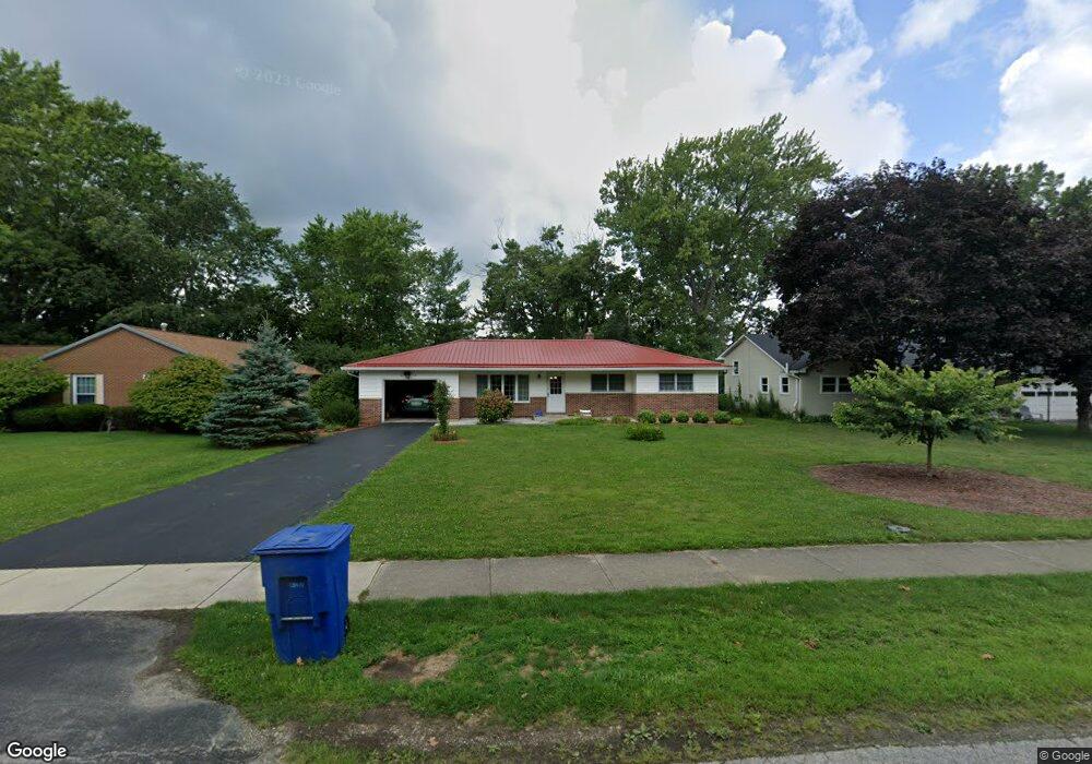
127 Westwood Ave Delaware, OH 43015
Estimated Value: $283,001 - $296,000
3
Beds
1
Bath
1,096
Sq Ft
$263/Sq Ft
Est. Value
About This Home
This home is located at 127 Westwood Ave, Delaware, OH 43015 and is currently estimated at $288,500, approximately $263 per square foot. 127 Westwood Ave is a home located in Delaware County with nearby schools including Ervin Carlisle Elementary School, John C. Dempsey Middle School, and Rutherford B. Hayes High School.
Ownership History
Date
Name
Owned For
Owner Type
Purchase Details
Closed on
Oct 28, 2011
Sold by
Sullivan Janet C
Bought by
Adkins Darren Neal and Adkins Kimberly Ann
Current Estimated Value
Home Financials for this Owner
Home Financials are based on the most recent Mortgage that was taken out on this home.
Original Mortgage
$107,010
Outstanding Balance
$73,322
Interest Rate
4.12%
Mortgage Type
New Conventional
Estimated Equity
$215,178
Purchase Details
Closed on
Oct 7, 2011
Sold by
Estate Of Walter E Sullivan
Bought by
Sullivan Janet C
Home Financials for this Owner
Home Financials are based on the most recent Mortgage that was taken out on this home.
Original Mortgage
$107,010
Outstanding Balance
$73,322
Interest Rate
4.12%
Mortgage Type
New Conventional
Estimated Equity
$215,178
Create a Home Valuation Report for This Property
The Home Valuation Report is an in-depth analysis detailing your home's value as well as a comparison with similar homes in the area
Home Values in the Area
Average Home Value in this Area
Purchase History
| Date | Buyer | Sale Price | Title Company |
|---|---|---|---|
| Adkins Darren Neal | $39,633 | Golden Title Agency | |
| Sullivan Janet C | -- | None Available |
Source: Public Records
Mortgage History
| Date | Status | Borrower | Loan Amount |
|---|---|---|---|
| Open | Adkins Darren Neal | $107,010 |
Source: Public Records
Tax History Compared to Growth
Tax History
| Year | Tax Paid | Tax Assessment Tax Assessment Total Assessment is a certain percentage of the fair market value that is determined by local assessors to be the total taxable value of land and additions on the property. | Land | Improvement |
|---|---|---|---|---|
| 2024 | $3,667 | $77,670 | $16,590 | $61,080 |
| 2023 | $3,674 | $77,670 | $16,590 | $61,080 |
| 2022 | $3,148 | $57,760 | $11,520 | $46,240 |
| 2021 | $3,218 | $57,760 | $11,520 | $46,240 |
| 2020 | $3,254 | $57,760 | $11,520 | $46,240 |
| 2019 | $2,868 | $46,130 | $10,010 | $36,120 |
| 2018 | $2,908 | $46,130 | $10,010 | $36,120 |
| 2017 | $2,665 | $42,350 | $9,800 | $32,550 |
| 2016 | $2,436 | $42,350 | $9,800 | $32,550 |
| 2015 | $2,449 | $42,350 | $9,800 | $32,550 |
| 2014 | $2,488 | $42,350 | $9,800 | $32,550 |
| 2013 | $2,502 | $42,350 | $9,800 | $32,550 |
Source: Public Records
Map
Nearby Homes
- 101 Blue Spruce Ct
- 102 Troy Rd
- 135 Crestview Dr
- 193 Lexington Blvd
- 169 Hillside Dr
- 568 Durham Ln
- 592 Willis Ln
- 590 Willis Ln
- 586 Willis Ln
- 131 Flowering Meadow Dr
- 425 Greenland Pass
- 401 Garnet Ranch Dr
- 394 Garnet Ranch Dr
- 400 Garnet Ranch Dr
- 406 Garnet Ranch Dr
- 412 Garnet Ranch Dr
- 413 Garnet Ranch Dr
- 424 Garnet Ranch Dr
- 430 Garnet Ranch Dr
- 181 Seatrain Dr
- 135 Westwood Ave
- 119 Westwood Ave
- 141 Westwood Ave
- 113 Westwood Ave
- 586 Buehler Dr
- 580 Buehler Dr
- 592 Buehler Dr
- 574 Buehler Dr
- 149 Westwood Ave
- 128 Westwood Ave
- 105 Westwood Ave
- 122 Westwood Ave
- 136 Westwood Ave
- 568 Buehler Dr
- 114 Westwood Ave
- 598 Buehler Dr
- 157 Westwood Ave
- 566 Buehler Dr
- 110 Westwood Ave
- 152 Westwood Ave