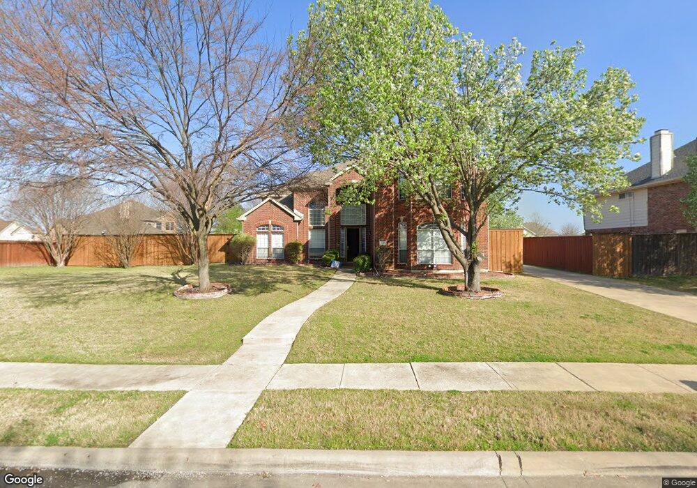
127 Westwood Dr Murphy, TX 75094
Estimated Value: $625,000 - $659,326
4
Beds
4
Baths
3,962
Sq Ft
$161/Sq Ft
Est. Value
About This Home
This home is located at 127 Westwood Dr, Murphy, TX 75094 and is currently estimated at $639,082, approximately $161 per square foot. 127 Westwood Dr is a home located in Collin County with nearby schools including Miller Elementary School, Murphy Middle School, and C A Mcmillen High School.
Ownership History
Date
Name
Owned For
Owner Type
Purchase Details
Closed on
Jan 25, 2021
Sold by
Sackey Frankie and Sackey Karen
Bought by
Broce Jason and Broce Keren
Current Estimated Value
Home Financials for this Owner
Home Financials are based on the most recent Mortgage that was taken out on this home.
Original Mortgage
$309,777
Outstanding Balance
$276,428
Interest Rate
2.7%
Mortgage Type
VA
Estimated Equity
$362,654
Purchase Details
Closed on
Mar 29, 2001
Sold by
U S Home Corp
Bought by
Sackey Frankie and Sackey Karen
Home Financials for this Owner
Home Financials are based on the most recent Mortgage that was taken out on this home.
Original Mortgage
$213,750
Interest Rate
7.13%
Create a Home Valuation Report for This Property
The Home Valuation Report is an in-depth analysis detailing your home's value as well as a comparison with similar homes in the area
Home Values in the Area
Average Home Value in this Area
Purchase History
| Date | Buyer | Sale Price | Title Company |
|---|---|---|---|
| Broce Jason | -- | Title Forward | |
| Sackey Frankie | -- | -- |
Source: Public Records
Mortgage History
| Date | Status | Borrower | Loan Amount |
|---|---|---|---|
| Open | Broce Jason | $309,777 | |
| Previous Owner | Sackey Frankie | $213,750 | |
| Closed | Sackey Frankie | $26,700 |
Source: Public Records
Tax History Compared to Growth
Tax History
| Year | Tax Paid | Tax Assessment Tax Assessment Total Assessment is a certain percentage of the fair market value that is determined by local assessors to be the total taxable value of land and additions on the property. | Land | Improvement |
|---|---|---|---|---|
| 2025 | $9,654 | $653,575 | $138,000 | $515,575 |
| 2024 | $9,654 | $663,623 | $138,000 | $527,348 |
| 2023 | $9,654 | $603,294 | $138,000 | $465,294 |
| 2022 | $10,402 | $531,143 | $120,000 | $411,143 |
| 2021 | $8,779 | $425,131 | $96,000 | $329,131 |
| 2020 | $8,515 | $407,716 | $84,000 | $323,716 |
| 2019 | $9,110 | $415,784 | $84,000 | $331,784 |
| 2018 | $8,614 | $389,568 | $84,000 | $305,568 |
| 2017 | $8,115 | $367,000 | $84,000 | $283,000 |
| 2016 | $7,621 | $363,430 | $72,000 | $291,430 |
| 2015 | $6,263 | $321,575 | $54,000 | $267,575 |
Source: Public Records
Map
Nearby Homes
- 524 Jasmine Dr
- 248 Mimosa Dr
- 237 Mimosa Dr
- 3309 Grantham Dr
- 202 Sweetgum Dr
- 3203 Grantham Dr
- 6048 Bertrand Dr
- 602 Horizon Dr
- 3624 Connaught Rd
- 5421 Palace Dr
- 5413 Carrington Dr
- 179 Moonlight Dr
- 465 Kinney Dr
- 5517 Enfield Dr
- 3613 Gloucester Rd
- 403 Pleasant Run
- 2603 Grant Dr
- 402 S Maxwell Creek Rd
- LOT#2 S Maxwell Creek Rd
- 813 Burgess Ln
- 131 Westwood Dr
- 534 Hackberry Dr
- 530 Hackberry Dr
- 538 Hackberry Dr
- 135 Westwood Dr
- 136 Oakbluff Dr
- 128 Westwood Dr
- 132 Oakbluff Dr
- 140 Oakbluff Dr
- 124 Westwood Dr
- 132 Westwood Dr
- 128 Oakbluff Dr
- 139 Westwood Dr
- 144 Oakbluff Dr
- 533 Hackberry Dr
- 136 Westwood Dr
- 120 Westwood Dr
- 537 Hackberry Dr
- 529 Hackberry Dr
- 148 Oakbluff Dr