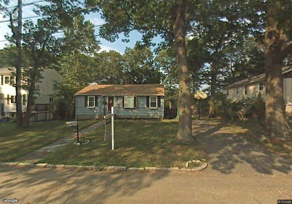
127 Woodside Ln Arlington, MA 02474
Arlington Heights NeighborhoodEstimated Value: $1,105,000 - $1,454,188
3
Beds
3
Baths
1,810
Sq Ft
$709/Sq Ft
Est. Value
About This Home
This home is located at 127 Woodside Ln, Arlington, MA 02474 and is currently estimated at $1,284,047, approximately $709 per square foot. 127 Woodside Ln is a home located in Middlesex County with nearby schools including M. Norcross Stratton Elementary School, Ottoson Middle School, and Arlington High School.
Ownership History
Date
Name
Owned For
Owner Type
Purchase Details
Closed on
Nov 23, 2010
Sold by
Deluca Thomas J
Bought by
Burgundy Rt and English
Current Estimated Value
Purchase Details
Closed on
Aug 3, 2010
Sold by
Lekakos Joanna and Dimakis Virginia
Bought by
Deluca Thomas J
Home Financials for this Owner
Home Financials are based on the most recent Mortgage that was taken out on this home.
Original Mortgage
$262,500
Interest Rate
4.78%
Mortgage Type
Purchase Money Mortgage
Create a Home Valuation Report for This Property
The Home Valuation Report is an in-depth analysis detailing your home's value as well as a comparison with similar homes in the area
Home Values in the Area
Average Home Value in this Area
Purchase History
| Date | Buyer | Sale Price | Title Company |
|---|---|---|---|
| Burgundy Rt | $615,000 | -- | |
| Deluca Thomas J | $350,000 | -- |
Source: Public Records
Mortgage History
| Date | Status | Borrower | Loan Amount |
|---|---|---|---|
| Previous Owner | Deluca Thomas J | $262,500 |
Source: Public Records
Tax History Compared to Growth
Tax History
| Year | Tax Paid | Tax Assessment Tax Assessment Total Assessment is a certain percentage of the fair market value that is determined by local assessors to be the total taxable value of land and additions on the property. | Land | Improvement |
|---|---|---|---|---|
| 2025 | $13,441 | $1,248,000 | $588,000 | $660,000 |
| 2024 | $12,605 | $1,190,300 | $580,900 | $609,400 |
| 2023 | $12,094 | $1,078,900 | $523,500 | $555,400 |
| 2022 | $11,505 | $1,007,400 | $502,000 | $505,400 |
| 2021 | $11,257 | $992,700 | $502,000 | $490,700 |
| 2020 | $10,979 | $992,700 | $502,000 | $490,700 |
| 2019 | $9,856 | $875,300 | $509,200 | $366,100 |
| 2018 | $9,051 | $746,200 | $380,100 | $366,100 |
| 2017 | $8,921 | $710,300 | $344,200 | $366,100 |
| 2016 | $8,909 | $696,000 | $329,900 | $366,100 |
| 2015 | $8,553 | $631,200 | $279,700 | $351,500 |
Source: Public Records
Map
Nearby Homes
- 52-56 Dudley St
- 335 Mystic St
- 975 Mass Ave Unit 106
- 18-20 Brattle St
- 12 Longmeadow Rd
- 995 Massachusetts Ave Unit 404
- 204 Plan at Majestic Mill Brook
- 1025 Massachusetts Ave Unit 404
- 1025 Massachusetts Ave Unit 506
- 1025 Massachusetts Ave Unit 401
- 1025 Massachusetts Ave Unit 210
- 1025 Massachusetts Ave Unit 402
- 1025 Massachusetts Ave Unit 308
- 1025 Massachusetts Ave Unit 411
- 1025 Massachusetts Ave Unit 313
- 1025 Massachusetts Ave Unit 304
- 1025 Massachusetts Ave Unit 414
- 1025 Massachusetts Ave Unit 212
- 1025 Massachusetts Ave Unit 305
- 1025 Massachusetts Ave Unit 201
- 123 Woodside Ln
- 119 Woodside Ln
- 20 Twin Circle Dr
- 24 Twin Circle Dr
- 135 Woodside Ln
- 192 Brattle St
- 115 Woodside Ln
- 120 Woodside Ln
- 28 Twin Circle Dr
- 16 Twin Circle Dr
- 139 Woodside Ln
- 188 Brattle St
- 185 Brattle St
- 134 Woodside Ln
- 32 Twin Circle Dr
- 106 Woodside Ln
- 184 Brattle St
- 12 Twin Circle Dr
- 111 Woodside Ln
- 138 Woodside Ln