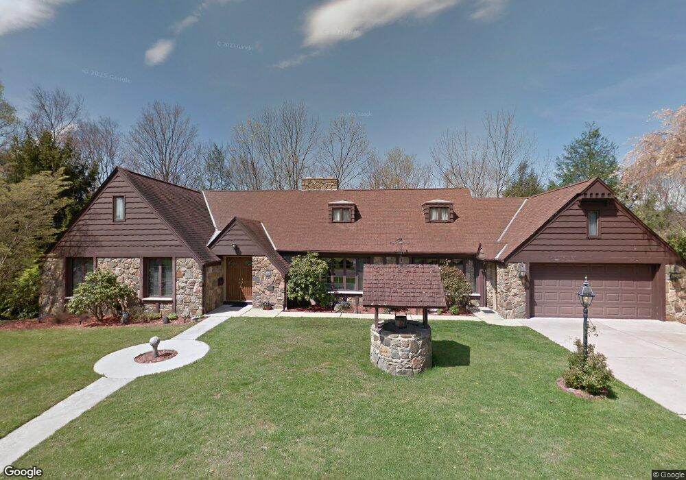
127 Woodtip Dr Shavertown, PA 18708
Estimated Value: $402,000 - $584,582
--
Bed
--
Bath
3,473
Sq Ft
$148/Sq Ft
Est. Value
About This Home
This home is located at 127 Woodtip Dr, Shavertown, PA 18708 and is currently estimated at $514,896, approximately $148 per square foot. 127 Woodtip Dr is a home located in Luzerne County with nearby schools including Dallas Senior High School and Cornerstone Christian Academy.
Ownership History
Date
Name
Owned For
Owner Type
Purchase Details
Closed on
Jul 12, 2004
Bought by
Wittkamp Carol A
Current Estimated Value
Create a Home Valuation Report for This Property
The Home Valuation Report is an in-depth analysis detailing your home's value as well as a comparison with similar homes in the area
Home Values in the Area
Average Home Value in this Area
Purchase History
| Date | Buyer | Sale Price | Title Company |
|---|---|---|---|
| Wittkamp Carol A | $220,000 | -- |
Source: Public Records
Tax History Compared to Growth
Tax History
| Year | Tax Paid | Tax Assessment Tax Assessment Total Assessment is a certain percentage of the fair market value that is determined by local assessors to be the total taxable value of land and additions on the property. | Land | Improvement |
|---|---|---|---|---|
| 2025 | $7,701 | $355,600 | $48,100 | $307,500 |
| 2024 | $7,463 | $355,600 | $48,100 | $307,500 |
| 2023 | $7,463 | $355,600 | $48,100 | $307,500 |
| 2022 | $7,398 | $355,600 | $48,100 | $307,500 |
| 2021 | $7,398 | $355,600 | $48,100 | $307,500 |
| 2020 | $7,398 | $355,600 | $48,100 | $307,500 |
| 2019 | $7,329 | $355,600 | $48,100 | $307,500 |
| 2018 | $7,257 | $355,600 | $48,100 | $307,500 |
| 2017 | $7,152 | $355,600 | $48,100 | $307,500 |
| 2016 | -- | $355,600 | $48,100 | $307,500 |
| 2015 | $6,007 | $355,600 | $48,100 | $307,500 |
| 2014 | $6,007 | $355,600 | $48,100 | $307,500 |
Source: Public Records
Map
Nearby Homes
- 120 Frangorma Dr
- 209 Terrace Ave
- 7 Orchard St
- 242 Maple St
- 7 Echo Valley Dr
- 249 Cliffside Ave
- Lot # 4 Pioneer Ave
- 318 Echo Valley Dr
- 59 Zinn St
- 3 N Pioneer Ave
- 70 Shaver Ave
- 98 Davis St
- 945 Lantern Hill Rd
- 235 E Center St
- 205 Beech St
- 175 N Pioneer Ave
- 2 Manor Dr
- 120 Ondish Rd
- 65 E Overbrook Rd
- 65 E Overbrook Ave
- 134 Woodtip Dr
- 124 Woodtip Dr
- 123 Woodtip Dr
- 136 Woodtip Dr
- 135 Woodtip Dr
- 121 Woodtip Dr
- 2 Fern Ridge Ct
- 127 W Hillside St
- 140 Woodtip Dr
- 139 Woodtip Dr
- 5 Fern Ridge Ct
- 4 Fern Ridge Ct
- 124 W Hillside St
- 143 Woodtip Dr
- 139 Frangorma Dr
- 198 Carverton Rd
- 206 Carverton Rd
- 194 Carverton Rd
- 134 W Hillside St
- 123 Frangorma Dr