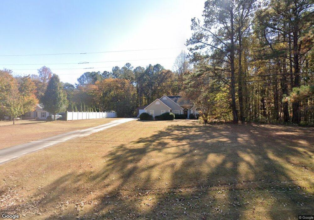
127 Woolsie Rd Sharpsburg, GA 30277
Estimated Value: $326,469 - $366,000
3
Beds
3
Baths
1,627
Sq Ft
$216/Sq Ft
Est. Value
About This Home
This home is located at 127 Woolsie Rd, Sharpsburg, GA 30277 and is currently estimated at $351,867, approximately $216 per square foot. 127 Woolsie Rd is a home located in Coweta County with nearby schools including Welch Elementary School, Lee Middle School, and East Coweta High School.
Ownership History
Date
Name
Owned For
Owner Type
Purchase Details
Closed on
May 27, 1999
Sold by
Woodside Homes Inc
Bought by
Ward James M and Ward Kelly J
Current Estimated Value
Home Financials for this Owner
Home Financials are based on the most recent Mortgage that was taken out on this home.
Original Mortgage
$123,500
Outstanding Balance
$31,507
Interest Rate
7.13%
Mortgage Type
New Conventional
Estimated Equity
$320,360
Purchase Details
Closed on
Feb 11, 1999
Sold by
Southern Crescent Co
Bought by
Woodside Homes Inc
Purchase Details
Closed on
Mar 19, 1996
Bought by
Southern Crescent Co
Purchase Details
Closed on
Feb 15, 1994
Bought by
Evergreen Communitie
Purchase Details
Closed on
Sep 30, 1976
Bought by
Brand Brand R and Brand H
Create a Home Valuation Report for This Property
The Home Valuation Report is an in-depth analysis detailing your home's value as well as a comparison with similar homes in the area
Home Values in the Area
Average Home Value in this Area
Purchase History
| Date | Buyer | Sale Price | Title Company |
|---|---|---|---|
| Ward James M | $130,900 | -- | |
| Woodside Homes Inc | $65,100 | -- | |
| Southern Crescent Co | $27,300 | -- | |
| Evergreen Communitie | $1,156,200 | -- | |
| Brand Brand R | $80,000 | -- |
Source: Public Records
Mortgage History
| Date | Status | Borrower | Loan Amount |
|---|---|---|---|
| Open | Ward James M | $123,500 |
Source: Public Records
Tax History Compared to Growth
Tax History
| Year | Tax Paid | Tax Assessment Tax Assessment Total Assessment is a certain percentage of the fair market value that is determined by local assessors to be the total taxable value of land and additions on the property. | Land | Improvement |
|---|---|---|---|---|
| 2025 | $2,771 | $123,993 | $26,000 | $97,993 |
| 2024 | $2,651 | $118,812 | $26,000 | $92,812 |
| 2023 | $2,651 | $118,078 | $20,000 | $98,078 |
| 2022 | $2,336 | $99,538 | $20,000 | $79,538 |
| 2021 | $1,991 | $80,302 | $16,000 | $64,302 |
| 2020 | $2,003 | $80,302 | $16,000 | $64,302 |
| 2019 | $1,851 | $68,035 | $10,000 | $58,035 |
| 2018 | $1,855 | $68,035 | $10,000 | $58,035 |
| 2017 | $1,694 | $62,568 | $10,000 | $52,568 |
| 2016 | $1,676 | $62,568 | $10,000 | $52,568 |
| 2015 | $1,410 | $54,157 | $10,000 | $44,157 |
| 2014 | $1,402 | $54,157 | $10,000 | $44,157 |
Source: Public Records
Map
Nearby Homes
- 45 Riverside Walk
- 150 Riverside Dr
- 11 Masters Way
- 5 Riverside Dr
- 75 Olympia Dr
- 41 Masters Dr
- 131 Pecan Lake Dr
- Camden Plan at Candleberry Place
- Savannah Plan at Candleberry Place
- Briarwood Plan at Candleberry Place
- Newport Plan at Candleberry Place
- 5 Candleberry Way
- 270 Sturgess Run
- 80 Vineyards Dr
- 65 Ellis Rd
- 20 Beaver Creek Ln
- 1367 Sharpsburg McCollum Rd
- 24 Marvin Gardens
- 9 Marvin Gardens
- 108 Waterford Place
- 133 Woolsie Rd
- 20 Riverside Pkwy
- 141 Woolsie Rd
- 10 Riverside Pkwy Unit 40
- 10 Riverside Pkwy
- 30 Riverside Pkwy
- 50 Riverside Pkwy
- 60 Riverside Pkwy Unit 1
- 5 Riverside Pkwy
- 15 Riverside Pkwy Unit B-2
- 78 Woolsie Rd
- 25 Riverside Pkwy
- 35 Riverside Pkwy
- 70 Riverside Pkwy
- 105 Riverside Walk
- 55 Riverside Pkwy
- 60 Woolsie Rd
- 5 Riverside Ct
- 65 Riverside Pkwy
- 75 Riverside Pkwy