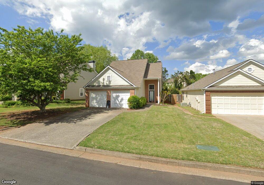
1270 Birchwood Ln Roswell, GA 30076
Estimated Value: $478,000 - $496,006
3
Beds
2
Baths
1,631
Sq Ft
$299/Sq Ft
Est. Value
About This Home
This home is located at 1270 Birchwood Ln, Roswell, GA 30076 and is currently estimated at $487,252, approximately $298 per square foot. 1270 Birchwood Ln is a home located in Fulton County with nearby schools including Sweet Apple Elementary School, Elkins Pointe Middle School, and Milton High School.
Ownership History
Date
Name
Owned For
Owner Type
Purchase Details
Closed on
May 22, 2007
Sold by
Kmoch David P and Kmoch Brandi L
Bought by
Taylor Scott T
Current Estimated Value
Home Financials for this Owner
Home Financials are based on the most recent Mortgage that was taken out on this home.
Original Mortgage
$174,800
Outstanding Balance
$106,325
Interest Rate
6.17%
Mortgage Type
New Conventional
Estimated Equity
$380,927
Purchase Details
Closed on
Sep 15, 1999
Sold by
Biafore Eugenia
Bought by
Lovell Brandi L
Home Financials for this Owner
Home Financials are based on the most recent Mortgage that was taken out on this home.
Original Mortgage
$158,000
Interest Rate
7.91%
Mortgage Type
New Conventional
Create a Home Valuation Report for This Property
The Home Valuation Report is an in-depth analysis detailing your home's value as well as a comparison with similar homes in the area
Home Values in the Area
Average Home Value in this Area
Purchase History
| Date | Buyer | Sale Price | Title Company |
|---|---|---|---|
| Taylor Scott T | $218,500 | -- | |
| Lovell Brandi L | $162,900 | -- |
Source: Public Records
Mortgage History
| Date | Status | Borrower | Loan Amount |
|---|---|---|---|
| Open | Taylor Scott T | $174,800 | |
| Previous Owner | Lovell Brandi L | $158,000 |
Source: Public Records
Tax History Compared to Growth
Tax History
| Year | Tax Paid | Tax Assessment Tax Assessment Total Assessment is a certain percentage of the fair market value that is determined by local assessors to be the total taxable value of land and additions on the property. | Land | Improvement |
|---|---|---|---|---|
| 2025 | $554 | $162,840 | $43,120 | $119,720 |
| 2023 | $4,647 | $164,640 | $58,000 | $106,640 |
| 2022 | $2,175 | $133,320 | $30,280 | $103,040 |
| 2021 | $2,585 | $117,440 | $26,200 | $91,240 |
| 2020 | $2,616 | $102,240 | $23,160 | $79,080 |
| 2019 | $433 | $106,960 | $22,760 | $84,200 |
| 2018 | $2,463 | $104,440 | $22,200 | $82,240 |
| 2017 | $2,068 | $82,840 | $16,840 | $66,000 |
| 2016 | $2,067 | $82,840 | $16,840 | $66,000 |
| 2015 | $2,527 | $82,840 | $16,840 | $66,000 |
| 2014 | $1,879 | $74,040 | $16,200 | $57,840 |
Source: Public Records
Map
Nearby Homes
- 4520 Orchard Trace
- 4404 Orchard Trace
- 1115 Primrose Dr
- 1330 Primrose Dr
- 530 Camber Woods Dr
- 640 Mae Ln
- 290 Rucker Rd
- 2002 Blossom Hill Dr
- 406 Sweet Apple Cir
- 1040 Jordan Ln
- 285 N Farm Dr
- 400 Carybell Ln
- 666 Abbey Ct
- 1565 Parkside Dr
- 300 Saddle Creek Ln
- 12440 Brookhill Crossing Ln
- 580 Stillhouse Ln Unit 2
- 113 Quinn Way
- 410 Hamilton Park Dr
- 11625 Northgate Way
- 1280 Birchwood Ln Unit 102
- 1280 Birchwood Ln Unit II
- 1260 Birchwood Ln Unit 1
- 1250 Birchwood Ln Unit 1
- 120 Ashton Ct Unit 1
- 2210 Ashton Dr Unit II
- 2200 Ashton Dr
- 2190 Ashton Dr Unit 2
- 130 Ashton Ct
- 130 Ashton Ct
- 2180 Ashton Dr
- 1275 Birchwood Ln Unit 1
- 1255 Birchwood Ln Unit 1
- 2170 Ashton Dr
- 1230 Birchwood Ln
- 1285 Birchwood Ln
- 110 Ashton Ct Unit 1
- 1245 Birchwood Ln
- 140 Ashton Ct
- 1295 Birchwood Ln