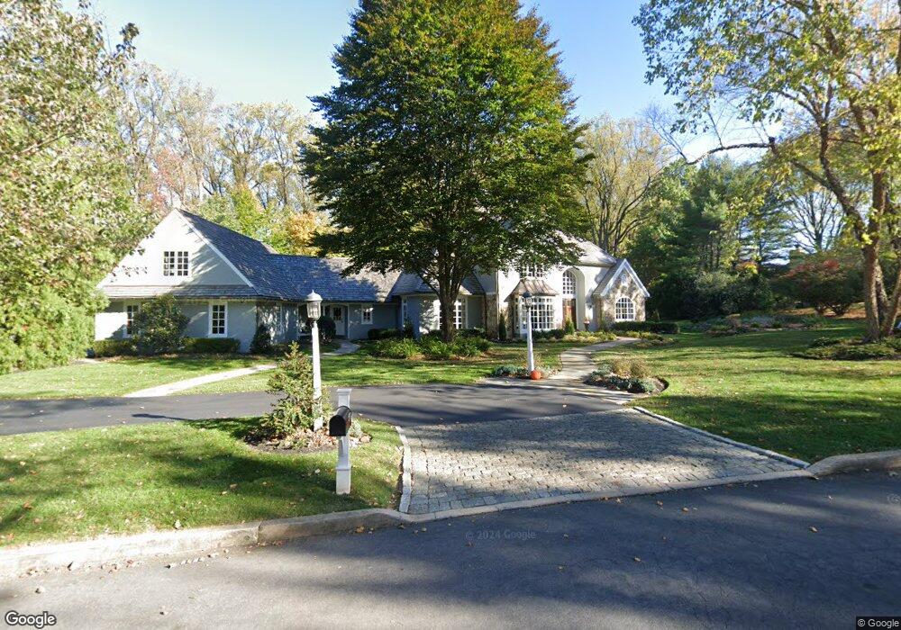
1270 Farm Rd Berwyn, PA 19312
Estimated Value: $1,649,346 - $2,118,000
5
Beds
6
Baths
4,513
Sq Ft
$429/Sq Ft
Est. Value
About This Home
This home is located at 1270 Farm Rd, Berwyn, PA 19312 and is currently estimated at $1,935,782, approximately $428 per square foot. 1270 Farm Rd is a home located in Chester County with nearby schools including Beaumont Elementary School, Tredyffrin-Easttown Middle School, and Conestoga Senior High School.
Ownership History
Date
Name
Owned For
Owner Type
Purchase Details
Closed on
Aug 12, 2009
Sold by
Amick Ted E and Amick Louise D
Bought by
Derkacz Michael M and Derkacz Dana A
Current Estimated Value
Home Financials for this Owner
Home Financials are based on the most recent Mortgage that was taken out on this home.
Original Mortgage
$900,000
Outstanding Balance
$585,606
Interest Rate
5.17%
Mortgage Type
New Conventional
Estimated Equity
$1,350,176
Create a Home Valuation Report for This Property
The Home Valuation Report is an in-depth analysis detailing your home's value as well as a comparison with similar homes in the area
Home Values in the Area
Average Home Value in this Area
Purchase History
| Date | Buyer | Sale Price | Title Company |
|---|---|---|---|
| Derkacz Michael M | $1,450,000 | None Available |
Source: Public Records
Mortgage History
| Date | Status | Borrower | Loan Amount |
|---|---|---|---|
| Open | Derkacz Michael M | $900,000 |
Source: Public Records
Tax History Compared to Growth
Tax History
| Year | Tax Paid | Tax Assessment Tax Assessment Total Assessment is a certain percentage of the fair market value that is determined by local assessors to be the total taxable value of land and additions on the property. | Land | Improvement |
|---|---|---|---|---|
| 2025 | $21,965 | $588,880 | $168,520 | $420,360 |
| 2024 | $21,965 | $588,880 | $168,520 | $420,360 |
| 2023 | $20,538 | $588,880 | $168,520 | $420,360 |
| 2022 | $19,976 | $588,880 | $168,520 | $420,360 |
| 2021 | $19,542 | $588,880 | $168,520 | $420,360 |
| 2020 | $18,999 | $588,880 | $168,520 | $420,360 |
| 2019 | $18,470 | $588,880 | $168,520 | $420,360 |
| 2018 | $18,150 | $588,880 | $168,520 | $420,360 |
| 2017 | $17,740 | $588,880 | $168,520 | $420,360 |
| 2016 | -- | $588,880 | $168,520 | $420,360 |
| 2015 | -- | $588,880 | $168,520 | $420,360 |
| 2014 | -- | $588,880 | $168,520 | $420,360 |
Source: Public Records
Map
Nearby Homes
- 191 Stony Point Dr
- 520 Hawthorne Place
- 837 Nathan Hale Rd
- 206 Yorktown Place Unit 106
- 650 Augusta Ct
- 709 Newtown Rd
- 1179 Beaumont Rd
- 2000 Saint Andrews Dr
- 32 Manchester Ct
- 91 Central Ave
- 6 Wingstone Ln
- 1441 Berwyn Paoli Rd
- 119 Waterloo Ave
- 0 Prescott Rd Unit PACT2110528
- 541 Woodside Ave
- 1052 Prescott Rd
- 553 Woodside Ave
- 718 Lot 1 Waterloo
- 327 Stoney Knoll Lane - Lot 5
- 1242 Old Lancaster Rd