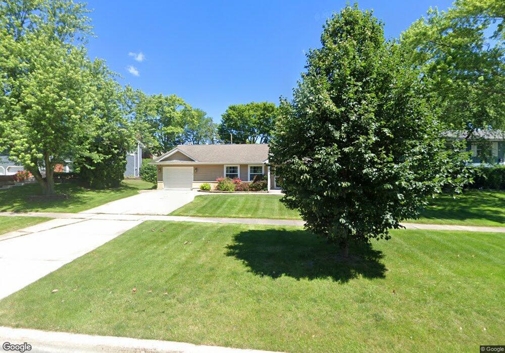
1270 Hassell Rd Hoffman Estates, IL 60169
High Point Park NeighborhoodEstimated Value: $419,980 - $474,000
4
Beds
2
Baths
1,755
Sq Ft
$253/Sq Ft
Est. Value
About This Home
This home is located at 1270 Hassell Rd, Hoffman Estates, IL 60169 and is currently estimated at $443,745, approximately $252 per square foot. 1270 Hassell Rd is a home located in Cook County with nearby schools including MacArthur International Spanish Academy, Dwight D Eisenhower Junior High School, and Hoffman Estates High School.
Ownership History
Date
Name
Owned For
Owner Type
Purchase Details
Closed on
Jan 26, 1996
Sold by
Paoli Raymond J and Paoli Donna
Bought by
Raio Anthony F and Raio Julie A
Current Estimated Value
Home Financials for this Owner
Home Financials are based on the most recent Mortgage that was taken out on this home.
Original Mortgage
$132,925
Interest Rate
8.29%
Mortgage Type
FHA
Create a Home Valuation Report for This Property
The Home Valuation Report is an in-depth analysis detailing your home's value as well as a comparison with similar homes in the area
Home Values in the Area
Average Home Value in this Area
Purchase History
| Date | Buyer | Sale Price | Title Company |
|---|---|---|---|
| Raio Anthony F | $140,000 | Attorneys Natl Title Network |
Source: Public Records
Mortgage History
| Date | Status | Borrower | Loan Amount |
|---|---|---|---|
| Previous Owner | Raio Anthony F | $132,925 |
Source: Public Records
Tax History
| Year | Tax Paid | Tax Assessment Tax Assessment Total Assessment is a certain percentage of the fair market value that is determined by local assessors to be the total taxable value of land and additions on the property. | Land | Improvement |
|---|---|---|---|---|
| 2025 | $8,189 | $38,001 | $7,961 | $30,040 |
| 2024 | $8,189 | $30,000 | $6,634 | $23,366 |
| 2023 | $7,894 | $30,000 | $6,634 | $23,366 |
| 2022 | $7,894 | $30,000 | $6,634 | $23,366 |
| 2021 | $6,898 | $23,919 | $4,422 | $19,497 |
| 2020 | $6,811 | $23,919 | $4,422 | $19,497 |
| 2019 | $6,777 | $26,577 | $4,422 | $22,155 |
| 2018 | $6,467 | $23,268 | $3,759 | $19,509 |
| 2017 | $6,371 | $23,268 | $3,759 | $19,509 |
| 2016 | $6,188 | $23,268 | $3,759 | $19,509 |
| 2015 | $5,171 | $18,724 | $3,316 | $15,408 |
| 2014 | $5,615 | $20,366 | $3,316 | $17,050 |
| 2013 | $5,453 | $20,366 | $3,316 | $17,050 |
Source: Public Records
Map
Nearby Homes
- 1410 Nottingham Ln
- 1095 Lancaster Ct
- 1665 Chippendale Rd
- 1930 Kenilworth Cir Unit E
- 1938 Huntington Blvd
- 1360 Devonshire Ln
- 730 Ashley Ct
- 1712 Fayette Walk Unit D
- 1800 Huntington Blvd Unit 208
- 1769 Sessions Walk Unit C
- 1724 Fayette Walk Unit J
- 2021 Kensington Ln Unit 3004
- 2027 Kensington Ln Unit 3001
- 2025 Kensington Ln Unit 3002
- 2023 Kensington Ln Unit 3003
- 1700 Robin Ln Unit 1D
- 1365 Newcastle Ln
- 1880 Bonnie Ln Unit 416
- 2051 Kettering Rd Unit 2
- 1659 Islandview Ct
- 1260 Hassell Rd
- 1290 Hassell Rd
- 1285 Mayfield Ln
- 1295 Mayfield Ln
- 1275 Mayfield Ln
- 1250 Hassell Rd
- 1300 Hassell Rd
- 1305 Mayfield Ln
- 1255 Mayfield Ln
- 1275 Hassell Ct
- 1230 Hassell Rd
- 1315 Mayfield Ln
- 1265 Hassell Cir
- 1235 Mayfield Ln
- 1315 Hassell Ct
- 1279 Hassell Ct
- 1330 Hassell Rd
- 1325 Mayfield Ln
- 1290 Mayfield Ln
- 1220 Hassell Rd
Your Personal Tour Guide
Ask me questions while you tour the home.