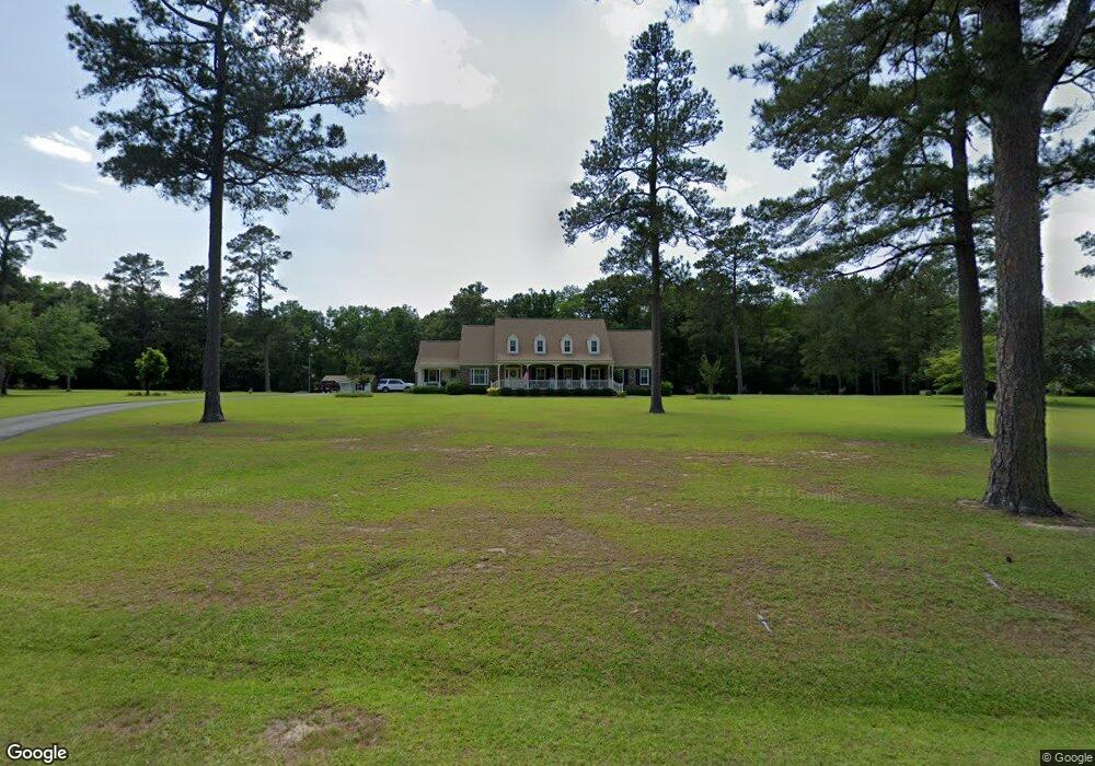
1270 Hickory Ridge Cir Manning, SC 29102
Estimated Value: $342,000 - $1,006,000
--
Bed
--
Bath
3,884
Sq Ft
$148/Sq Ft
Est. Value
About This Home
This home is located at 1270 Hickory Ridge Cir, Manning, SC 29102 and is currently estimated at $573,305, approximately $147 per square foot. 1270 Hickory Ridge Cir is a home with nearby schools including Manning Early Childhood Center, Manning Primary School, and Manning Elementary School.
Ownership History
Date
Name
Owned For
Owner Type
Purchase Details
Closed on
Nov 19, 2019
Sold by
Bozard Henry P
Bought by
Bozard Henry P and Bozard Amy G
Current Estimated Value
Purchase Details
Closed on
Nov 14, 2019
Sold by
Bozard Ashton E
Bought by
Bozard Henry P
Purchase Details
Closed on
Apr 11, 2018
Sold by
Henry P Sr & L H Bozard Rt
Bought by
Bozard Henry P and Bozard Ashton E
Purchase Details
Closed on
Jun 29, 2017
Sold by
Bozard Henry P and Bozard Lynne H
Bought by
Bozard Henry P and Bozard Lynne H
Create a Home Valuation Report for This Property
The Home Valuation Report is an in-depth analysis detailing your home's value as well as a comparison with similar homes in the area
Home Values in the Area
Average Home Value in this Area
Purchase History
| Date | Buyer | Sale Price | Title Company |
|---|---|---|---|
| Bozard Henry P | -- | -- | |
| Bozard Henry P | -- | -- | |
| Bozard Henry P | -- | -- | |
| Bozard Henry P | -- | None Available |
Source: Public Records
Tax History Compared to Growth
Tax History
| Year | Tax Paid | Tax Assessment Tax Assessment Total Assessment is a certain percentage of the fair market value that is determined by local assessors to be the total taxable value of land and additions on the property. | Land | Improvement |
|---|---|---|---|---|
| 2024 | $3,146 | $15,718 | $3,518 | $12,200 |
| 2023 | $3,083 | $15,816 | $3,540 | $12,276 |
| 2022 | $3,046 | $15,816 | $3,540 | $12,276 |
| 2021 | $2,608 | $13,668 | $3,080 | $10,588 |
| 2020 | $7,126 | $13,668 | $3,080 | $10,588 |
| 2019 | $6,823 | $13,668 | $3,080 | $10,588 |
| 2018 | $6,568 | $20,502 | $0 | $0 |
| 2017 | $1,936 | $13,664 | $0 | $0 |
| 2016 | $1,874 | $13,664 | $0 | $0 |
| 2015 | $1,806 | $13,079 | $2,195 | $10,884 |
| 2014 | $1,778 | $13,079 | $2,195 | $10,884 |
| 2013 | -- | $13,079 | $2,195 | $10,884 |
Source: Public Records
Map
Nearby Homes
- 1054 Hickory Ridge Cir
- TBD White Oak Dr
- 1023 Shortleaf Dr
- 1868 Haseldon Dr
- 1356 Mckenzie Rd
- 1111 Nicole Dr
- 1665 Heritage Dr
- 605 Gib Dr
- 617 Pickwood Dr
- 1682 Heritage Dr
- 1158 Doral Dr
- 0000 Sylvan Dr
- 1026 Jamie Ct
- 1038 Jonte Ln
- 412 Briarcliff St
- 1012 Jonte Dr
- 1441 Bojo Cir Unit Lot 29
- 1085 Birdie Ct
- TBD S Carolina 260
- 1200 Mulligan Dr
- 1182 Hickory Ridge Cir
- 1288 Hickory Ridge Cir
- 1308 Hickory Ridge Cir
- 1364 Hickory Ridge Cir
- 1029 Mccarthy Ln
- 1096 Mccarthy Ln
- 1398 Hickory Ridge Cir
- 1299 Hunters Ln
- 1198 Hunters Ln
- 1765 Oak Grove Church Rd
- 1817 Oak Grove Church Rd
- 1658 Hickory Ridge Cir
- 1444 Hickory Ridge Cir
- 1158 Hunters Ln
- 1260 Pointer Dr
- 1218 Pointer Dr
- 1075 Peggy Ln
- Tbd Peggy Ln
- 1186 Pointer Dr
- 1486 Hickory Ridge Cir