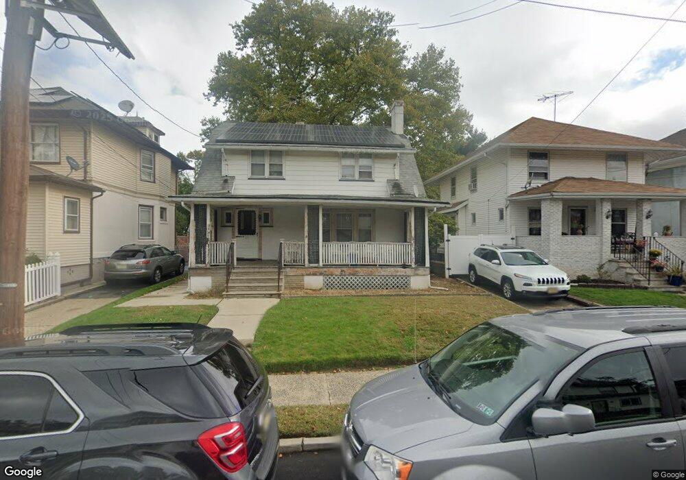
1270 N Broad St Unit 2B Hillside, NJ 07205
Westminster NeighborhoodEstimated Value: $228,125 - $334,000
--
Bed
--
Bath
1,005
Sq Ft
$284/Sq Ft
Est. Value
About This Home
This home is located at 1270 N Broad St Unit 2B, Hillside, NJ 07205 and is currently estimated at $285,042, approximately $283 per square foot. 1270 N Broad St Unit 2B is a home located in Union County with nearby schools including Abram P. Morris-Saybrook Elementary School, Hurden Looker School, and Ola Edwards Community School.
Ownership History
Date
Name
Owned For
Owner Type
Purchase Details
Closed on
Aug 23, 2024
Sold by
Mccoy Dorothy J
Bought by
Mccoy Toray Justin and Mccoy Dorothy J
Current Estimated Value
Home Financials for this Owner
Home Financials are based on the most recent Mortgage that was taken out on this home.
Original Mortgage
$114,000
Interest Rate
6.2%
Mortgage Type
New Conventional
Purchase Details
Closed on
Apr 21, 2000
Sold by
First Union National Bank
Bought by
Mccoy Dorothy J
Home Financials for this Owner
Home Financials are based on the most recent Mortgage that was taken out on this home.
Original Mortgage
$56,905
Interest Rate
8.1%
Mortgage Type
Unknown
Purchase Details
Closed on
Feb 10, 1999
Sold by
Federal Home Loan Mortgage Corporation
Bought by
First Union National Bank
Purchase Details
Closed on
Dec 1, 1998
Sold by
Pochopin Dennis
Bought by
Federal Home Loan Mortgage Corporation
Create a Home Valuation Report for This Property
The Home Valuation Report is an in-depth analysis detailing your home's value as well as a comparison with similar homes in the area
Home Values in the Area
Average Home Value in this Area
Purchase History
| Date | Buyer | Sale Price | Title Company |
|---|---|---|---|
| Mccoy Toray Justin | -- | None Listed On Document | |
| Mccoy Toray Justin | -- | None Listed On Document | |
| Mccoy Dorothy J | $59,900 | -- | |
| First Union National Bank | -- | -- | |
| Federal Home Loan Mortgage Corporation | -- | -- |
Source: Public Records
Mortgage History
| Date | Status | Borrower | Loan Amount |
|---|---|---|---|
| Previous Owner | Mccoy Toray Justin | $114,000 | |
| Previous Owner | Mccoy Dorothy J | $56,905 |
Source: Public Records
Tax History Compared to Growth
Tax History
| Year | Tax Paid | Tax Assessment Tax Assessment Total Assessment is a certain percentage of the fair market value that is determined by local assessors to be the total taxable value of land and additions on the property. | Land | Improvement |
|---|---|---|---|---|
| 2025 | $4,308 | $52,200 | $10,000 | $42,200 |
| 2024 | $4,183 | $52,200 | $10,000 | $42,200 |
| 2023 | $4,183 | $52,200 | $10,000 | $42,200 |
| 2022 | $4,144 | $52,200 | $10,000 | $42,200 |
| 2021 | $4,117 | $52,200 | $10,000 | $42,200 |
| 2020 | $4,093 | $52,200 | $10,000 | $42,200 |
| 2019 | $4,014 | $52,200 | $10,000 | $42,200 |
| 2018 | $3,973 | $52,200 | $10,000 | $42,200 |
| 2017 | $3,949 | $52,200 | $10,000 | $42,200 |
| 2016 | $3,945 | $52,200 | $10,000 | $42,200 |
| 2015 | $3,910 | $52,200 | $10,000 | $42,200 |
| 2014 | -- | $52,200 | $10,000 | $42,200 |
Source: Public Records
Map
Nearby Homes
- 1141 Church St
- 1444 N Broad St
- 124 Woodruff Place
- 1432 Lexington Place Unit 1434
- 1408 Lexington Place Unit 1410
- 1451 Bond St
- 1473 Center St
- 1379 Garfield Place
- 1290 Baker St
- 1282 Baker St
- 1406 Maple Ave
- 155 Silver Ave
- 1414 Boa Place Unit 2
- 170 Windsor Way
- 149 Baltimore Ave
- 420 Hollywood Ave
- 383 Conant St
- 146 Williamson Ave
- 36 Hansbury Ave Unit 38
- 904 Cross Ave
- 1270 N Broad St Unit 3A
- 1270 N Broad St Unit 2A
- 1270 N Broad St Unit 2D
- 1270 N Broad St Unit 3C
- 1270 N Broad St Unit 1A
- 1270 N Broad St Unit 3D
- 1270 N Broad St Unit 3B
- 1270 N Broad St Unit 1D
- 1270 N Broad St Unit 1C
- 1270 N Broad St Unit 1B
- 1270 N Broad St
- 1264 N Broad St
- 1273 Robert St
- 1277 Robert St
- 1269 Robert St
- 1279 Robert St
- 1265 Robert St
- 1265 Robert St Unit 2
- 1278 N Broad St
- 1283 Robert St