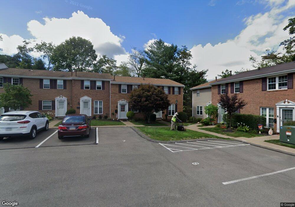
1270 Stoops Ferry Rd Coraopolis, PA 15108
Estimated Value: $213,000 - $258,000
3
Beds
1
Bath
1,161
Sq Ft
$205/Sq Ft
Est. Value
About This Home
This home is located at 1270 Stoops Ferry Rd, Coraopolis, PA 15108 and is currently estimated at $238,224, approximately $205 per square foot. 1270 Stoops Ferry Rd is a home located in Allegheny County with nearby schools including Moon Area High School, Montessori Children's Community, and St James Elementary School.
Ownership History
Date
Name
Owned For
Owner Type
Purchase Details
Closed on
Jan 19, 2021
Sold by
Camesi Alexander and Camesi Anita
Bought by
Rohm Nicole
Current Estimated Value
Home Financials for this Owner
Home Financials are based on the most recent Mortgage that was taken out on this home.
Original Mortgage
$152,000
Outstanding Balance
$135,661
Interest Rate
2.71%
Mortgage Type
New Conventional
Estimated Equity
$102,563
Purchase Details
Closed on
Jul 26, 2000
Sold by
Kosarik Andrew P
Bought by
Camesi Alexander and Camesi Anita
Create a Home Valuation Report for This Property
The Home Valuation Report is an in-depth analysis detailing your home's value as well as a comparison with similar homes in the area
Home Values in the Area
Average Home Value in this Area
Purchase History
| Date | Buyer | Sale Price | Title Company |
|---|---|---|---|
| Rohm Nicole | $160,000 | -- | |
| Pearson Craig B | $160,000 | None Available | |
| Camesi Alexander | $110,000 | -- |
Source: Public Records
Mortgage History
| Date | Status | Borrower | Loan Amount |
|---|---|---|---|
| Open | Pearson Craig B | $152,000 |
Source: Public Records
Tax History Compared to Growth
Tax History
| Year | Tax Paid | Tax Assessment Tax Assessment Total Assessment is a certain percentage of the fair market value that is determined by local assessors to be the total taxable value of land and additions on the property. | Land | Improvement |
|---|---|---|---|---|
| 2025 | $2,454 | $78,500 | $26,700 | $51,800 |
| 2024 | $2,454 | $78,500 | $26,700 | $51,800 |
| 2023 | $2,366 | $78,500 | $26,700 | $51,800 |
| 2022 | $2,909 | $78,500 | $26,700 | $51,800 |
| 2021 | $2,909 | $96,500 | $26,700 | $69,800 |
| 2020 | $2,836 | $96,500 | $26,700 | $69,800 |
| 2019 | $2,759 | $96,500 | $26,700 | $69,800 |
| 2018 | $456 | $96,500 | $26,700 | $69,800 |
| 2017 | $2,608 | $96,500 | $26,700 | $69,800 |
| 2016 | $456 | $96,500 | $26,700 | $69,800 |
| 2015 | $456 | $96,500 | $26,700 | $69,800 |
| 2014 | $2,540 | $96,500 | $26,700 | $69,800 |
Source: Public Records
Map
Nearby Homes
- 711 Newton Square
- 155 River Ridge Dr
- 223 Elk Ridge Dr
- 153 River Ridge Dr
- Andrews II - Finished basement Plan at River Ridge
- Andrews Plan at River Ridge
- Regent - Finished Basement Plan at River Ridge
- 151 River Ridge Dr
- 227 Elk Ridge Dr
- 149 River Ridge Dr
- 147 River Ridge Dr
- 160 River Ridge Dr
- 162 River Ridge Dr
- 158 River Ridge Dr
- 156 River Ridge Dr
- 120 River Ridge Dr
- 124 River Ridge Dr
- 126 River Ridge Dr
- Wexford with Finished Basement Plan at Elk Ridge
- 154 N Jamestown Rd
- 611 Newton Square
- 609 Newton Square
- 607 Newton Square
- 605 Newton Square Unit 605
- 617 Newton Square Unit 617
- 603 Newton Square Unit 603
- 617 Newton Square Dr
- 601 Newton Square
- 619 Newton Square
- 619 Newton Square Dr
- 621 Newton Square
- 623 Newton Square Unit 623
- 625 Newton Square Unit 625
- 1244 Stoops Ferry Rd
- 501 Newton Square
- 627 Newton Square Unit 627
- 503 Newton Sq
- 505 Newton Square
- 507 Newton Square
- 629 Newton Square Unit 629